Spring 2002
Spring 2002 |
|||||||
|
|
|||||||
New from Esri Press
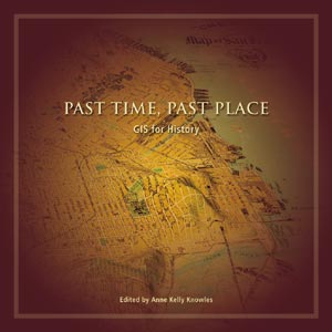
Past Time, Past Place: GIS for History |
|
|
The place is the Great Plains. The year is 1935, and dust storms are so bad that the area they will blanket over the next five years is called the Dust Bowl. People immediately begin asking why, and the obvious answer, that farmers were overplowing their fields, would become for decades the only answer. The place is Danebury, Hampshire, England. The time is now, and an archaeologist doing viewshed analysis of long barrows notices that from no single barrow can any other barrow be seen. If, as archaeologists have long surmised, the barrows were built to alert strangers of boundaries, why were they hidden in the landscape? Past Time, Past Place, from Esri Press, is a collection of essays about historical questions that are being answered with the help of GIS. That geographers use GIS technology would surprise no one; but that historians should find answers to historical questions in the cunning labyrinth of a geographic information system might be surprising, even for a historian. As the editor, Anne Knowles, says in her introduction, "Traditionally, historians acknowledged geography mainly as the physical landscape, meriting little more than a few pages of artful description, or as location in its simplest sense, noted when necessary in 'locator' maps. But there have always been historians fascinated by maps and geography." This volume aims, among other things, to extend that fascination to all historians and students of history. Past Time, Past Place promotes the notion that not only can geography contribute a good deal to historical research, but that a GIS can reveal patterns in historical data as well as it does in environmental, urban planning, or utilities data; that a GIS enables historians, too, to do things that previously would have been difficult if not impossible. The contributors to this volume present the advantages of using GIS, of course, but they also present the peculiar difficulties of applying this technology, with its assumptions of precision and accuracy, to data that is often inaccurate and imprecise. The range of topics in this book should also prove useful. There is a survey of the groundbreaking Great Britain Historical GIS, which covers well over a century of boundary changes in England and Wales, and the stories of three other important databases--the Electronic Cultural Atlas Initiative (ECAI), the North American Religion Atlas (NARA), and the Plieades project, which is the Web version (an extended and ever-expanding version) of the recently published Barrington Atlas of the Greek and Roman World. History teachers, of course, will find much to use in these essays, particularly as the introduction points out, "as a focused geographical supplement to the U.S. history survey course." But teachers of anthropology, sociology, geography, and other subjects will also find many examples of how other scholars are applying GIS to specific research questions. And urban planners, managers of heritage projects, and anyone involved in historical preservation will also find much to ponder in this volume. The contributors to Past Time, Past Place are writing for people who are either new to GIS or just starting to apply the technology to historical questions, so each chapter explains the basic GIS concepts and methods relevant to that study. Visit www.esri.com/esripress or call 1-800-447-9778 to order Esri Press books. They can also be purchased at the Esri Store. |
 The place is Massachusetts. The year is 1692, and a few teenage girls in Salem Village begin accusing their neighbors of witchcraft. People immediately begin asking why, and the answers are, and continue to be, as various as the answerers.