Spring 2003
Spring 2003 |
|||||||
|
|
|||||||
Parcel Mapping in Nashua, New Hampshire, Goes Paperless |
|||||||
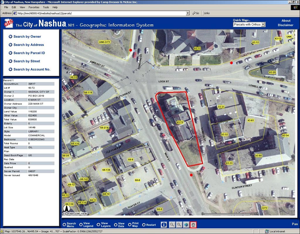
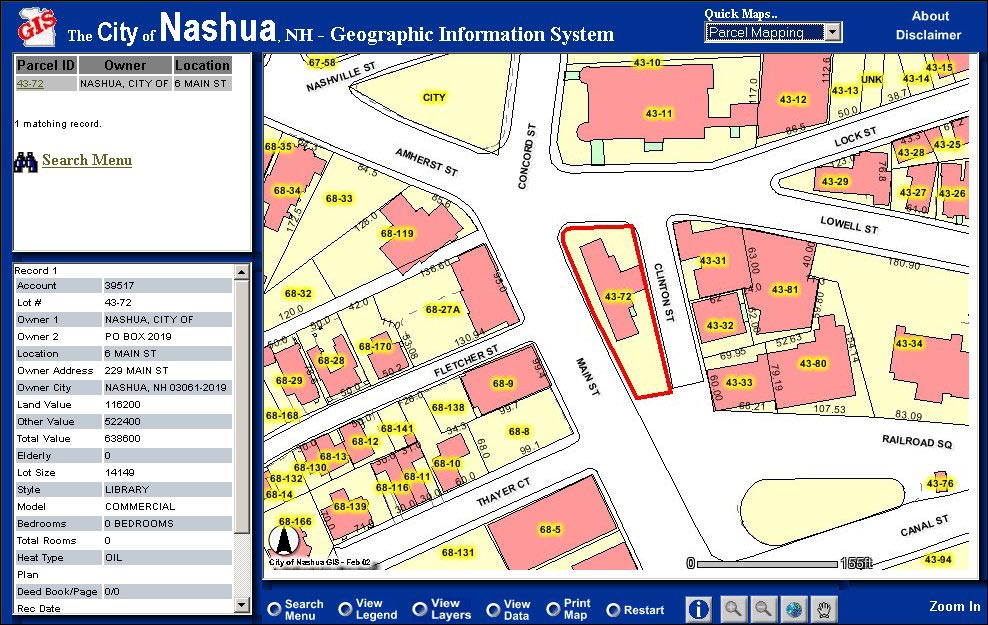
When you finally decide that you have to go down to your city hall or county records department to get information, it's usually because you couldn't obtain the information anyplace else. Once you've committed to going there, you probably hope that the stars and planets will line up just right and you'll be in and out in a few minutes with the information you came for. It usually doesn't work out that way, does it? But many local governments, such as the city government in Nashua, New Hampshire, are finding that by using GIS, they can make a citizen's visit to city hall much less difficult and time-consuming. According to Angelo Marino, chief tax assessor and GIS coordinator for the city of Nashua, finding information on a tax assessment for a single property used to take a half hour or more. "You'd pull out the old tax map books with some of the maps being nine feet long, roll them out on the floor, find your property among hundreds or thousands of other parcels on one of hundreds of tax maps, find the property ID number, go to a text-only workstation terminal, key into the terminal the property ID number, and go through various screens before you'd find the information you wanted," says Marino.
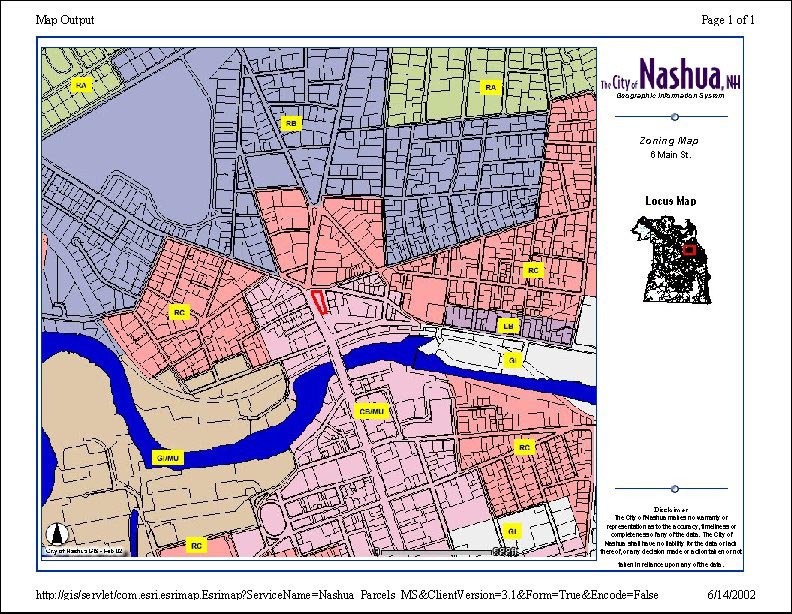
If you wanted to compare a similar property in the same neighborhood, you had to go back to the map and start over again. A real estate agent or an appraiser with a whole list of properties to research might spend half a day in the Assessor's Office in the basement of Nashua City Hall. Meanwhile, someone on the city's payroll would be assisting the walk-in traffic instead of attending to other important tasks. Today, you won't find the citizens of Nashua on the basement floor of city hall poring over nine-foot maps covering the city's 27,000 parcels. Instead you'll see them simply clicking away at one of several customized computer workstations equipped with ArcIMS. "Now you go to the screen, type in an address or the owner's name, and it brings up the map," says Marino. "Then you can click on the parcels near it all you want and get that information. They're really easy to use, so it definitely frees up our employees to do the other things they need to do as well." These customer service workstations are just one example of the improvements that GIS has brought to the city's government since Nashua began working with its engineering and GIS consultant, Camp, Dresser and McKee (CDM) Inc., headquartered in Cambridge, Massachusetts. An Esri Business Partner, CDM is a global, full-service consulting/engineering firm helping clients improve the environment, infrastructure, and information access. CDM has been assisting public and private clients implement enterprisewide GIS systems since its GIS Group was formed in 1986. CDM was contracted by Nashua in 1998 to help it comply with U.S. Environmental Protection Agency regulations regarding Combined Sewer Overflows (CSO). The multimillion dollar project to replace the city's aging combined sewer system led the city to contract for detailed aerial photography. "With the magnitude of the sewer design project, we knew right away that we should get GIS involved," says Jayson Brennen, a GIS consultant for CDM and a Nashua native. "Once the aerials were complete, parcel, sewer, storm water, and other layers were developed. The city then completed a GIS needs assessment, which brought other departments into the implementation process. From this, an enterprisewide implementation evolved. Some of the applications that the city is implementing include real-time vehicle tracking, snowplow routing, asset and permit management, and police and fire reporting--all kinds of ideas have been popping up."
Although CDM has been instrumental in the development of the citywide GIS, Brennen gives all of the credit to Marino and Nashua's forward-thinking city government. "Some see GIS as a way to 'make cool maps,'" says Brennen. "Nashua immediately saw it as a tool that will enhance departmental management and customer service." Marino and CDM worked to develop applications based on ArcIMS that were customized for the city departments that would use them. By integrating the system with the city's long-established database, known as ADMINS, all of the city's approximately 500 employees had access to a mountain of data through an easy-to-use interface through which they could view the data spatially. For instance, the police department uses the GIS to view aerial photography and find possible hiding places in a certain area to help plan tactical situation responses. In all, the system can provide more than 100 categories of information stored in the ADMINS database by searching by a property owner's name, an address or just the street name, parcel ID number, or tax account number. Users can also search by clicking on the map, which features detailed aerial photography. Marino came up with a creative way to introduce the new tool to the city's officials and various departments. "We held a number of 'lunch and learn' sessions for all city employees," says Marino. "Everyone in city government got on board and started asking for more." As the city's departments communicate their needs, Marino and CDM develop custom applications and add pulldown menus to access new functions, layers, and "quick maps" that provide photos of properties, owner names, hydrants, property lines, and more. "The ArcIMS application catapulted Nashua beyond being a city with typical GIS capabilities," says Brennen of his hometown. "By installing an application that everyone can use, GIS use in the city has increased tenfold among the staff and the city extended it to the public through the customer terminals in city hall." As of June 2002, Nashua was working toward making the property assessment maps available on the city's Web site within a few months. But the city's plans for GIS use don't end there. "I'd really like to start using ArcPad, taking it out into the field and using it with GPS to facilitate data collection," says Marino. "When you begin to see efficiencies in both time and money, that's when the aldermen take notice and fund the projects and look for new ways to use it." Today, even if someone wanted to roll out a nine-foot map on the basement floor, he/she might not be able to. Most of the old paper tax maps have ceased to exist. Soon enough, people won't even have to drive to city hall. For more information, contact Angelo Marino, chief tax assessor and GIS coordinator, Nashua, New Hampshire (tel.: 603-589-3040, e-mail: marinoa@ci.nashua.nh.us). For more information about Camp, Dresser and McKee's GIS services, contact Jayson Brennen (tel.: 603-222-8323, fax: 603-645-6891, e-mail: brennenjd@cdm.com), or visit www.cdm.com. |