Spring 2006
Spring 2006 |
|||||||
|
|
|||||||
Using GIS to Ensure Effective Communication and Protection
Protecting Archaeological Resources During an Oil Spill in Washington State |
|||||
|
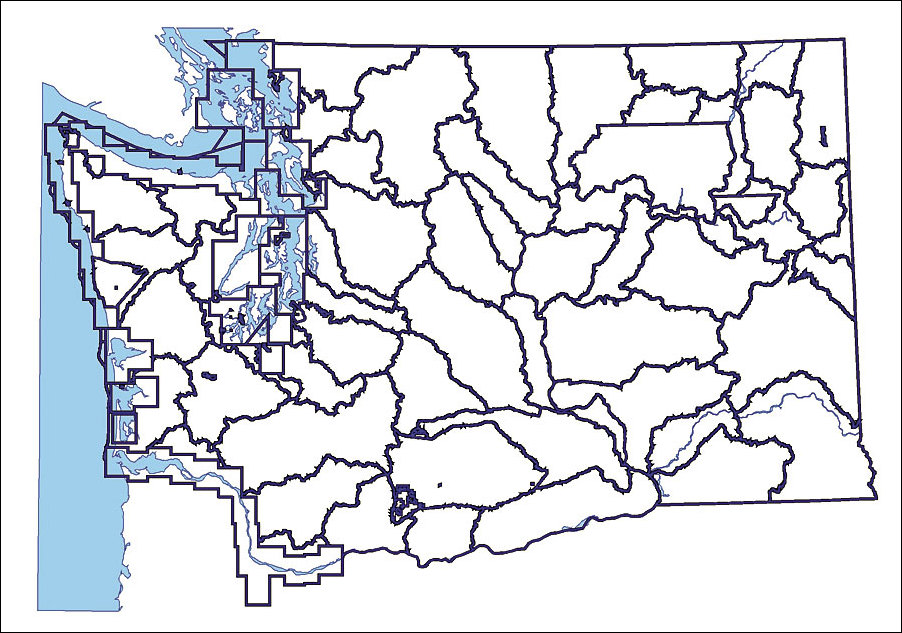
There are 29 federally recognized tribes resident in Washington State, as well as a rich history of cultural sites located along coastal shorelines and rivers. Therefore, any oil spill has the potential to damage and contaminate archaeological sites associated with these areas.
During an emergency response to such an oil spill, an effective response requires accurate information and clear communications. To meet this criteria, the Washington State Department of Archaeology and Historic Preservation (DAHP) and its GIS consultant, GeoEngineers, Inc., have created a GIS application that provides the Oil Spill Incident Command Structure current data on archaeological site locations during an oil spill. This application was developed for the Washington State Department of Ecology Oil Spill Response Program and includes contact information for notifying concerned tribal government cultural staff. This Oil Spill Tribal Contact tool provides quick and easy access to current tribal contact names for geographic regions. During a recent spill event, the ecology responders were able to quickly identify the tribes of concern by using the application. By clicking on a map at the location of an oil spill, a list of federally recognized tribes was generated on the fly through an associated database. Dr. Allyson Brooks, State Historic Preservation officer and director of DAHP, states, "Our ability to protect these unique and special places in Washington is directly related to the speed with which we can get information to the tribes and other decision makers and first responders on the scene. By providing current data in spatial and tabular format, GIS helps us accomplish that mission." DAHP uses a combination of ArcView and ArcInfo for digitizing and maintaining archaeology site locations. As part of DAHP's GIS initiative, more than 19,000 archaeological sites have been mapped in GIS and attributed with information regarding site type (e.g., burials, petroglyphs). Each site is mapped within a geodatabase and linked to a scanned image of the original documentation regarding the discovery of the site. This data is available to DAHP staff via a customized ArcGIS Desktop interface. It is not subject to public disclosure; however, data sharing is possible with governmental agencies through memorandums of understanding. In this way, DAHP is able to share this information with the Washington Department of Ecology for protection of these valuable resources during oil spill events.
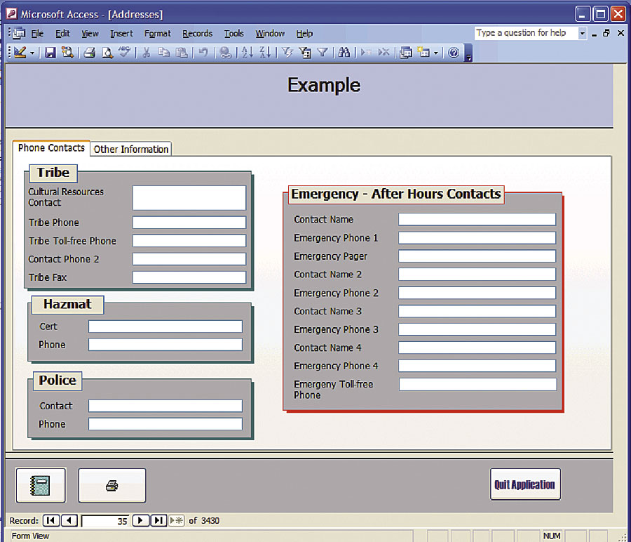
With funding from the state's Coastal Protection Fund and the assistance of the Tribal Historic Preservation Offices and cultural staff of the 29 tribes, DAHP created a series of specific GIS layers for each tribal government reflecting its geographic area of interest, its reservation lands, and watersheds for which each tribe's cultural department wanted notification when a spill occurred. In many parts of the state, multiple tribes require notification. Also along the Columbia and Snake rivers, tribes now resident in Oregon and Idaho have an interest and require notification. The GIS application has a database table identifying any archaeological site potentially at risk and the specific cultural staff contact with phone number, an after-hours emergency number, and details on any staff who have hazmat training. These screens were created for ease of use during an emergency and allow for quick printing of contact sheets. Also, since names and phone numbers frequently change, the table was created to allow for ease of updating. For more information, contact State Archaeologist Dr. Rob Whitlam, DAHP (tel.: 360-586-3080, e-mail: rob.whitlam@dahp.wa.gov). |