Spring 2007
Spring 2007 |
|||||||
|
|
|||||||
GIS Hero Promotes Spatial Data Infrastructure Initiatives on the Continent of Africa
Kate Lance Helps Unite the Geospatial Community |
|
|
Ask most GIS professionals on the African continent if they know Kate Lance, and the answer is a resounding, "Well of course! She helped me get a grant, find a business partner, share my data . . ."
Lance holds a master's degree in forestry from Yale University, initially focusing on tropical forest mapping. As a research assistant for a study on treefall gaps and forest regeneration in central Guyana, she mapped 1,500 trees to grids set up at several sites using nothing more than stakes, fishing line, and flagging tape. She explains, "While it was a pleasure going to work every day in the rain forest, it did cross my mind that there had to be a better way to map what was going on."
Back at Yale University, Lance intended to focus on the integration of imagery from multiple sensors with ancillary data to improve tropical forest mapping. Her experience, however, led her in another direction. The challenges of geographic information access, integration, and effective use led Lance to invest her energies in advancing spatial data infrastructure. She became interested in management issues, such as how people use information for management decisions, as well as how to ensure data availability, access, and quality. "Not quite the career I envisioned early on," says Lance, "but nonetheless it has been gratifying." Although she no longer has the luxury of trudging around in forests collecting data, then spatially analyzing it, Lance has put GIS in the hands of many others. Working to promote spatial data infrastructure for less than a decade, she has an outstanding track record. Beginning in 1999 as a research fellow at the International Center for Tropical Agriculture (CIAT), Lance coordinated the Central American Geographic Information Project (PROCIG). She worked with GIS specialists from the national statistics institutes, national mapping agencies, and ministries of environment and agriculture to develop technical and institutional components of SDI. Identifying potential applicants for Global Maps/Global Spatial Data Infrastructure (GSDI) program grants was another effort she undertook to equip national and regional agencies with software to produce fundamental datasets. Lance then shifted her focus to Africa and the Caribbean. While implementing United States Agency for International Development (USAID)-supported projects of the U.S. Geological Survey Earth Resources Observation & Science (EROS) Data Center from 2001 to 2004, she had the opportunity to work with colleagues in more than 20 countries in improving interagency collaboration. The SDI-Africa Newsletter is a response to the fundamental concern Lance had from her practical experience—the fragmentation of the geographic information community. With countless projects generating potentially inconsistent datasets, a mechanism was needed to highlight "who is doing what where," as well as "who is funding the work." "Kate's contributions have cut across the five subregions of the African continent," says Dr. Jide Kufoniyi, executive director, Regional Centre for Training in Aerospace Surveys (RECTAS), Ile-Ife, Nigeria. In the western subregion, a few of Lance's numerous contributions include supplying relevant documents to the Nigerian Geoinformation Policy Drafting Committee in 2003; participating in the stakeholders workshop for the adoption of the draft policy; providing free advisory service for the implementation of the national geospatial infrastructure in Nigeria; and being the resource person at a five-day regional workshop on SDI for 27 participants from 15 western and central African countries in RECTAS in 2005. Kufoniyi goes on to explain, "One should not forget her positive contribution to the preparation of the handbook SDI Africa, an implementation guide published by the United Nations (UN) Economic Commission for Africa (ECA). I haven't seen her complain of being tired even once during the past five years that I have known her." Craig von Hagen, Food and Agriculture Organization of the United Nations, Somalia Water and Land Information Management/Global Land Cover Network Projects, says, "Kate has basically championed the concepts of SDI in Africa. The fruits of her labor are now being seen in many countries across Africa." To address the fundamental fragmentation problem, Lance also started a Ph.D. program at the International Institute for Geo-Information Science and Earth Observation (ITC) and Wageningen University in the Netherlands. Currently, she is exploring mechanisms to improve cross-agency coordination of geospatial investments, drawing upon literature in public management, budget reform, and international aid. On both the communication and funding fronts, "SDI is a hard sell," says Lance. "It is a 'beast' of an initiative, since it requires interinstitutional, cross-sector, long-term coordination—something that defies the administrative and budgetary structures in Africa, as well as the donor agencies' funding cycles. It also encompasses a range of technical, institutional, policy, and legislative components. Furthermore, SDI champions have the challenge of 'proving' that geospatial technologies are vital tools to support good government and economic decision making in their respective countries. And to top it off, they must convey SDI in all its complexity in several jargon-free sentences." Committed to promoting the use of reliable geospatial data and tools, Lance, while working on her Ph.D., continues to edit the SDI-Africa Newsletter, published by the Global Spatial Data Infrastructure Association. She also cochairs the GSDI Legal and Economic Working Group. Lance works hard at bringing information to the people who need it, a seemingly impossible task in such a vast continent. Lance is a long way from the imagery analysis and ground truth and the GIS analysis she did using ArcInfo and ArcView as a research assistant in the 1990s. But even then her focus was on the data, whether converting datasets to ArcInfo coverages, developing Simple Macro Language (SML) to automated attribute coding, or editing and cleaning coverages. Her passion for collecting and distributing data has stayed the course. Lance concludes, "To quote Dozie Ezigbalike from the Economic Commission for Africa, 'How do we develop SDI in Africa? The same way one eats an elephant—one bite at a time.'" More InformationFor more information, contact Kate Lance, International Institute for Geo-Information Science and Earth Observation, Hengelostraat 99, P.O. Box 6, 7500 AA, Enschede, the Netherlands (tel.: 31-0-53-4874-241; fax: 31-0-53-4874-575; e-mail: lance@itc.nl). |
 This article is part of an ongoing series honoring individuals who have made a difference in the world by applying a GIS solution to challenges or needs within conservation or their communities. Since these unique individuals have been selected for their innovations or special achievements in a particular field, the series is appropriately named GIS Heroes. Esri recognizes Kate Lance as a GIS hero.
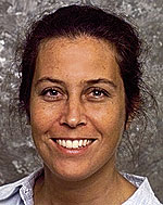 Lance is a source of inspiration for anyone who wishes to learn the art of networking. Her efforts in bringing coherent, timely information about GIS into the workplace have helped many people across a large continent. She has saved colleagues countless hours of painfully slow Web searches at expensive Internet caf�s by collating and disseminating necessary information herself. Founder and editor of the Spatial Data Infrastructure (SDI)-Africa Newsletter (
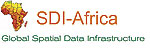 On her way back to the classroom to address this issue, Lance ventured to the Virgin Islands where she spent a summer mapping mangroves. After that, she headed to Masoala, Madagascar, where she mapped villages and farms across the 1,500-square-mile peninsula to ground truth encroachment into Madagascar's largest, continuous block of rain forest. All this was accomplished on foot using a GPS.