Spring 2010
Spring 2010 |
|||||||
|
|
|||||||
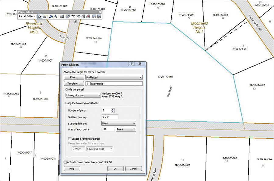
Free Toolbar for Land Records and Parcel Editing Workflows
New Parcel Editor Toolbar Featured in ArcGIS 10 |
|||
The Cadastral Editor workflow tool that was introduced in the 9.3 release of the ArcGIS Survey Analyst extension has been improved to accommodate a wide variety of land records and parcel editing workflows. Available as a free toolbar in ArcGIS Desktop 10 (ArcInfo and ArcEditor), Parcel Editor replaces the ArcGIS Survey Analyst extension yet includes all the extension's Cadastral Editor functionality with new tools, an updated data model, and an improved user experience. The Parcel Editor toolbar allows parcel managers, such as surveyors, tax assessors, and rights-of-way managers, to edit and maintain parcels from ArcGIS Desktop software's ArcMap application user interface. Using Parcel Editor, parcels may be created and edited by anyone with ArcEditor and ArcInfo licenses. Parcel Editor is Esri's most efficient technology for editing and maintaining parcel features. The tool provides industry-specific functions, such as split by area, parcel merge, and parcel traverse. In addition to editing performance, users may optionally benefit from the unique ability of Parcel Editor to support positional accuracy management of an entire GIS through the least-squares calculation of corner positions. More InformationFor a preview of the new Parcel Editor toolbar before its final release, register to become part of the Esri ArcGIS 10 beta program at beta.esri.com. |