ArcGIS for INSPIRE
New Software Portal Supports Compliance, Data Sharing, and Discovery
Highlights
- ArcGIS for INSPIRE helps organizations comply with INSPIRE.
- The ArcGIS system provides a common platform for GIS applications throughout any European organization.
- ArcGIS for INSPIRE helps EU member nations share harmonized geospatial data across Europe.
GIS is valuable to government and is used extensively in many integrated applications, such as natural resources, land management, law enforcement, and economic recovery. Government is evolving to adapt to new technology changes, and more and more services are focused on web and mobile applications. New media, such as real-time data, social networks, mashups, and Web 2.0, are speeding up this change. Those who are ready embrace these changes and see new opportunities.
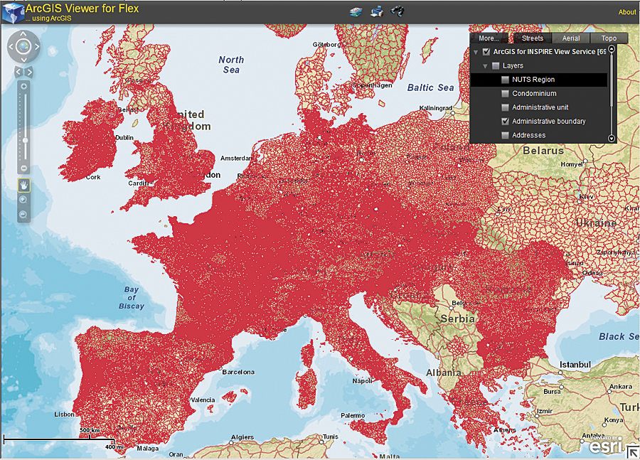
Flex Viewer consuming an INSPIRE view service displaying INSPIRE data. (This product includes intellectual property from European national mapping and cadastral agencies and is licensed on behalf of these by EuroGeographics.)
One change emerging in this new information society is the Infrastructure for Spatial Information in Europe (INSPIRE), the legal framework created to guide Europe's spatial data infrastructure. INSPIRE addresses pan-European issues surrounding standardized data models, services, and metadata that need to be resolved to create a geospatial platform that supports a large community of users and applications. Essentially, it will provide a road map to authoritative datasets, geospatial services, catalogs outlining content, an application program interface (API) for developers to create value-added applications, and core geospatial applications that can be used throughout Europe.
Through the INSPIRE framework, European Union (EU) member nations hope to better address issues and challenges they face in the environment, through climate change, in maintaining the health and safety of their populations, with transportation issues, and more. The ability to create these new solutions through this framework will be open to everyone: government, data infrastructure developers, the research community, application developers, data infrastructure innovators, and the general public. INSPIRE aims to integrate all levels of government by supporting open access, collaboration, and harmonization and is the core pillar of the European geospatial information society driving the adoption of geospatial data.
To support this community, Esri has adapted the ArcGIS system to provide a common platform for GIS applications throughout any European organization. This solution, ArcGIS for INSPIRE, extends ArcGIS and provides discovery, view, and download services for INSPIRE-compliant data, as well as the ability to create metadata and data models for those who need it.
Sharing Geospatial Data Across Europe
ArcGIS for INSPIRE helps EU member nations share harmonized geospatial data across Europe. Sharing can take place between countries, at various levels of government, and in the private and research sectors. The economic benefits of creating data once, sharing it, and using it multiple times are exponential and can be done easily through collaboration and mashups available via modern technology. ArcGIS for INSPIRE upholds the vision of INSPIRE not as an isolated activity but as a baseline that supports the geospatial enabling of a variety of domains. Using ArcGIS for INSPIRE, data can be available when it is needed in an interoperable manner. This helps streamline decision-making processes and allows organizations to react helpfully to situations where it is needed, such as environmental emergencies. For example, the European Environmental Agency (EEA) is able to share data, as well as reports, as it provides information that supports policy making across Europe. Such reports as EEA's "Mapping the Impacts of Natural Hazards and Technological Accidents in Europe" addresses hazards and offers an explanation as to why they occur based on research. Researchers and others can in turn take this data and do their own research for a more intimate look at regional challenges.
While exciting, INSPIRE compliance can also be challenging. Data owners must publish their data, and member nations are responsible for organizing their data so others are able to apply it to their own needs. Specifications for data publishing can be complex, and there are strict conformance requirements. ArcGIS for INSPIRE helps organizations more easily and quickly comply with INSPIRE.
INSPIRE is very diverse, covering data, metadata, and discovery of the data, as well as access, sharing, monitoring, and reporting. Data themes can be open ended depending on the needs of those who create the data. EU member nations are required to have metadata and discovery views of their data according to INSPIRE regulations by the end of 2011. The next milestones in the INSPIRE implementation road map include the download and transformation of data, as well as the ability to create INSPIRE-compliant Annex I data. The INSPIRE Directive addresses 34 spatial data themes needed for environmental applications. These themes are subdivided into three annexes for the directive. Down the road, the ability to continue supporting new iterations of data, e.g., Annex II and III data, will be required for INSPIRE compliance. ArcGIS for INSPIRE provides a GIS foundation for the INSPIRE platform, evolving to continue to meet requirements, that can support the entire supply chain, from data providers to consumers. Taking the complexity out of INSPIRE compliance means that more business needs can be met as extensible INSPIRE-compliant solutions are delivered.
Helping European Organizations Become INSPIRE Compliant
ArcGIS for INSPIRE meets the core requirements of INSPIRE, including
- Managing and publishing INSPIRE-compliant data
- Managing INSPIRE-compliant metadata
- Transforming existing data into INSPIRE-compliant data
- Providing INSPIRE-compliant view services
- Providing INSPIRE-compliant discovery services
- Consuming INSPIRE-compliant geospatial data and services
ArcGIS for INSPIRE is an extension to ArcGIS software. ArcGIS for INSPIRE includes INSPIRE data models and allows organizations to manage INSPIRE data, metadata, and web services in the ArcGIS Desktop environment. ArcGIS Server includes INSPIRE view and download services, a geoportal solution, and INSPIRE discovery services and provides a means to manage INSPIRE metadata. ArcGIS Server client APIs are available to create and customize web applications that consume INSPIRE services.
ArcGIS for INSPIRE also facilitates data sharing. Existing information from storage systems can be integrated into business processes and transformed into INSPIRE-compliant data by using ArcGIS for INSPIRE data models and web services in a data repository for spatial datasets optimized for INSPIRE data specifications. This INSPIRE-compliant data can then be delivered via INSPIRE network services through what is, in essence, a European spatial data infrastructure.
Discovering data using ArcGIS for INSPIRE is straightforward as well. Using multiple discovery services, ArcGIS for INSPIRE supports harvesting or federated searches. These discovery services are part of the software and include an open source geoportal solution. Rich desktop and web-based editors support INSPIRE metadata. Discovery service client add-ons and widgets included in the software connect producers and users throughout Europe. ArcGIS for INSPIRE also consumes INSPIRE services by allowing users to view INSPIRE services in ArcMap and various web clients.
For more information, read "ArcGIS for INSPIRE: A Collaborative Geospatial Information Sharing Solution for the European Union," "INSPIRE Geoportals Bridge Producers and Consumers," and "Building INSPIRE: The Spatial Data Infrastructure for Europe."
Related Podcast
Esri Supports INSPIRE
Guenther Pichler, Esri Business Development Manager for European Union-related issues, discusses how Esri technology helps European nation-states comply with INSPIRE directives. Listen to the podcast. [10:00 | 25 MB]