Perth Airport Flies High with Geospatial Intelligence
Australian Airport Gains Enterprise-wide Access to Location Intelligence Tools
Highlights
- With GIS, Westralia Airports Corporation effectively disseminates and manages location intelligence data between multiple departments.
- Staff is better informed and empowered to make better business decisions.
- Location intelligence through GIS is important for planning the airport infrastructure and the construction or relocation of services.
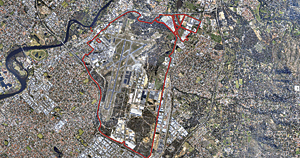
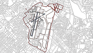
Strategically located in relation to Southeast Asia, Europe, and Africa, Perth Airport is Australia's fourth largest airport in terms of passenger traffic. Under a 99-year lease arrangement with the commonwealth government, the airport is operated by Westralia Airports Corporation Pty Ltd (WAC). The Perth Airport estate encompasses more than 2,100 hectares and is the premier international, domestic, and regional gateway to the state of Western Australia.

Westralia Airports Corporation effectively disseminates and manages its data throughout multiple departments, creating workforce efficiencies through time-saving and near real-time information sharing processes.
Western Australia is home to a strong economy led by natural resources, and since Perth is Australia's most isolated capital city, Perth Airport is a critical infrastructure component in the state. The airport has recently experienced the highest passenger growth rates of any Australian capital city airport, reporting a 7.5 percent increase in passenger numbers for the 2009–2010 financial year. More than 10.4 million passengers traveled through Perth Airport in 2009–2010, and total passenger movements per year are forecast to more than double to 18.9 million by 2029.
To meet this growth projection and prepare for the expansion of terminal facilities, WAC sought to gather more data across the airport estate, taking multiple safety and security, operational, environmental, customer service, commercial, and service infrastructure factors into account. WAC wanted to be able to integrate data from this range of complex interrelated areas and understand how the location of various factors was influencing their use and constraints.
To achieve this, WAC required a solution that provided more enhanced spatial information management. During the research and investigation process, WAC contacted ESRI Australia Pty. Ltd., Esri's distributor in Australia, which had developed a technology that could help Perth Airport find a corporate-wide location intelligence solution, and the two companies decided to work together on the project.
The team's key goals were to create a solution using ArcGIS technology that would
- Provide a single authoritative source of spatial information.
- Add value to the business and decision-making processes.
- Improve efficiencies in repetitive or complex tasks.
- Provide an intuitive way to locate information held in business systems.
- Ensure that adequate and reliable technology is deployed to support location-based systems and business activities.
At the heart of WAC's location intelligence solution was Esri GIS and Dekho software, which was developed by ESRI Australia. Based on ArcGIS, Dekho helps WAC integrate information from databases that have a location element, including property and asset management. The software enables WAC to effectively disseminate and manage this data throughout multiple departments, creating workforce efficiencies through time-saving and near real-time information sharing processes.
WAC is a significant service provider, managing the power, gas, sewer, water, fuel, drainage, and communications needs of two terminals and more than 200 tenants. It is also effectively the landlord, retail hub, and conservation authority within the Perth Airport estate. The corporate-wide solution enables WAC staff throughout the entire organization to access essential location-related data to support operation of the airport.
"Before we implemented GIS, all spatial information requests were submitted to the Design Office to generate the relevant maps and data," says Fiona Lander, general manager Corporate Services. "This meant that departments did not have real-time access to information, and the Design Office could become bogged down fulfilling the myriad of simple requests rather than utilizing [staff] skills for design and spatial information management.
"Through the implementation of GIS, we now provide all staff with access to self-serve maps," Lander continues. "These can help with anything from planning the location of a new vending machine to scoping the environmental impacts of building a new warehouse on the estate. With so many stakeholders using location intelligence to get a greater insight into their working area, staff are better informed and therefore empowered to make better business decisions."
Beyond the ability to create maps and visualize where assets are, location intelligence is playing a major role in planning and development of the expanding airport precinct.
 "Location intelligence is vital in planning the airport infrastructure for the construction or relocation of services and the maintenance of airport assets," says Lander. "Through effective use of location intelligence, we will be able to move to a more proactive maintenance schedule and more efficiently allocate and plan resources, resulting in significant cost savings and a better running suite of assets."
WAC has many more plans for using location intelligence at Perth Airport to optimize workflows and better understand the dynamic nature of the site, for example, further integration with the asset management and maintenance processes, detailed land-use reporting, enhanced utilization of location intelligence for operational activities, and mobile access to GIS.
