Better Policing Through Analysis
Ogden Police Take Advantage of GIS in Real Time Crime Center
Highlights
- ArcGIS software provides a multimission common operating picture.
- Real Time Crime Center performs statistical queries automatically through ArcGIS software.
- GIS helps analysts reach conclusions about crime that might otherwise be missed.
The City of Ogden, Utah, with a population of approximately 85,000 people, is nestled against the Wasatch Mountains with fantastic views of the Great Salt Lake located to the west. Through the years, the city has served as a major railway center and still handles a great deal of traffic today. Ogden is the location of Weber State University.

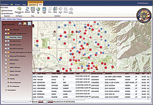
Ogden Police Common Operational Picture (COP) provides location information on outstanding felony arrest warrants. This data is used by police to alert responding officers to safety concerns, plan apprehension strategies, and coordinate enforcement efforts.
The Ogden Police Department (OPD) has the responsibility for protecting life and property through the enforcement of federal and state laws, as well as city codes. This entails a wide variety of calls for service, some of an emergency nature and others for information, traffic control, and peacekeeping measures for any public safety-related matter.
The majority of the department's efforts and manpower are focused on the suppression, detection, and investigation of crime. Most of this activity comes after discovering or being notified of a possible criminal situation. However, the department also realizes the importance of attempting to eliminate crime and criminal opportunity through the implementation of crime prevention programs.
To better serve its community, OPD recently launched its multimission Real Time Crime Center (RTCC). The center provides 24/7 support to law enforcement and deploys a host of advanced technologies, including camera systems, crime databases, and vehicle tracking. Serving as its foundational integration platform, ArcGIS software provides a multimission common operating picture. The agency's use of GIS comes from nearly a decade's worth of previous work. GIS automatically links crime and other datasets maintained in different databases. OPD can perform advanced analysis and digitally map the results. These functions have allowed police staff to effectively deter crime and make arrests. Bringing those functions into the RTCC has helped extend these benefits to new levels and more people.
"Having GIS available in our Real Time Crime Center allows us to operate more efficiently and work in a more proactive, integrated fashion," says Jon J. Greiner, former chief of police, Ogden Police Department. "It helps us—each different bureau of the police department—make better decisions about how we should investigate crime. It reveals important new information that leads to better decision making and use of limited resources."
Initial GIS Success
The Ogden Police Department consists of 144 sworn officers serving the community's 85,000 residents. The OPD crime analysis unit first began using the full capabilities of Esri desktop GIS software for its daily work nearly a decade ago. Analysts could compare incident information—such as burglaries, robberies, assaults, auto theft, gang activity, and other crime—with other information, such as the location of parolees, sex offenders, known criminals, and gang members. This provides an initial data picture that may help in predictive analysis or geographic profiling.

Ogden Police Department relies on ArcGIS Server, as well as ArcGIS.com, to share information with the public or partnering police agencies. Pictured: Known burglary suspects are shown inside a 1,000-foot buffer of forced-entry residential burglaries.
In 2008, OPD saw a significant enhancement: a more powerful web-based analysis tool allowed people to identify patterns through dynamic hot spot mapping, which is simply analysis that shows areas of crime intensity. This opened up crime data to any OPD officer with web access. Just a few mouse clicks allowed officers to quickly view, analyze, and share crime trend maps. The intuitive solution helped officers get the information they needed without requesting it from the crime analysis unit, taking more training, or installing additional software. Officers could do their jobs better without having to become GIS software experts. The agency also added automated vehicle location (AVL) capabilities to its GIS system.
"It was added so that we could track and analyze patrol patterns and their relationship to crime patterns," says Josh Jones, senior project coordinator—GIS, City of Ogden. "This tool has been helpful in monitoring criminal activity, as well as planning crime fighting activities and monitoring their success."
That same year, Ogden teamed with Esri Partner Pictometry to include detailed oblique aerial photography within its city databases. This data made its way to OPD. The Pictometry-supplied data allows the easy computer viewing of city buildings and other structures from all sides and angles. Analysts can measure distances between windows, fences, streets, and other items of interest without going out to the site, which might risk compromising an operation.
For instance, the Pictometry data has been particularly useful in Special Weapons and Tactics (SWAT) and narcotic strike force actions. Commanders can better develop maneuvers prior to carrying out actual field operations. Instead of speculating on the time it would take to cross a yard; go over a fence; and forcibly enter a one-story, two-bedroom house, officers can get exact distance measurements and view detailed oblique photos that show the area and situation where the officers will deploy.
"The power of GIS rests in its ability to relate different information, particularly in a spatial context," says Greiner. "This helps trained analysts reach a conclusion about crime and other data relationships that might otherwise be missed. Since most of our city information contains a location reference, placing it on a map is a logical investigative tool."
A New Level of Success: The Real Time Crime Center
OPD reached its next technology milestone by opening the RTCC in July 2011. The RTCC, formally named the Area Tactical Analysis Center (ATAC), uses state-of-the-art tools to integrate many disparate data sources. The center houses multiple records: local warrants, criminal history, jail data, property information, arrest affidavits, and more. These records can be used by analysts, administrators, investigators, and officers in the field.
Previously, the OPD crime analysis unit supplied a monthly statistical report that included Esri software-derived maps. The information was given to the command staff and lieutenants to develop crime reduction plans and respond to issues of concern. The information was manually extracted from the record management system (RMS) and CAD systems and uploaded into GIS software for analysis.
The city uses the RTCC to perform these queries automatically through ArcGIS software. The new workflow reduces the time analysts spend to extract, cleanse, and upload many disparate data sources.
"While there are some established protocols and procedures for major events handled through ATAC, we try to allow officers and analysts the freedom of independent thinking, enabling better solution-based recommendations," says Greiner.
In addition, RTCC features a deployment of the Microsoft Fusion Core Solution (FCS). OPD will be the first law enforcement department of its size to deploy this platform. FCS was developed as a result of collaboration between Microsoft and Esri. The powerful data management and collaboration tool Microsoft SharePoint is also fully integrated with the analysis tools found in ArcGIS software.
FCS provides a way to bring different data silos together in one place. In addition, it provides a National Information Exchange Model-compliant way to access and exchange data. It allows on-the-fly mapping of address and coordinate information linked to SharePoint. It will also aid in the intake, storage, archiving, dissemination, and search of OPD data. The FCS mapping capability will serve as the common operating picture for the RTCC. It will display events as they happen with real-time AVL data, weather data, plume modeling, and social media feeds.
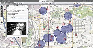
Other data sources that will be integrated into the RTCC will be third-party data mining tools, license plate reading systems, integration with more than 200 city-operated surveillance cameras, tracking and control of an unmanned surveillance blimp, and electronic briefing notes.
"This technology truly allows us to improve our efficiency," says Greiner. "We can make connections and come up with solutions to problems that we might not have been able to do in any other way."
For more information, contact Jon Greiner, former chief of police, Ogden Police Department (e-mail: chiefjjg@aol.com), or Wayne Tarwater, chief of police (e-mail: WayneTarwater@ci.ogden.ut.us).
Related Podcast
GIS Tutorial for Crime Analysis
Will Gorr discusses his and Kristen S. Kurland's new book, GIS Tutorial for Crime Analysis. Listen to the podcast. [10:00 | 12 MB]