Summer 2002
Summer 2002 |
|||||||
|
|
|||||||
National Oceanic and Atmospheric Administration Develops "Shoreline Data Explorer"
NOAA Provides Digital Data to the Public Via the Internet with GIS |
|||||||
|
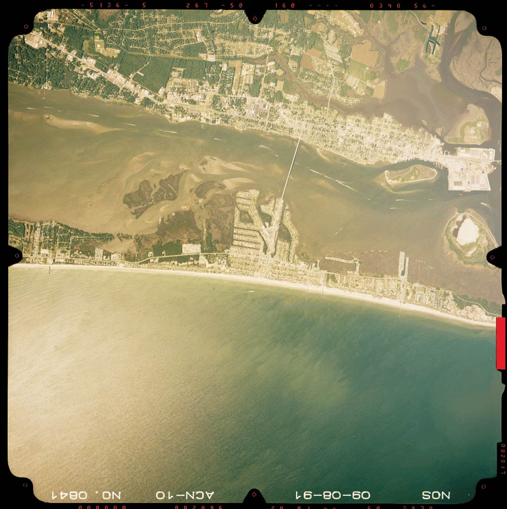
The Remote Sensing Division of the National Geodetic Survey (NGS), a component of NOAA, plans and acquires aerial photography and compiles shoreline data primarily for application to the nautical charts produced by NOAA's Office of Coast Survey. In recent years, this data has been produced in digital form, and many of the older hard-copy shoreline manuscripts have been converted to digital format.
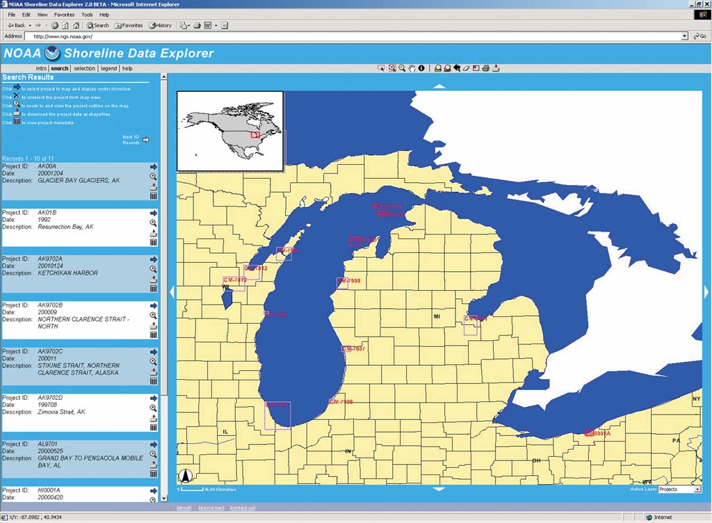
Given the importance of detailed shoreline data to coastal communities, researchers, and others conducting GIS analysis or producing special purpose maps in the coastal zone, NOAA embarked on a project to provide this digital data to the general public via the Internet. "One of our primary goals for making the shoreline data available over the Internet was to put these digital data sets into the hands of local, state, and other organizations who can make use of the data," says Charlie Challstrom, director of NGS. "Now these users can download the shoreline data in shapefile format and include these layers as part of their GIS analysis and maps." The first challenge for NOAA was to find a method for storing and quickly retrieving these large spatial data sets. After evaluating several alternatives, NOAA elected to use ArcSDE and Oracle to build the shoreline geodatabase. "ArcGIS was already being used throughout NOAA to manage our spatial data, so our familiarity with the Esri product line was an important factor in determining which geodatabase to implement," says George Frank, NGS project manager. "The performance, scalability, and compatibility of ArcSDE with other products such as ArcIMS made our decision easy." The scalability of the shoreline geodatabase was perhaps the biggest concern. With more than a thousand projects containing millions of features, the shoreline geodatabase would quickly become unmanageable if the proper storage solution was not chosen.
With the core pieces of the shoreline geodatabase in place, NOAA was now ready to develop the Internet GIS and data distribution system--to be called the NOAA Shoreline Data Explorer. TerraVerge Corporation, an Esri Business Partner specializing in the design of Internet-based GIS, was selected to design and develop the system. "NOAA chose TerraVerge to develop the Shoreline Data Explorer after seeing several examples of their Internet systems," says Frank. "Their expertise in developing Internet GIS systems, experience in working with large data sets, and partnership with Esri made them an ideal choice for designing our system." TerraVerge and NOAA staff worked together to develop a system plan that addressed both the desire to automate the system and the need to give the end user multiple methods for locating and downloading shoreline data. The final system design had the following primary goals:
After examining the system requirements, it was decided to use a combination of ArcIMS, Macromedia ColdFusion, Oracle, and ArcSDE to power the system. ArcIMS and the ArcIMS ColdFusion Connector provide all mapping, data download, and GIS functionality. ColdFusion handles tabular data queries and session management while Oracle and ArcSDE house all tabular attribute and shoreline spatial data. "The combination of ArcIMS and ColdFusion allowed us to develop a very 'thin' client so that there is very little to download to the user's browser other than the map image itself," says Critter Gewles, senior application developer with TerraVerge. "Additionally, by connecting ArcIMS to the shoreline ArcSDE geodatabase, we could allow for the generation of user-defined data sets and creation of custom, downloadable shapefiles."
The shoreline geodatabase contains key project attributes such as name, identification, extents, date, and location. Using these key fields, along with visible project outlines on the map, users have multiple tabular and spatial tools for searching and locating shoreline data. Once the user locates a project of interest, the shoreline data may be added to the map for viewing, or it may be downloaded in shapefile format. The download tool is sophisticated enough to allow for the download of the entire project or only portions of the project based on feature type and/or spatial extent. Other than the download functionality of the Shoreline Data Explorer, the system behaves as most Internet GIS viewers would. The user has a full suite of map navigation, feature selection, identify, and other functions that allow for the viewing and querying of the shoreline data without the necessity for owning a desktop GIS. "The publication of the shoreline data via the Internet has been a long-time goal of NOAA and NGS," says Frank. "The NOAA Shoreline Data Explorer has now given the public an additional capability of viewing and extracting shoreline data directly from our geodatabase through the Internet." Access the NOAA Shoreline Data Explorer at www.ngs.noaa.gov/RSD/shoredata/NGS_Shoreline_Products.htm or visit the NGS home page (www.ngs.noaa.gov). For more information, contact Randy Page, president, TerraVerge Corporation (tel.: 919-629-0090, ext. 101; e-mail: randy.page@terraverge.com; Web: www.terraverge.com). |
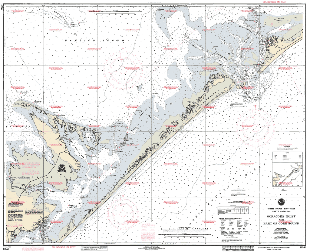
 When envisioning the shoreline of the United States (which includes tidal areas such as bays and rivers), it's hard to imagine that it measures more than 95,000 miles in length. That is greater than 40 percent of the distance to the moon! One of the many missions of the National Oceanic and Atmospheric Administration (NOAA) is to survey these coastal regions to provide an official and accurate delineation of the shoreline. These surveys provide shoreline data for the production of nautical charts and accurate geographical references needed for managing coastal resources.