Summer 2005
Summer 2005 |
|||||||
|
|
|||||||
GIS as a Utility
Commonwealth of Kentucky's Enterprise Implementation |
|||
|
By Kent Anness, Kimberly Anness, and Gary R. Harp
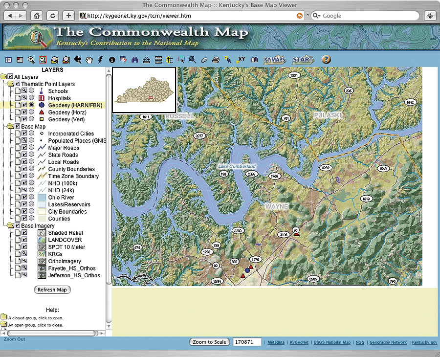
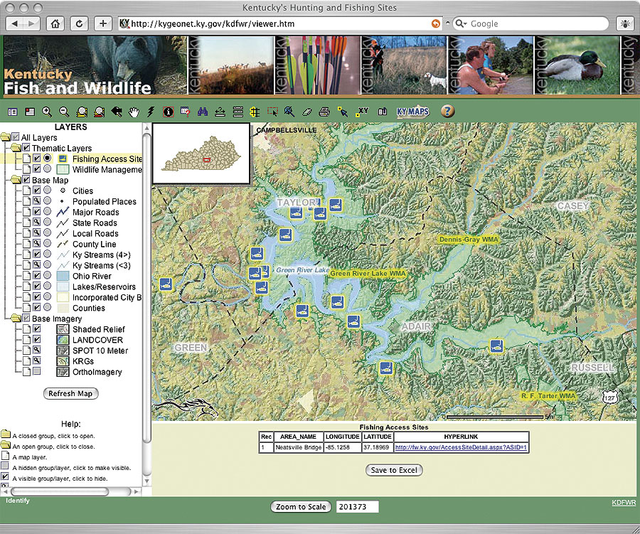
For years, Kentucky has been described as one of the best mapped states in the United States. In the past two decades, major efforts have been made to compile this "mapping," using state-of-the-art GIS technologies. The early successes of the Kentucky Natural Resources and Environmental Protection Cabinet, the Louisville/Jefferson County Information Consortium, and Northern Kentucky's GIS have demonstrated the value of leveraging quality geospatial data within all levels of government; the private sector; and, of course, the citizenry of the Commonwealth. Kentucky was one of the first states to have an office dedicated to GIS, put GIS data on the Internet for free download, and have a fully functional statewide Geography Network (ArcIMS metadata services) loaded with valuable geospatial resources. Building on the successful results of these efforts, Kentucky has now moved GIS into the enterprise, is rapidly expanding its application, and has made access to data resources nearly "plug-and-play" for all ArcGIS Desktop (ArcView, ArcEditor, and ArcInfo) users. The ChallengeData sharing and collaboration have been the key to many successful GIS implementations within Kentucky state government, as well as at the regional and local levels. Responsible data stewards have diligently built and maintained their geospatial resources and have shared them accordingly with entities that can benefit from their use. These data stewards became "publishers" that contribute to the Kentucky Geography Network (KYGEONET). The challenge at hand then was to assemble these distributed resources along with all associated metadata to create the Geospatial Data Clearinghouse that had been envisioned by so many leaders in the Commonwealth's GIS community. The SolutionThe success and ever-increasing usage of KYGEONET (kygeonet.ky.gov) since its inception in 2002 have been recognized around the world. However, until early 2005, all the KYGEONET resources were still distributed across many data stewards with master datasets held within that entity. Today, the resources are still distributed, but they are also consolidated at one point within the enterprise. Late in 2004, Governor Ernie Fletcher's administration saw the need to move many of the Commonwealth's IT functions into its world-class Cold Harbor Computing Center and to create a "center of GIS expertise" that could be leveraged by all state agencies, regional entities, and local government. Under the leadership of Commissioner Mike Inman and Director Gary R. Harp, the Division of Geographic Information (DGI) began implementation of its newly drafted strategic plan. This plan outlined a strategy to offer "GIS as a utility" within state government and eventually to the private sector and the general public. Up until that time, the Office of Geographic Information (now DGI) had simply served in an enabling role but never had the resources to implement or create specific deliverables for the GIS community. But, with the vision of its leadership and an infusion of new and capable staffing (Kent and Kimberly Anness), DGI began the implementation of a new repository for all geospatial data resources. This repository, built using ArcSDE 9.x, has become known as KyVector and KyRaster. These dedicated services are now the cornerstone of GIS in the Commonwealth.
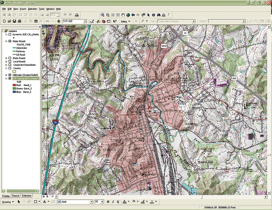
According to Kimberly Anness, creator of KyVector, there are nearly 125 layers available with an additional 25 layers that are considered "secure." Many more layers are slated to be incorporated throughout the year. As with KyRaster, KyVector feeds the Commonwealth's Web mapping services and provides layer-level access to ArcGIS Desktop users on the wide area network (WAN). This true enterprise implementation will allow some agencies that are just getting into GIS to enter this exciting field without having to buy a server to store needed base data. Thus, it is driving down the cost of getting into GIS at the ground level. Additionally, in the past, it was very common for most GIS workstations in state government to have a secondary hard drive (more than 36 GB) that held all file-based orthoimagery and topographic maps. Users are now indicating that their direct access to KyRaster provides them with imagery on the desktop at speeds as fast as they experienced with imagery on their local hard drives. Additional replicated instances of KyVector and KyRaster are being created at the Kentucky National Guard's Emergency Operations Center in Frankfort, Kentucky. An older instance of KyRaster used by the Kentucky Geological Survey (and housed at the University of Kentucky's McVey Hall Computing Center) will be updated to the current version of KyRaster and KyVector in the coming months. "KyRaster and KyVector continue to provide the foundation for Internet map services across Kentucky," says Dan Carey, Kentucky Geological Survey. "Thanks to these services, the Kentucky Geological Survey was able to set up Internet map services—in a matter of hours—to serve oil and gas, water well, and coal information. We continue to rely on them for a variety of broad GIS applications." ResultsAs of April 2005, the KyRaster and KyVector services were complete and stood in mirrored ArcSDE instances at the Cold Harbor Computing Facility. The instances were mirrored to separate traffic and reduce contention for the geospatial data resources. One instance is dedicated to supporting Kentucky's The other ArcSDE instance is dedicated to providing GIS users on the Commonwealth's WAN with direct access to all geospatial data resources that are available through KYGEONET. Much has been learned in the testing and implementation of this service, and it is quite apparent that Kentucky's ArcSDE instances, coupled with the state's high-performance WAN, are the new and proven methodology for efficiently delivering GIS data to users while simultaneously reducing data redundancy. Individual databases are being created for each data steward (KYGEONET Publisher) allowing them to securely connect to their workspace and consistently provide updates as new data is generated. These updates are then rolled into the master ArcSDE instance so all users have immediate access to the most current information. Formal announcement and rollout of these services were carried out during the April 2005 meeting of the Esri Kentucky Users Group. Nearly 100 attendees were given an overview of the services along with a demonstration of how the services could be leveraged using Esri client software packages, such as ArcExplorer and ArcGIS Desktop. The response and feedback have been overwhelmingly positive. There are obviously plans for expansion of the services with more layers and provision of these services to local and regional units of government and, subsequently, the private sector. All of this will be carried out "via the network" and will be bolstered by Governor Fletcher's initiative to saturate the Commonwealth with broadband connectivity by the year 2007. For more information, contact Adam Kent Anness, GIS manager, Division of Geographic Information, Commonwealth of Kentucky (tel.: 502-573-1450, ext. 235; e-mail: kent.anness@ky.gov). |