Summer 2006
Summer 2006 |
|||||||
|
|
|||||||
Conservation GeoPortal to Support Worldwide Data Sharing and Discovery |
|||
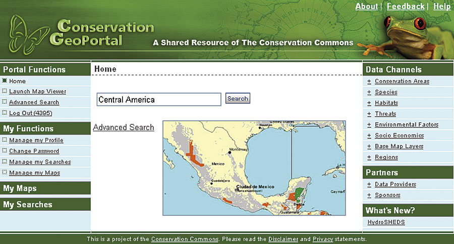
The Conservation GeoPortal is a tangible and practical expression of the Conservation Commons (www.conservationcommons.org). The World Conservation Union, or IUCN (after the union's former name, the International Union for the Conservation of Nature and Natural Resources), launched Conservation Commons in November 2004 at the World Conservation Congress. The Commons is a global initiative of conservation, scientific, government, and private sector organizations committed to working together to ensure, wherever possible, free and open access to biodiversity data and information. It outlines a set of principles that support open access to, and in particular the fair use of, data and information related to the conservation of biodiversity. The Conservation GeoPortal provides a Web-based application that enables the conservation community to discover, create, publish, and manage its metadata. In addition to a metadata catalog, it includes a 2D Map Viewer for viewing live map services, as well as the possibility of 3D viewing of map services using ArcGIS Explorer. Conservation geospatial data and maps can be further organized into categories and subcategories, called "Channels," which support quick discovery of premier datasets in each category. The GeoPortal is being initially sponsored by Conservation International, the National Geographic Society, The Nature Conservancy, and the United Nations Environment Programme World Conservation Monitoring Center with contributions of time, energy, and metadata from a growing list of Conservation Commons members. Esri is providing substantial enhancements to the GeoPortal, as its initial contribution to the Commons. Deployed with a conservation focus, the Conservation GeoPortal includes all the basic functionality of the Esri GIS Portal Toolkit. Esri is investing resources in adding viewer and editing functionality and providing detailed basemap data. Esri will also provide a portion of the enterprise server infrastructure. Initially the Conservation GeoPortal allows users to do the following:
The Conservation GeoPortal supports the Conservation Common's vision to improve open access to, and unrestricted use of, data, information, and knowledge related to the conservation of biodiversity, with the belief that this will contribute to improving conservation outcomes. Esri endorses the Conservation Commons' vision and principles and encourages other organizations to join the Commons and help the conservation community develop and share data, tools, and approaches to support conservation and sustainable development worldwide. More InformationFor more information about Conservation GeoPortal, please visit www.conservationmaps.org or www.conservationcommons.org. |