The Big Sky State Finds Gold in Statewide Cadastral Database
Montana's GIS-Based Cadastre Layered with Riches
Highlights
- Montana created the first GIS-based statewide cadastral system in the nation.
- The cadastral system's annual ROI is more than $9 million.
- The Montana cadastral data is widely available on the web.
As the fourth-largest state in the United States, Montana is synonymous with frontier. Under the state's famous "big sky" are 145,552 square miles of sparsely populated open land. Running in a diagonal line from northwest to south-central Montana, the Continental Divide splits and roughly defines the topography of the Big Sky State. West of the divide stand the northern and central Rocky Mountains, while east of the divide are mostly prairies and plains. Meanwhile, rivers; lakes; forests; national parks and monuments; long, lonesome highways; Canada; and four other US states divide, dot, and border Montana's 56 counties.

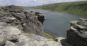
Overview of roof material derived from tax parcel data.
Managing all the geographic data associated with a territory as immense as Montana is no small task. The state recognized this challenge and pioneered a GIS-based statewide cadastral database. Montana's spatial data infrastructure, as recognized by the Montana Land Information Council, consists of 14 layers, with the cadastral layer being one of the most mature. The layer is based on the tax cadastre, a legal repository of land records that identifies the owner, location, boundaries, description, and property rights associated with a parcel of land. Montana's cadastral layer is most closely associated with the property assessment processes, but usage of the data goes far beyond the state Department of Revenue (DOR).
"More than half of government business processes are associated with parcels," says Montana Base Map Service Center (BMSC) chief Stewart Kirkpatrick. "Questions like, Who owns that parcel? or What features are associated with this parcel? are a constant at the local and state levels. It made sense that we, the State of Montana, had a standardized digital cadastre system that everyone could access."
According to the US Office of Management and Budget's Federal Enterprise Architecture framework, Kirkpatrick is right. The framework states that 74 percent of government data is location based, and that number is even higher at the state and local levels. Back in 1996, Montana hired Kirkpatrick as the project manager to explore the concept of a statewide cadastre, build a project plan, and obtain funding to collect and maintain tax parcel data in a standardized format using ArcGIS technology as the platform. Recognizing how their organizations could benefit from a statewide cadastre, Burlington Northern, Montana Dakota Utilities, Montana Power, and the United States Department of the Interior Bureau of Land Management (BLM) all signed on as major contributors to the project.
With initial funding in place, the conversion of paper records to digital format commenced in 1998, and in 2003, when the new digital tax parcel framework was complete, Montana had the only statewide cadastral database in the nation. Although the data was available by then, full benefits, such as a return on the state's $3 million cadastre database investment, were not realized until 2005. That initial investment included the development of the cadastral database. It also included the five-year task of paying contractors and state staff to convert, standardize, and integrate mostly paper-based data from approximately 900,000 parcels into the new ArcGIS software-based cadastral database.
By 2009, the state estimated the minimum annual value of its digital parcel and cadastral data at just over $10 million. It figures that the annual return on investment (ROI) is $9,335,700. ROI figures came from a Montana state study that focused on the value and costs associated with the cadastral system, including an evaluation of the IT investment in the cadastral layer; identification of business processes, users, and beneficiaries that depend on the cadastral layer; identification of the relationship between the cadastral framework and the other 12 framework layers; and development of a financial analysis that documents the current and ongoing costs and benefits of the cadastral layer.
An abundance of government agencies lend data to the system. DOR and eight counties collect the tax parcel data, while other agencies and interests collect ancillary data on conservation easements; municipal and school district boundaries; special districts like water, sewer, and mosquito abatement; and other data that conveys rights and interest on the land. It is BMSC's responsibility to integrate the tax parcels and related data into a statewide database monthly and link the tax parcels to DOR's computer-assisted mass appraisal system, ORION. BMSC also integrates BLM's geographic coordinate database as the digital representation of the public land survey (PLS) in Montana, since the PLS is the foundation of landownership in the state.
All cadastral data, including parcels and other spatially coincident feature classes, is stored in an Esri geodatabase by BMSC, while DOR's tabular data is moved to an Oracle database linked to the parcels. The data is housed in ArcGIS Server, then distributed as shapefiles and geodatabases where businesses, organizations, and other interested parties can go for cadastral data and maps.
Lost Lake in Montana.
Citizens, private organizations, and various state and county agencies use the cadastral information in a wide variety of ways. BMSC distributes the information to the public through the Montana Cadastral Mapping Application website, while the Montana State Library's GIS portal web page is the distribution point for metadata describing the state's cadastral database.
Esri Partner POWER Engineers Inc., a global engineering firm based in Hailey, Idaho, is an example of a private organization that appreciates the ease and speed of acquiring data from Montana's cadastral websites. Over the years, the firm has downloaded copious amounts of data for various Montana infrastructure projects, such as routing transmission and telecommunications lines and subsequent management of rights-of-way acquisitions.
POWER Engineers' recent business in Montana includes replacing old 115-kilovolt (kV) transmission lines with the larger 230 kV lines. The new transmission system may utilize the same corridor, but in some cases, the upgrade requires that more rights-of-way are acquired to accommodate the bigger structures. When routing a proposed power transmission corridor, the cadastral data can be used to minimize easement acquisition costs.
"We get data straight from the Montana cadastre websites and plug it into our own GIS," says POWER Engineers consultant Scott Chapman. "It's as easy as going to the website and selecting the county we're working in, then downloading the data."
State, county, and local municipalities can access the system, and they can link their own GIS solutions. The ArcGIS software-based cadastre has proved to be a significant time-saver for all kinds of small and large government tasks. In addition, BMSC provides hundreds of hours of assistance annually to local governments maintaining their own cadastral databases and holds educational workshops and seminars to expand cadastral knowledge.
Montana's Butte-Silver Bow is just one of the many local governments to reap the rewards of the digital cadastre. As the director of Butte-Silver Bow's planning department, Jon Sesso oversees a residential metals abatement program. Having cadastral data easily accessible in a GIS is important to the city-county government, especially when a property is sold. It's a high priority to test for and abate the presence of toxins, especially on properties where children live, because youth are extremely susceptible to dangerous chemicals, such as lead, found in or around a home.
When a property is sold, it gets recorded in the county's GIS, which then alerts Sesso's department. If the property has already been tested, no action is taken. However, when a property that has not been tested changes ownership, performing a test becomes a high priority, since the new owners could have children.
Says Sesso. "Having these land records digitized in the cadastral system has been a tremendous help for us. We have a legal obligation to keep track of where we have tested, where we've done abatements, and where we haven't."
For more information, contact Montana Base Map Service Center chief Stewart Kirkpatrick (e-mail: skirkpatrick@mt.gov) or visit gis.mt.gov.