Winter 2002/2003
Winter 2002/2003 |
|||||||
|
|
|||||||
Better Planning Using a High-Resolution Digital Elevation Terrain Model
In the City of Sioux Falls, South Dakota, GIS Helps With River Management |
|||||||||
|
By Lauri B. Sohl, GIS Analyst, City of Sioux Falls, South Dakota, and Lawrence Faulkner, President, Solid Terrain Modeling
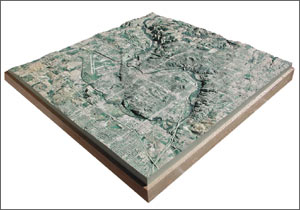
The Big Sioux River enters Sioux Falls, South Dakota, from the north and meanders through the core of the city before exiting on the northeast. One of the issues the City of Sioux Falls faces on a daily basis is its relationship with water, specifically measures to control the river when there is too much water or precautions to implement when there is too little. Numerous flood precautionary measures are already in place including a diversion channel, dikes, and other flood management controls. In addition, the City of Sioux Falls relies on the Big Sioux River for a large portion of its water supply. This past summer, many water supply restriction measures were implemented to ensure an adequate supply and to lessen reliance on groundwater. The GIS employees of the City of Sioux Falls have the task of explaining complex problems or issues to decision makers and appointed officials. This task is made easier with the use of modern technologies that use GIS. The City of Sioux Falls utilizes Esri's ArcInfo 8.x and extensions, which enables it to create products that are used to educate. Examples include hard-copy maps that feature digital elevation models, aerial photographs, or satellite imagery; three-dimensional visuals that are captured on a computer and projected onto a screen for a large audience; and vector data that represents storm sewer, sanitary sewer, and water distribution, just to name a few. However, sometimes a problem or issue needs to be viewed and considered in another medium. The process of flood management is ongoing, and the city needed a tangible tool for planning and analysis that would be accessible to all city departments--a physical and visual device to promote understanding of the physical features of the area. The need for such a tool led the City of Sioux Falls to pursue the creation of a solid terrain model of Sioux Falls and the surrounding area.
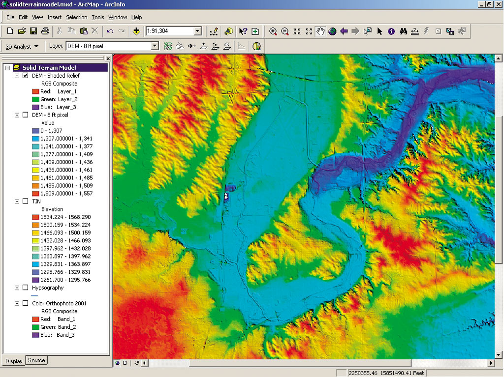
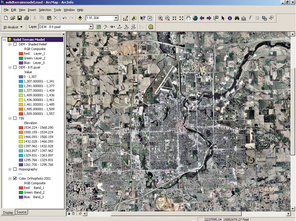
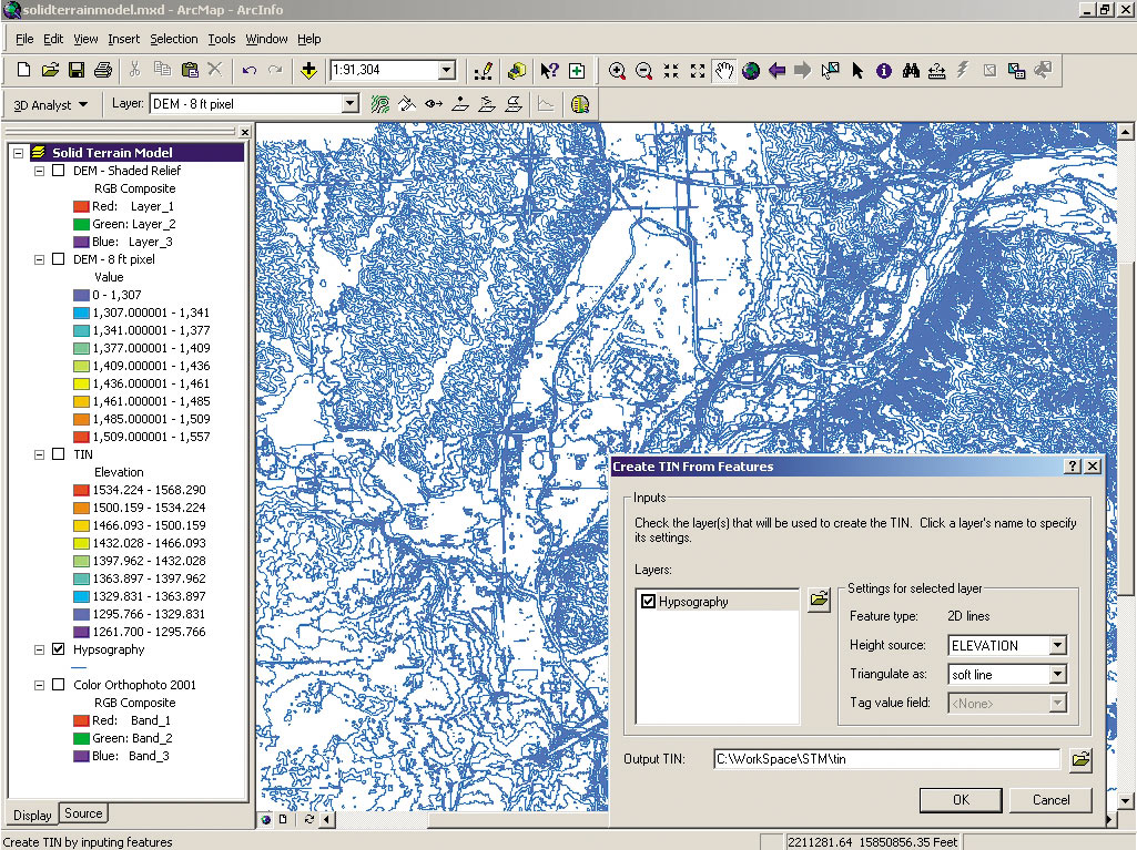
There is a proverb that says, "When the student is ready, the teacher will come." When the city began in earnest to investigate how to make such a solid terrain model, a geographic trade magazine brought to their attention the only vendor that creates such a model, Solid Terrain Modeling (STM), located in Fillmore, California. The city checked out STM's Web site (www.stm-usa.com) and at the same time began to see other models STM created for the National Geographic Society and in various publications. Before long, STM began working with the City of Sioux Falls to help solve the problem of conveying complex information in a simple manner. How to Build a Solid Terrain ModelTo make the solid terrain model, STM required two inputs: an image (e.g., aerial photograph, satellite image) and a digital elevation model (DEM). Fortunately, the City of Sioux Falls was able to readily submit a five-foot, pixel color orthophoto taken of the city and surrounding area by Horizons, Inc., of Rapid City, South Dakota, in April 2001. The DEM, however, needed to be created from the ground up by the City of Sioux Falls using the ArcGIS 3D Analyst extension in ArcInfo 8.x on a Dell Precision 330 Pentium 4 1,500 MHz with 512 MB RAM. The DEM and orthophoto were then submitted to Solid Terrain Modeling for processing. (If a client does not have the ability to obtain an image or DEM, Solid Terrain Modeling can assist with the process.)
After receiving the DEM and image files from the city, STM performed a data quality and registration check. The data was found to be in excellent condition. The DEM contained fine detail and was absent of spikes or holes, and the image was cloud free. ArcGIS was used throughout the process including verifying the image/DEM overlay. In the end, the DEM and image aligned seamlessly. The next step was to cut the DEM out of a solid block of material using high-density foam and a computer-controlled milling machine. It took about one day to size the raw material to 48" x 48" and machine the DEM. Then, the raw model was coated with primer and paint to prepare for printing, which also took one day. The final process was to put the model into STM's specially designed printer and print the image onto the surface. The model was finished with a clear coat to protect the image and mounted on an oak frame suitable for display. A New Take on a Natural Barrier in the Core of the CityThe model's presence in the GIS office at City Hall has garnered a great deal of attention. Since the Big Sioux River is a natural barrier in the core of the city, Kevin Smith, the assistant director of Public Works comments, "Having a true three-dimensional model assists the city in determining how we have affected the land around us and, more important, how we can continue to grow in the most efficient and environmentally friendly way possible."
Also, one of the interesting aspects of the model is that the image used was taken during a high water year, and the areas prone to flooding are visually obvious. Not only has the model educated decision makers and local officials who make decisions regarding water in the area, but the model is also being utilized in all aspects of city government. "Both professionals and nonprofessionals alike can easily visualize the contours and surface features that form our community," Smith says. Citizens who visit the GIS office are amazed that they can observe and touch a model of the city in a form that changes how they view the area in which they live. For more information, contact Lauri Sohl, GIS analyst with the City of Sioux Falls (tel.: 605-367-8625, e-mail: lsohl@siouxfalls.org, Web: gis.siouxfalls.org), or Lawrence Faulkner, president of Solid Terrain Modeling (tel.: 805-524-7307, e-mail: lfaulkner@stm-usa.com, Web: www.stm-usa.com). |