Winter 2006/2007
Winter 2006/2007 |
|||||||
|
|
|||||||
Esri Recaps a Year of Meeting Its Users' Needs
As GIS Continues to Evolve, Esri Grows with the Flow |
|||
|
As Esri reviews 2006 and looks to the future, GIS software continues to evolve to meet the changing needs of business, industry, government, and education. GIS is becoming a way to make geographic knowledge available to everyone. Esri Product Highlights in 2006The 2006 release of ArcGIS 9.2 featured its new productivity tools, data visualization and analysis capabilities, sophisticated cartographic tools, high-precision coordinate storage, and expanded support for standards. Broad interoperability with spatial data makes it easier than ever to integrate disparate data from a variety of sources. For more productivity, ArcGIS 9.2 introduces a new workflow for authoring, serving, and using geographic data. New client applications in combination with ArcGIS Server provide mobile workers, analysts, decisions makers, and the public with access to the technology. Improved tables, new navigation tools, and keyboard shortcuts help make users more productive. ArcGIS Server 9.2 delivers a complete Web GIS for spatial data management, visualization, and analysis. It is an open and interoperable server that supports a broad range of clients including ArcGIS Explorer, out-of-the-box browser-based applications, ArcGIS Mobile, and ArcGIS Desktop. This year, Esri expanded its commitment to building an open and interoperable GIS platform. Several interoperability improvements in ArcGIS 9.2 and the ArcGIS Data Interoperability extension include support for Open Geospatial Consortium, Inc. (OGC); Web Map Service (WMS); Web Feature Service (WFS); and GML Simple Features on both the client and server. ArcGIS 9.2 supports the ISO 19139 metadata standard, and there is enhanced assistance for reading, exporting, and working with CAD drawings from AutoCAD and MicroStation. In December 2006, Esri made ArcGIS Server 9.2 available to all customer sites with ArcGIS Server, ArcIMS, and ArcSDE. ArcGIS Explorer was included with ArcGIS Server and is a lightweight desktop client that can easily access, visualize, and manipulate geographic data on a server. ArcGIS Explorer can use local data, such as shapefiles, file geodatabases, KML, JPEG 2000, GeoTIFF, MrSID, IMG, and other image formats. ArcGIS Explorer users can access ArcGIS Online Services, which provides a series of ready-to-use online map services, globe services, and other GIS services (see "ArcGIS Online Services Introduced"). Esri released ArcGIS 9.1 Business Analyst in 2006. The software helps companies, agencies, and organizations perform accurate marketing analyses faster and more efficiently. ArcGIS 9.1 Business Analyst includes complete integration with the ArcGIS 9 framework, routing, and drive-time tools based on ArcGIS Network Analyst; enhanced reporting capabilities; updated datasets; and new techniques to create, manage, and compare trade areas. Esri's 2006 demographic data estimates and 2011 projections were released and are available on demand as downloadable reports and maps from Business Analyst Online (www.esri.com/bao), Esri's online reporting and mapping service. In May, the North America street dataset for RouteMAP IMS was released. It includes updated street data, postal boundaries, landmarks, and water features for the United States, Canada, and Puerto Rico. RouteMAP IMS is designed to help users add mapping and routing capabilities to their Web sites.
The new version of the GIS Portal Toolkit includes improved installation and configuration, better metadata management and access control, and integration with ArcGIS Desktop. It is a technology and services solution for implementing local, regional, national, and global spatial data infrastructure portals. Esri Training and EducationThe New Training and Education Web site (www.esri.com/training) was launched in 2006. It is a single online environment developed to better serve Esri users who need information about training options and provide one place to find answers to training-related questions. Visitors can find information on instructor-led and Web-based training, search for courses and learning centers, view class schedules and course recommendations, access Virtual Campus Web-based training, and explore the Internet's most comprehensive library of GIS literature. The site also features resources especially designed for training managers. Esri's instructor-led courses continue to be the first choice of training among GIS professionals with more than 30,000 people worldwide trained in the year 2006. Several important new courses to the Esri training curriculum, including Learning GIS Using ArcGIS Desktop, Introduction to ArcGIS Server, and Data Production and Editing Techniques, were added. These courses continue Esri's tradition of responding quickly to users' educational needs. The latest education solution from Esri, the online classroom, delivers real-time instructor-led training over the Internet, giving students a high-quality training experience without the need to travel. online classroom courses combine personal delivery by an experienced Esri instructor with the accessibility and convenience of learning over the Web.
In addition to new courses in 2006, Esri Educational Services also unveiled the third learning pathway in its Learning Pathways program. The Fundamentals of ArcGIS Desktop pathway is designed for those who are new to GIS and ArcGIS Desktop. The pathway includes instructor-led and Web-based courses that provide information on GIS concepts and the uniqueness of spatial data and explore how GIS can be used to solve problems and answer questions. Those completing a learning pathway will acquire knowledge and skills that can be applied directly to their jobs. Visit www.esri.com/pathways for more information on learning pathways. The year 2006 saw the debut of Instructional Series podcasts to make training accessible by anyone anywhere. With more than 10,000 downloads per month, the podcasts are the newest way to receive free Esri software training on demand. They provide short, focused training that fits effortlessly into anyone's schedule and can easily be downloaded to a computer or MP3 player. Listeners can choose from more than 25 topics, including Editing in ArcGIS: General Tips and Tricks, Geodatabase Archiving: Introduction to Concepts and Capabilities, and Performance Tips and Tricks: ArcGIS Desktop. Visit www.esri.com/podcasts to subscribe to the podcast feed to be notified when new content becomes available. Visit www.esri.com/training to begin using this new resource. Esri Press
User Conference Promotes CommunicationRegistration at the 26th Annual Esri International User Conference exceeded 14,000 in 2006. The event, held August 7–11 in San Diego, California, included 300 technical workshops, 1,100 paper presentations, and many user group meetings. Highlights of the weeklong confab included keynote speaker Bob Kerrey, president of New York City's The New School and former Nebraska senator, and introductions to Esri software developments, including the new 9.2 release. This year, 175 winners were recipients of Esri's Special Achievement in GIS award, which celebrates the accomplishments of GIS innovators and the benefits they bring to their communities. "GIS technology can be thought of as a new medium for communication, not unlike newspapers, radio, television, and the Internet," said Esri president Jack Dangermond during the opening session. "This medium is being used to help people better understand and collaborate, as well as formulate and tell stories about conditions, situations, and events, and even forecast the future." Advancing GIS Education
Also in 2006, a new statewide license went into place for Virginia giving all Virginia public school students in grades 6–12 the opportunity to use GIS software and extensions. The eighth annual GIS Day was held November 15, 2006. Hundreds of successful events were conducted in 85 countries around the world and in all 50 states. GIS Day provides an international forum for users of GIS technology to demonstrate real-world applications that are making a difference in society (see "GIS Day Brings New Dimension in Geography to Communities Worldwide"). GIS Day 2007 will be held November 14, 2007. Corporate Alliance 2006The Esri Corporate Alliance team engages with the leading providers of IT platforms, enterprise applications, and global data to promote and market Esri GIS technology in multiple industries throughout the world. Esri continued to enjoy strong, mutually beneficial relationships with its corporate alliances in 2006. In the business intelligence (BI) space, Esri extended its reach with new integration options available for Business Objects and Cognos technology joining existing integration with Hyperion, Information Builders, and SAS. The alliances in the BI space are embracing ArcGIS Server as the platform of choice for BI integration. In the enterprise content management (ECM) space, Esri alliances Documentum, FileNet, and Hummingbird were purchased by large platform technology vendors, which is enabling these organizations to continue to broaden Esri's reach in the IT space. Data providers NAVTEQ and TeleAtlas continued to expand their geographic coverage in 2006, which has opened up new markets for joint offerings and assisted Esri's customers in expanding their successful implementations. Esri supported SAP's internal Sagres project, which is helping to redefine the needs for GIS/SAP integration. Its Microsoft relationship continues to focus on broad-level platform and developer support, including support for SQL Server 2005. Additionally, Esri's ArcGIS 9.2 includes SQL Server Express. IBM's innovative use of Esri's GIS and Web services for workplace collaboration, mashups, and service- oriented architecture implementation highlighted a strong year of joint technology integration and customer support. ConclusionEsri exists to help its users—GIS professionals. These men and women are helping advance science, advance conservation, improve human health, mitigate conflicts, and make businesses more productive. In almost every dimension, the work of Esri's users and business partners is helping build a better world and improving the way that we manage our planet. |
 In its 37th year, growth continues at Esri. Its focus on GIS users remains unchanged while consistent growth, financial stability, and broadening relationships continue to strengthen. Esri leads the way in advancing GIS to help find better solutions to the world's challenges. Today, the company has more than 4,200 skilled employees worldwide who work with hundreds of business partners and tens of thousands of GIS users who are working to understand the new challenges that the ever-changing world brings.
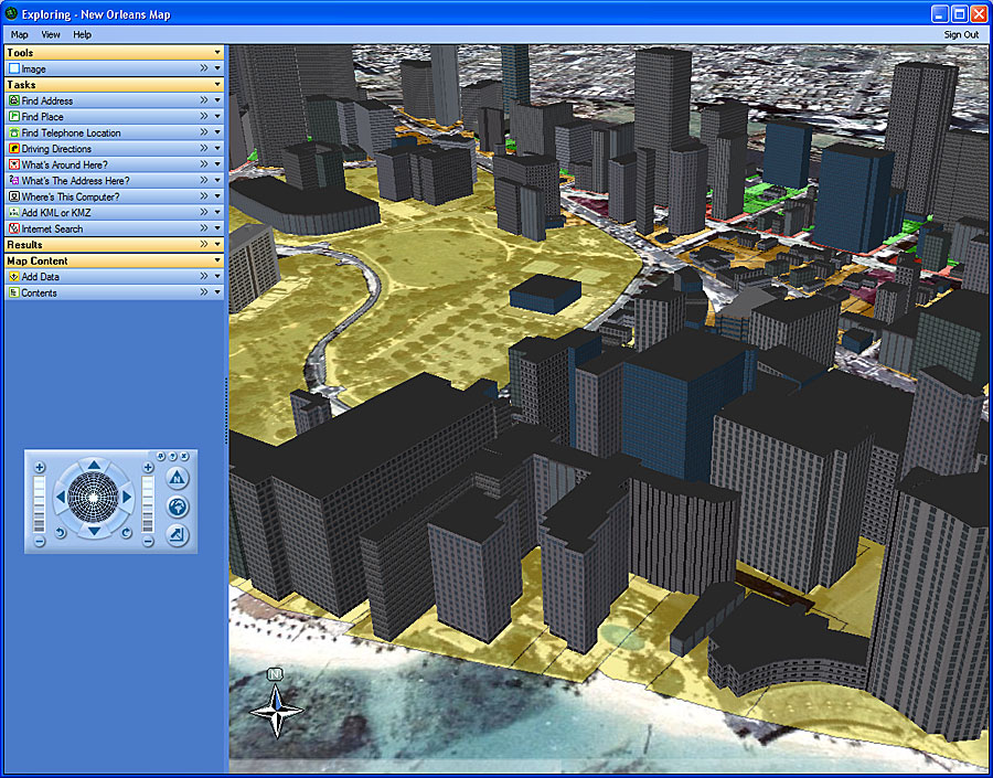
 Esri continued to be a leader in GIS education and training on the Web in 2006. More than 100 Web-based training options are now available for those seeking training on Esri software products, industry solutions, and GIS theory. A variety of training options debuted in 2006, ranging from focused training seminars to comprehensive courses, such as What's New in ArcGIS Desktop at 9.2, Learning Visual Basic for Applications for New ArcGIS Developers, and Migrating from ArcView 3.x to ArcGIS Desktop. Visit
  Esri Press has published several new titles ranging from GIS tutorials and dictionaries to the latest on urban analysis and environmental management. Highlights include A to Z GIS: An Illustrated Dictionary of Geographic Information Systems, GIS Tutorial for Health, and Charting the Unknown: How Computer Mapping at Harvard Became GIS (see "
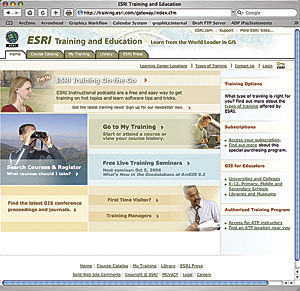 The Sixth Annual Esri Education User Conference preceded the conference with more than 500 K–12 teachers, college and university faculty, school administrators, community leaders, librarians, and museum professionals from 46 states and 22 countries gathering to exchange ideas and learn about the current issues and latest developments in GIS in education. Keynote speaker Allen Carroll, chief cartographer for the National Geographic Society, discussed the current state of education and the role of educators in bringing geographic thinking to today's youth.