Winter 2006/2007
Winter 2006/2007 |
|||||||
|
|
|||||||
Exploration in the Age of Digital Earth |
|||
|
By Dawn J. Wright
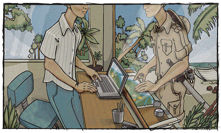
Explornography is an interesting term that was first coined by John Tierney in a 1998 New York Times article. It was defined there as "the vicarious thrill of exploring when there is nothing left to explore." His discussion of the term was actually meant to be a critique of the Peary expedition to the North Pole in particular and of some forms of extreme tourism to exotic or dangerous places in general. But if one extends this beyond the notion of just exploring physical places on the Earth's surface, one can think of exploration and discovery in a new way. We are now in what many call a second age of discovery, where virtual worlds of real and imagined phenomena may be explored through computers on a desktop, in large visualization theaters, on small handheld devices, or soon even through small devices on our clothing or eyewear. But, thankfully, there is still much left to explore physically. For example, in terms of surveying and mapping of the Earth's surface, very little is known about the fine-scale topography and structure of the global seafloor. There now exists satellite altimetry covering all the world's oceans from which low-resolution bathymetry can be derived. But slower, more spatially restricted shipboard measurements must still be made at sea to gather the higher-resolution data required for tectonic studies or the baseline framework datasets needed for a host of applications from laying marine cable to conserving marine protected areas. Only 35 to 40 percent of the entire Earth's surface (including the seafloor) has been mapped at a similar resolution of a common hiking map or topographic maps of other planets, such as Mars and Venus. So in our quest to build a "digital earth"—global access to all possible geographic data about places on the surface and the subsurface—researchers and practitioners face many enticing challenges, including the development of visualization systems with user-friendly interfaces that enable the analysis, modeling, and simulation of data, as well as just the simple viewing of it. For several years, the National Aeronautics and Space Administration (NASA) led a Digital Earth Initiative that included the development of a prototype visualization system, a large globe that a user could manipulate with special gloves and glasses, "a very visual earth explorer that lets scientists, both young and old, examine information about the earth to learn how the forces of biology and geology interact to shape our home planet." In a parallel effort, Google Earth has now essentially taken up this mantle and led the way with its high performance, seamlessness, and a de facto exchange standard in Keyhole Markup Language (KML) and KML, Zipped (KMZ). The GIS world is following suit with the addition of better integration and leveraging of models, analyses, and metadata, in addition to the 3D data. These are examples of helping to build the second age of discovery through geographic information science, recognizing that technologies give rise to questions about their appropriate and most efficient use, questions that need theoretical frameworks to be solved. For instance, interoperability is one of many research topics that geographic information science, computer science, and others still grapple with. At times we pay the price for building technology in the absence of good theory.
In the United States, the term cyberinfrastructure is being used with greater frequency to refer to how the traditional modes of scientific research (e.g., experimentation in the lab, observation in the field, processing/analyzing on a single calculator or computer, calculating on the back of an envelope) are being extended or replaced by information networks. Indeed, just as physical infrastructure has represented roads, bridges, railroad lines, power grids, etc., as fundamental components of modern communities, cyberinfrastructure now refers to the fundamental components of modern scientific and engineering methodologies (i.e., information technology, digital communications, and distributed computing). As stated by a recent blue ribbon advisory panel of the U.S. National Science Foundation (NSF), one of the primary funders of basic and applied research in the United States, "Cyberinfrastructure will become as fundamental and important as an enabler for the enterprise as laboratories and instrumentation, as fundamental as classroom instruction, and as fundamental as the system of conferences and journals for dissemination of research outcomes." Distributed computing is a particularly important part of the equation, as the computing power in cyberinfrastructure for serving, rendering, analyzing, and simulating may be as distributed as the datasets themselves (and this distribution often implies that data producers and providers are willing and able to share their products, often in near real time). As such, research in cyberinfrastructure deals with the interoperability of technologies, as well as their efficiency, connectivity, and usability, within the realms of large systems, such as university consortia, large research collaboratives, and local/county/state/federal governments. Current Initiatives in the United StatesNSF now provides federal dollars through an Office of Cyberinfrastructure, with a focus on acquisition and upgrading of supercomputing facilities, high-capacity mass storage systems, enterprise software suites and programming environments, support staffers, etc., for the academic community. It may soon become one of the most important funding programs at NSF for geographic information science. Related to this is the NSF Digital Government Web portal (www.digitalgovernment.org) with a mission to link academic research in information technology (including cyberinfrastructure) to the mission, directives, and activities of government at the federal and state levels and to evaluate the overall resulting impact on governance and democracy. These "e-science" programs point to the priorities placed by our government on these areas and the recognition that new subdisciplines may be created as a result. There has also been great interest expressed regarding funding collaboratives between U.S. researchers and European partners and that cyberinfrastructure developed in the United States be interoperable with that being developed and deployed elsewhere. There are many examples of cyberinfrastructure projects in development, far too numerous to highlight, but one currently under way in the United States, the Oregon Coastal Atlas (www.coastalatlas.net), has many connections to the Marine Irish Digital Atlas (MIDA). The Oregon Coastal Atlas was funded primarily by the NSF Digital Government Program and is a collaboration between the State of Oregon's Ocean-Coastal Management Program (state government), Oregon State University (academia), and Ecotrust (nonprofit environmental organization). The heart of the atlas is an interactive map, data, and a metadata portal for coastal zone managers and coastal planners, with additional outreach sections for scientists, secondary school educators, and the general public. The portal enables users to obtain datasets, understand their original context, and use them for solving a spatial problem via online tools. The design of the atlas draws from the reality that resource decision-making applications require much more than simple access to data. Resource managers commonly make decisions that involve modeling risk, assessing cumulative impacts, and weighing proposed alterations to ecosystem functions and values. These decisions involve pulling together datasets and, thus, knowledge from such disparate disciplines as biology, geology, oceanography, hydrology, chemistry, and engineering. Practitioners within each one of these disciplines are often vested in the technologies that dominate the market within their particular field. This presents significant data integration difficulties for investigators involved in management decisions that are as inherently interdisciplinary as those in the coastal zone. The goal of the atlas effort is to address these problems by incorporating a variety of geospatial data coupled with analysis tools that the data can be applied to that are run on the Web within the atlas itself or downloaded to the desktop. Advanced GIS tools to date that are available within the atlas include the Coastal Erosion Hazard Suite, Coastal Inundation Visualization tool, Watershed Assessment tool, and Coastal Access and Beach Water Quality viewers. In this way, the collaborative seeks to improve universal participation in coastal decision making among communities within the state of Oregon by extending infrastructure to public offices that would otherwise face difficulties accessing these services and resources. The Oregon Coastal Atlas and Marine Irish Digital Atlas were discussed in detail at a recent Transatlantic Workshop on Coastal Mapping and Informatics (funded by the Marine Institute of Ireland, National Development Program of Ireland, and NSF), along with similar coastal atlas efforts in Belgium, Canada, France, the United Kingdom, and other parts of the United States (workshop1.science.oregonstate.edu). Workshop 1 (Potentials and Limitations of Coastal Web Atlases) took place in Cork, Ireland, July 24–28, 2006, and brought together more than 40 key experts from academia, government agencies, and conservation organizations on both sides of the Atlantic to share technologies and lesson learned from the development of coastal atlases. Workshop 2 will be held at Oregon State University, July 16–20, 2007, and will focus on building a common approach to managing and disseminating coastal data, maps, and information within these atlases, including an agreement on initial common vocabularies and thesauri to facilitate database searches in Europe and North America. As an example of a cyberinfrastructure that will be developed on a much broader scale (regional to national), the workshop participants are considering the formation of an international network or federation of coastal atlases. This has important implications for maritime policy throughout the European Union, as such mapping plays a critical role in issues of national sovereignty, resource management, maritime safety, and hazard assessment. With the release of the Pew and U.S. Ocean Commission reports, there is growing public awareness in the United States of the critical state of our coastal zones and fisheries. Government agencies, businesses, academic institutions, and even nonprofit organizations all have a tremendous stake in the development and management of geospatial data resources, especially in the coastal zone, since, worldwide, 20 percent of humanity live less than 25 kilometers from the coast, and 39 percent, or 2.2 billion people, live within 100 kilometers of the coast. Other broad-scale cyberinfrastructure examples include the Biomedical Research Network, a collaboration of three U.S. West Coast universities (California Institute of Technology [CalTech]; the University of California, Los Angeles [UCLA]; and the University of California, San Diego [UCSD]) with Duke University on the East Coast to distribute and integrate multiscale biomedical data for human disease studies. GEONGrid (www.geongrid.org) is a large, five-year collaborative effort spearheaded by the Pennsylvania State University, San Diego State University, and San Diego Supercomputer Center to foster interdisciplinary research among geologists and geophysicists. These and many other collaboratives all participate to some extent in geodata.gov, the reincarnation of the nationwide network of geospatial metadata clearinghouses at the heart of the U.S. National Spatial Data Infrastructure. Geodata.gov's Geospatial One-Stop Initiative (toward one-stop "shopping" for free government and academic data) is part of the ongoing technological and e-government trend toward collecting and maintaining datasets locally or regionally and sharing them nationally or internationally (in some cases as fulfillment of a grant deliverable or contract, which must be completed before an organization becomes eligible to apply again for future funding). A Concluding Eye to the FutureThe following is a small sampling of compelling cyberinfrastructure research topics being undertaken within the GIS/geographic information science (GIScience) community. Further explanation and references may be found on the Web sites of the University Consortium for Geographic Information Science (UCGIS) (www.ucgis.org) and the GIScience 2006 conference in M�nster, Germany (www.giscience.org).
As work continues in these areas, and collaborations and funding levels remain at least at the present levels, the future appears bright for a new kind of exploration and discovery (even productive rediscovery) of physical places, environmental databases, information spaces, spatial data infrastructures, and the like, through cyberinfrastructures. About the AuthorDawn Wright (a.k.a. "Deepsea Dawn") is a professor of geography and oceanography at Oregon State University, where she has been on the faculty since 1995. Dawn has explored some of the most geologically active regions of the planet on more than 20 oceanographic expeditions. She has published five books and more than 70 papers. In 2005, she received the Milton Harris Award for Excellence in Basic Research. More InformationFor more information, contact Dawn Wright, 104 Wilkinson Hall, Department of Geosciences, Oregon State University, Corvallis, Oregon 97331-5506 (e-mail: dawn@dusk.geo.orst.edu, Web: dusk.geo.orst.edu). This article is based on her keynote address delivered in Dublin, Ireland, to the GIS Ireland Conference, sponsored by the Irish Organisation for Geographic Information (IRLOGI). |
 What might the concept of exploration and the notion of discovery mean to geographers and GIS practitioners today? Exploration of our planet through fieldwork and, hence, discovery of new places is still ongoing, but so is the exploration of environmental databases, even information spaces that do not necessarily include spatial data. Therefore, "discovery" of a place does not necessarily mean having to "be there" in the field. Presented in this context are the themes of data sharing and the benefits thereof in the United States and the emergence of cyberinfrastructures (i.e., the use of high-end information technology in day-to-day activities, not just for the occasional supercomputer job), which are taking hold in basic and applied research and also within the realm of digital government. Under the umbrella of cyberinfrastructures, exciting new research topics are being developed in the areas of Web GIS (e.g., modeling, algorithms, data structures, stability, performance, and other computing issues), ontological libraries and semantic interoperability within Web GIS, and networks of data and metadata clearinghouses that are being built with open-specification Web mapping services and Web feature services.