Florida City Delivers 24/7 Service with Site Starters
by Aaron Drake, City of Melbourne
The City of Melbourne, located halfway between
Jacksonville and Miami, is a picturesque Atlantic coastal community
that thrives on high technology, manufacturing, and tourism. The
city is part of Florida's "Space Coast," so-named for
to its close proximity to NASA's Kennedy Space Center.
Melbourne's GIS Team recently completed and released
a new interactive Internet-based mapping system that uses the ArcIMS
Site Starter applications from Esri. This system lets the public
quickly find location-based information such zoning, crime, and
flood zone information. This type of information, previously available
only by visiting or calling Melbourne's City Hall, can now be accessed
online at Melbourne's GIS Web site (gis.melbourneflorida.org).
GIS Team Goals
The Site Starter applications met the GIS Team's
requirements for a lightweight, easily-customized application with
robust search capabilities and an easy-to-use interface that would
be suitable for low-bandwidth users.
Light Weight--Although
the Internet is moving toward broadband applications, the GIS Team
wanted the mapping applications to run as effectively for 28.8 KB
modem users as users with cable or DSL connections. The Site Starter
applications, lightweight and optimized for low bandwidth, utilize
Active Server Pages (ASP) so most processes are performed by the
Web server instead of the browser.
Robust Search Capabilities--The
Search application, one of two Site Starter applications, supports
many types of search methods. These methods were customized so that
a visitor to the Melbourne Web site can search for information by
address, owner name, tax identification number, or parcel identification
number. Melbourne's implementation of the Search application quickly
and efficiently retrieves requested information from an indexed
Microsoft Access database.
Easily Customized--Site
Starter applications are easy to customize. Changing one or two
items in an application's global parameter file modifies the application.
Things such as report item aliases can be modified, updated, or
deleted in this file. Cascading Style Sheets (CSS) manage items
such as application background color, font color, and font type
and can be easily changed.
Easy to Use--The
Site Starter applications provide users with a simple interface
that is easy to use. The user simply chooses the type of search
method, enters the desired information, and hits go. From the tabular
data returned, the user can choose a record to see a detailed report
or view an interactive map. The interactive map lets users pan,
zoom, and identify features.
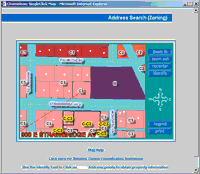 |
| The Melbourne site provides many different
types of search methods. |
Melbourne's Implementation
Melbourne is the first municipality in the area
to offer such a service. The GIS Team had been striving for quite
some time to provide it. Users can now access property ownership
and sales information and view interactive zoning, flood zone, crime,
council district, and aerial maps 24 hours a day. This also means
City employees can concentrate on other projects, rather than providing
information to the public.
The property information used by Melbourne's GIS
Web site comes from Brevard County, Florida, and is continually
updated. Melbourne's implementation of the Site Starter applications
delivers the city and municipal information requested by the public.
It serves the needs of many types of users.
- Real estate agents and brokers often need zoning, and flood
zone information. Previously, agents and brokers contacted the
Planning and Economic Development department to access this information.
Now this information can be retrieved online in a quick and efficient
manner.
- Prospective homebuyers can view flood zone maps and determine
the location of a property in relation to known flood areas. Homebuyers
can also research crime occurrences in neighborhoods. The application
provides a snapshot showing when, where, and what crimes have
occurred between 1998 and 2000. Detailed information, such as
victim and suspect names, is not provided.
- Citizens can determine which council district they live in using
the Council Member District Search application
Users lacking specific search criteria (i.e., no
street address, owner name, or parcel identification number) can
interactively locate information using the Viewer application. The
default extent for the Viewer application is the City limits. Users
can zoom in on an area to locate a parcel and view information on
it or view thematic information.
The GIS Team is pleased that this information now
available to the public and plans to add applications in the near
future that will let users view information on utilities, existing
land uses, and vacant land. The team hopes public feedback will
be available to guide them in enhancing the site with additional
applications.
For more information, contact
Aaron Drake, GIS Coordinator
Melbourne, Florida
Tel.: 321-674-5804
E-mail: adrake@melbourneflorida.org
About the Author
Aaron Drake is the GIS coordinator at the City
of Melbourne, Florida. He developed the City's interactive mapping
system and GIS Web site. He holds a master's degree in GIS from
Florida Atlantic University and a bachelor's degree from the University
of Central Florida.
|