ArcUser Online
Turning Red Zones into Blue Zones
How GIS can help create healthy communities
By Monica Pratt, ArcUser Editor
This article as a PDF.
"How can we turn red zones into Blue Zones?"
Seth Wiafe asked this question of the attendees of the Healthy Communities by Design Summit, cosponsored by Esri and Loma Linda University in November 2010.
This map on ArcGIS.com shows where residents can walk to sources of healthy food.
The summit, cosponsored by Esri and Loma Linda University, explored the ways that GIS can be used to design communities that foster lifestyles that improve the well-being of their residents. (For more information on this event, see the accompanying article, "Summit Promotes GeoDesign for Healthy Communities.")
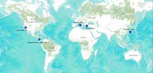
Blue Zones is the name given by explorer, educator, and author Dan Buettner to places where people live long lives—often past the age of 100. Buettner found that people living in Sardinia, Italy; Okinawa, Japan; Loma Linda, California; Nicoya Peninsula, Costa Rica; and Icaria, Greece, lived not only long but also active lives.
Interest in determining the factors that contribute to a long, healthy, and active life has grown as health care systems in the United States and elsewhere have become more burdened by the substantial increase in chronic diseases and conditions, such as diabetes, heart disease, and high blood pressure, that are associated with lifestyle choices.
The healthy communities movement began in the mid-1980s as a response to the rise of chronic conditions rooted in lifestyle and environmental factors. This movement adopted a very broad definition of health and a very different approach to fostering it. In contrast to traditional health care, which concentrates efforts on identifying and treating disease in individuals, healthy communities work on strategies for improving the health of populations.
Creating a Blue Zone
Joel Spoonheim, director of Health Initiatives for Blue Zones, Healthways, described to Healthy Communities by Design Summit attendees how a prototype project made substantial improvements to the health of a Minnesota community in just 10 months. The project's goal was to transform this city into a Blue Zone by modifying the behavior of its residents.
The AARP/Blue Zones Vitality Project, based on Buettner's research, was sponsored with a $750,000 grant from UnitedHealth Foundation. It implemented a holistic approach to the well-being of the entire community—not just individuals. The focus was on well-being rather than health, because this broader term covers more than just physical health. Organizers wanted to find ways to make it easy for people to not only eat healthier food but also become more physically active, develop supportive relationships, and acquire a greater sense of purpose in their lives. They believe that changing environment is the key to changing lifestyles.
Albert Lea, a city of 18,000 located approximately 90 miles south of Minneapolis, was chosen for the project. The program began in January 2009 with a host of programs that encouraged these lifestyle changes in innovative and fun ways. Parents and volunteers walked children to elementary schools as part of the Walking School Bus Program. The project also organized adults into walking teams that promoted friendship and regular exercise. Grocery stores were urged to stock food that promotes longevity. Restaurants offered healthy side options and smaller portions. Space was made available for community gardens. Noted transportation expert Dan Burden did a walkability audit of Albert Lea. As a result, the town added sections of sidewalk that now connect previously existing routes.
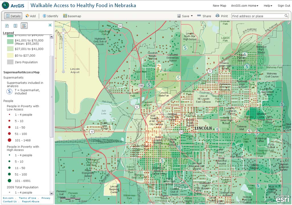
Environment influences food choice and physical activity. This map on ArcGIS.com shows where residents can walk to sources of healthy food.
Some changes were more subtle. Some simple modifications to home and workplace had a big impact. Using smaller plates, placing healthy foods at eye level, decorating lunchrooms so they were more enjoyable places to eat, holding standing or walking meetings, and changing vending machine selections were all quickly and inexpensively effected, making it easier for residents to add wholesome food and moderate exercise to their daily routines.
When the project officially ended in October 2009, the program's active participants had, on average, added 3.1 years to their projected longevity. They lost an average of two pounds, consumed more vegetables, engaged in more physical activities, and reported they felt less sadness. The City of Albert Lea has continued supporting the programs that were started during the project.
Spoonheim observed that successful programs are run by people who know the community and make recommendations that are specific and appropriate. Just applying a set prescription is not effective. GIS supplies the context for the community. Using an environmental approach, Spoonheim believes that communities can be transformed to improve the quality of life, not just its duration.
Enpowering Local Change
Erika Lewis-Huntly, who works in the city manager's office in Rancho Cucamonga, California, another presenter at the Healthy Communities by Design Summit, described how GIS has empowered Healthy RC, the city's successful and ambitious program for promoting a more vibrant community that has incorporated many of the techniques that were also used in Albert Lea.
The city's enterprise-wide GIS, Rancho Enterprise Geographic Information System (REGIS), is integrated into the daily operations of city staff members. It supplies maps, helps optimize operations, and makes support available to all city departments. Specific GIS applications have been developed by many departments including code enforcement, engineering, police, fire, emergency operations, community services, planning, special districts, and the city clerk's office.
A public-facing Web site, MyNeighborhood, hosts applications that give residents easy access to information on trash pickup, street sweeping, the general plan, zoning, city facilities, school districts, parks, utilities, and many other services. In recognition of REGIS' outstanding work, it received a Special Achievement in GIS Award in 2010.
In 2008, the City of Rancho Cucamonga launched Healthy RC, an initiative that encourages a lifestyle that promotes the well-being of its 180,000 residents and sustainability for the community. This approach comprehensively works to build a better community not only through programs and events but also by addressing changes in policy and infrastructure.
Because GIS is used extensively in creating the general plan, Healthy RC was able to use GIS to weave elements into the plan that promote healthy lifestyles. The GIS division has supported successful grant requests including a Robert Wood Johnson Foundation Healthy Kids, Healthy Communities program grant. The city was one of 40 in the United States chosen to participate in the four-year effort to improve food choices and increase physical activity for children and families, particularly those at highest risk for obesity.
As part of Healthy RC, REGIS was also used to locate city areas in need. Esri and city data was combined and used to identify areas of the city that had few green spaces, had limited access to grocery stores, or lacked infrastructure that let residents safely walk. GIS also helped the city find places for community gardens and farmers markets. After identifying community needs, the city held forums where residents identified good and bad features of their neighborhoods on maps.
The Healthy RC Challenge Online tool encourages healthier choices by giving residents an easy way to track exercise, diet, and even hydration. The Activity Tracker on the site lets program participants input steps from a pedometer or convert the time spent on many physical activities into equivalent measurements in steps. With an interactive map of the city, participants can measure walking or running routes by drawing them on the map. The site has routes for exploring the city, or participants can create and save multiple walking, running, or biking routes and share them with others. The site also helps people find other people to exercise with and promotes friendly competition through challenges.
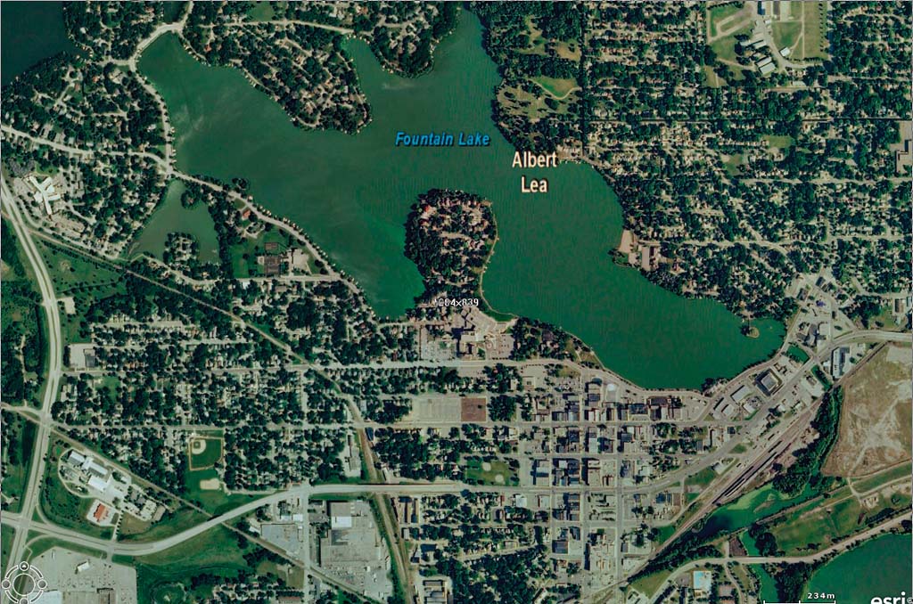
A project in Albert Lea, Minnesota applied a holistic approach to improving the well-being of an entire community.
The Time Is Now
Healthy RC exemplifies how a local government and its citizens can use geographic knowledge to redesign communities as places where people live long and active lives. Declining levels of well-being and rising costs—both economic and societal—attributed to lifestyle diseases and conditions are challenging communities to become Blue Zones.
This new era of citizen engagement and GIS has become an ecosystem on the Web that provides the framework for understanding communities. Many forces—technological, social, and economic—have converged to make this possible. ArcGIS supports a pervasive geospatial platform that encompasses desktop, mobile, server, and Web. The Community Maps Program and other programs like it are making high quality maps widely available.
As Jack Dangermond, Esri's president observed in his keynote address at the Healthy Communities by Design Summit, "Now we can measure and interact with everything and exert ourselves to say what we feel and think through a map." With the advances in GIS technology across all platforms and the development of the GeoDesign, which incorporates outcomes into decision making, there are greater opportunities to create the kind of communities in which people thrive.