Umlindi is the Zulu word for watchman. South African weather conditions vary greatly not only across the country but from year to year. In a country that has experienced two of the most severe droughts in the last century (1982-83 and 1991-92) as well as consecutive years of above-average rainfall, a system that supplies better current and historical information on rainfall and other conditions that affect agriculture helps farmers manage risks associated with crop production.
Intelligently managing land and water resources is critical to maintaining adequate food production in the face of the increasing demands of South Africa's growing population. GIS supplies decision support for crop production and soil and water conservation measures.
The Government of South Africa's National Department of Agriculture (NDA) realized that GIS, with its capability for storing, analyzing, and integrating data, was the only viable option for addressing issues associated with population growth while complying with international agreements such as Agenda 21 (an international agreement for sustainable development).
The Agricultural Geographic Information System (AGIS) is a joint venture of the NDA, the Agricultural Research Council (ARC), and the Provincial Departments of Agriculture (PDA). By assembling, integrating, and managing agriculturally related data for the nation in a GIS, AGIS is improving both decision making and sharing expertise. Centrally maintained agricultural datasets will avoid duplication of effort and better ensure the completeness and quality of datasets.
The Web applications, such as Umlindi, make data already available more readily accessible. The ARC-Institute for Soil, Climate, and Water, using financial aid from NDA, implemented Umlindi. This application uses information derived from National Oceanic and Atmospheric Administration (NOAA) satellite and climate data that is processed and displayed using ArcView 3.2 with the ArcView Spatial Analyst extension to produce the fire, rainfall, natural vegetation, crop growth, and drought maps.
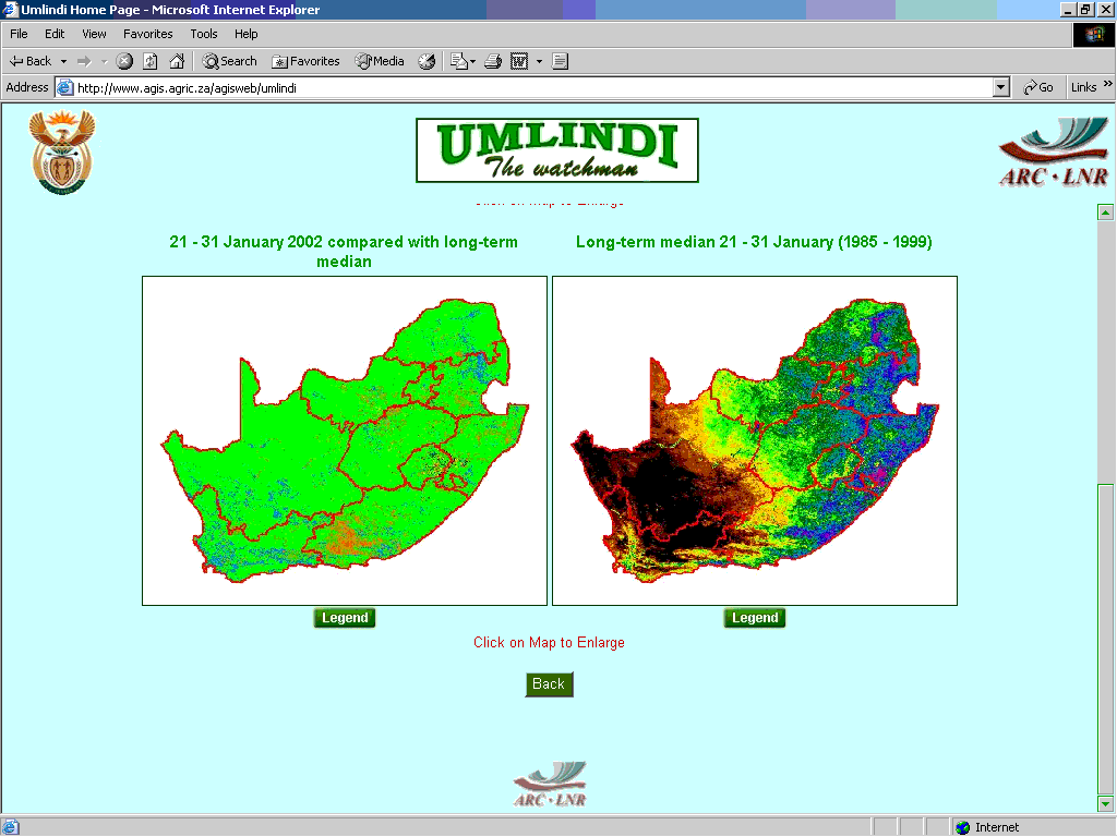
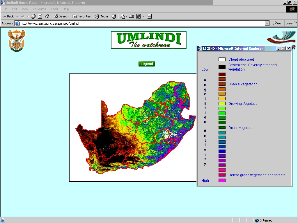
Monthly reports to NDA's Crop Estimates Committee, also available from the site, characterize vegetation conditions based on analysis of NOAA-Advanced Very High Resolution Radiometer (AVHRR) Channel 1 and 2 data. This data is useful in detecting the presence and condition of green vegetation. These images, measured over a 10-day period (i.e., dekad), show the highest green values. Maps are created using the Normalized Difference Vegetation Index (NDVI). NDVI images for the current year are compared to a long-term average for each area (1990-2000) to benchmark vegetation change over time.
Visitors to the site can also query the available data and view maps for the entire country or just one province and can specify a time period. Four query categories are available--crop growth and drought, vegetation activity, rainfall, and fire.
Mapping these indicators using GIS helps government decision makers and farmers monitor the conditions that affect crop productivity. A better understanding of conditions on an ongoing basis helps planning efforts and, by providing an early warning system, aids in response to adverse conditions such as the outset of a drought.