ArcUser Online
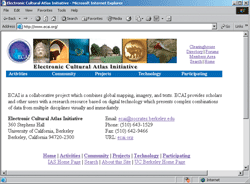
The development of GIS has opened a multitude of opportunities for research and teaching across a wide variety of academic disciplines. However, many scholars and researchers do not understand how this technology can be applied to their discipline. This is especially true of disciplines such as the humanities. In response to this need, The Polis Center at Indiana University-Purdue University Indianapolis (IUPUI) has developed an education program that supports GIS use within the academy by providing a complete range of services that include software application training, conceptual training, and curriculum development. In addition to offering multiple software-specific courses through the Esri Authorized Training Program, The Polis Center also provides customized courses designed to help participants go beyond simply learning the tools. These courses cover such topics as data collection methodologies, analysis and interpretation of mapped data, and proper mapping techniques. Many courses, both technical and theoretical, are also designed for specific audiences. This is important because the issues associated with using GIS in an academic environment often differ between disciplines. The Polis Center has promoted the use of GIS in education through a variety of projects and programs that include the Electronic Cultural Atlas Initiative (ECAI), the Social Assets and Vulnerabilities Indicators (SAVI) project, and research and teaching workshops. ECAIECAI is a project that began in 1997 as an international collaborative effort to create a Web-based interactive atlas of cultural data using time-enabled GIS technology. It encourages new research through facilitating scholarly access to a wide variety of spatially and temporally referenced data. The atlas provides a common interface and metadata catalog. New tools to combine, analyze, and display multidimensional data—quantitative, textual, and image—from a wide array of disciplines promote interdisciplinary research. By drawing on existing data and using distributed database and Internet GIS technology, ECAI provides this resource at low cost or no cost to the end user. Many humanities scholars lack the technical and managerial expertise to apply information technologies effectively. Sessions have brought together humanities researchers and scholars from around the world so they can learn how to apply GIS as a tool for the collection, management, and display of historical data. Participants have included representatives from the National Palace Museum and Academia Sinica in Taipei, Taiwan; Fudan University in Shanghai, China; the Archaeological Historical Data Service in the United Kingdom, and many others. Additional information about the ECAI project is available at www.ecai.org. SAVI ProjectIn addition to the national and international activities already described, The Polis Center has also helped incorporate GIS into curriculum and research initiatives of local universities and research institutions. One of the projects that has especially promoted the use of GIS within these organizations is SAVI, a comprehensive electronic database of mapped and tabular data about the nine-county Indianapolis Metropolitan Statistical Area (MSA). SAVI collects, organizes, and presents information on community assets such as schools, libraries, churches, hospitals, and community centers. It also includes social demographic information such as census, health, education, criminal justice, welfare, and other data that can identify neighborhoods with high levels of crime, unemployment, and/or large numbers of welfare recipients. Project data is accessed using an interactive Web-based mapping tool called SAVI-Interactive that is available at www.savi.org. The diverse data collected by SAVI offers opportunities for research and teaching applications across a wide range of disciplines. Using these holdings, The Polis Center has developed GIS curriculums within disciplines such as education, religion, nursing, geography, planning, and social work and has worked with local residents to use this data to address issues of local concern. Data supplied by SAVI has also been used to support the development of GIS in area kindergarten through 12th grade (K-12) programs. In collaboration with the IUPUI Department of Geography, the Geographic Educators' Network of Indiana, and the IUPUI University Library, The Polis Center offered a five-day series of workshops in 2001 for K-12 educators. The SAVI-oriented sessions of the workshop focused on real-world GIS applications. In addition to introducing the SAVI model, presentations featured school enrollment projection methods and use of historical census data in community analysis. Classroom SAVI sessions included practice with ArcView and a training course, Profiling Your Neighborhood, using SAVI-Interactive. Research and Teaching WorkshopsOne of the most popular workshops offered by Polis is GIS as a Tool for Research and Teaching. This workshop introduces participants to the capabilities of GIS, identifies data and support resources, and examines funding opportunities for research applications using GIS. If computer facilities are available, the workshop also includes a hands-on component so that participants can experience the power of GIS firsthand. This workshop has been offered at academic institutions and conferences across the country. For additional information, contact Kevin Mickey |
