Community Service Merging With GIS Technology
As geospatial interest spreads, 4-H leaders see great possibilities for youth to help themselves and their communities through local geospatial research projects. "4-H community mapping projects will assist young people to build their science and technology knowledge, personal outlook, and work skills and aspirations," says Tom Tate, national program leader with the U.S. Department of Agriculture (USDA). "At the same time, through these geographic projects youth and adults can improve decision making capacity in their communities and help strengthen local economic, social, and environmental well being."
For more than 100 years, 4-H has been teaching leadership, citizenship, and life skills to young people. 4-H is a community of nearly seven million members and more than 600,000 adult volunteers across the United States. The organization is administered nationally by the Cooperative State Research, Education, and Extension Service (CSREES), USDA, and at the state/local level by land grant universities and the system of county 4-H agents. These organizations and program collaborators, such as Esri, are working to help youth make a difference in the world.
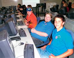 |
| Technology has always been a key aspect of 4-H. Today, these technologies include computers, the Internet, and geospatial tools. |
Technology has always been a key aspect of the organization's vision of youth development. Throughout its history, 4-H has helped advance agricultural research and innovative technologies. Today, these technologies include computers, the Internet, and geospatial tools and processes that are promoted by the National 4-H Youth Technology Leadership Team, the National 4-H GIS/GPS Technology Program, and the National GIS/GPS Technology Integration Team. 4-H teams involved with technology, composed of youth members and adult mentors, teach through training programs, conferences, and projects. A team's focus is driven by the needs of the community, and these teams work with local officials on projects that benefit all citizens.
4-H clubs and their coordinating organizations have found the growing pervasiveness of GPS has offered a great starting point for work with geospatial technologies. At Iowa State University (ISU), a cooperative program between ISU Extension 4-H Youth Development and the Iowa Space Grant Consortium includes extensive use of GPS and is now making a natural transition to GIS. The same process is going on in Washington County, Oregon, where 4-H Extension helps 4-Hers build geographic skills from orienteering to GPS to GIS.
GIS users can and do play a crucial role in ensuring the success of 4-H technology efforts by serving as mentors and community research collaborators. "Most youth in our technology program are familiar with computers, the Internet, and slide show demonstrations, but there is so much more," says Kevin Kesler, a community development 4-H and youth advisor from Utah State University. "When youth learn about GPS and GIS, they are eager to know more but it can be difficult to find people who already know GIS and can help teach."
Kesler, like many other 4-H technology team leaders, has been introducing GIS and GPS technology to communities. Currently, he leads a core group of 4-H youth that will create community teams once they complete their training. Each group will work closely with different county organizations and departments to create projects that introduce the power of technology. In some cases, the groups will work with county GIS personnel to create specific projects or help with existing ones. "When GIS users come forward to help with this effort, they help the youth as well as their entire community," says Kesler. "The marriage between the GIS community and 4-H clubs is a union that will lead to incredible things."
To aid 4-H, Esri created the GIS Program for U.S. 4-H in cooperation with National 4-H headquarters to support geospatial outreach, education, and community efforts by fostering the integration of GIS in U.S. 4-H clubs. A portion of the Esri initiative is a 2004 grant program for up to 100 U.S. clubs. Grant recipients, to be announced in April, will receive a club license of GIS software, data, and support.
Learn more about 4-H technology programs and how to become a club mentor or research collaborator at www.4-h.org/tech/gisgps. More information about the Esri 4-H program is available at www.esri.com/4-h.
|