Extend Crime Analysis with ArcGIS Spatial Statistics Tools
By Lauren Scott and Nathan Warmerdam
Editor's note: Crime mapping using traditional GIS analysis techniques has been helping law enforcement agencies track crime incidents and produce density maps showing overall crime patterns. With improvements in the availability and quality of crime data in digital format and more robust GIS software, police departments have expanded the use of GIS. They are using spatial data analysis to assess crime patterns, optimize resource allocation, and improve emergency call response. The spatial statistics tools in ArcGIS enhance spatial data analysis of crime data by supplying tools that use statistical methods designed specifically for use with spatial data. This article describes how the Hot Spot Analysis, Mean Center, Linear Directional Mean, and Standard Deviational Ellipse tools, available at all license levels, can be used for more sophisticated types of crime analysis.
Understanding Where Crime Occurs
Crime hot spots are areas of high crime intensity. Knowing where crime is concentrated helps law enforcement agencies make better decisions about allocating police resources. In addition, using GIS to map crime hot spots can effectively communicate crime patterns and crime prevention strategies to decision makers and the public.
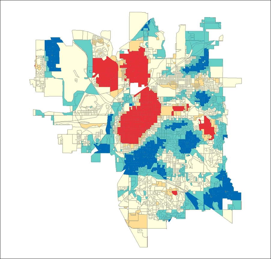
The Hot Spot Analysis tool in ArcGIS 9 identifies spatial clusters of statistically significant high or low attribute values. Given a set of weighted data points, such as the number of crimes per census block, and operating under the expectation that data values are randomly distributed across the study area, this tool delineates clusters of census blocks with higher than expected crime incidents. These clusters are hot spots. The Hot Spot Analysis tool also delineates spatial clusters of lower than expected crime incidents. These clusters reflect crime cold spots and may provide clues about policy or environmental factors that discourage crime.
 |
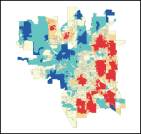 |
| Crime hot spots generated from vandalism data for Lincoln, Nebraska, that have not been normalized. Hot spots are shown in bright red and located in downtown Lincoln, an area with a large population. Cold spots, or areas of low crime, are shown in dark blue and are located in suburban areas. |
Hot spot analysis using vandalism data that was normalized with data from all crime incidents for Lincoln, Nebraska. Again, areas with high incidence of vandalism are shown in bright red and low vandalism areas are shown in dark blue. |
Running the Hot Spot Analysis tool against raw total crime counts provides the analyst with an overall picture of crime patterns. A map of these crime patterns effectively communicates where crime activities are highest and where they are lowest. However, the police officers working in the study area day to day will likely already know firsthand where crime activities are highest. Often more useful are analyses that incorporate risk assessment by controlling study area variations in population, overall crime patterns, and environmental factors.
Performing Risk Assessment
One would expect more crimes in areas with more people and fewer crimes in areas with fewer people. Communities are a tapestry of neighborhoods (each one with different characteristics). In essence, a study area can be viewed as a landscape of crime. Gang activities; the types of businesses in an area; and factors that can be difficult to quantify, such as lighting, access to freeways, or a high proportion of residents with criminal records, can drive up the crime rate in some neighborhoods.
For example, if the task is to determine where to implement a vandalism prevention program, simply running the Hot Spot Analysis tool on raw vandalism counts will probably find hot spots just where they would be expected (in downtown areas that have lots of people and, typically, lots of crime). However, dividing vandalism counts in each census tract by all crime counts will represent vandalism counts as a proportion of all crime events. Running the hot spot analysis on these normalized ratios will provide a different picture. It will show the location of clusters of tracts in which vandalism represents a larger than expected proportion of all crime events. Such an analysis, carried out on crime data from Lincoln, Nebraska, showed that vandalism is primarily a suburban issue. Consequently, implementing a vandalism prevention program in the downtown area probably would not be as effective as implementing a program in the suburbs where vandalism constitutes a larger proportion of overall crime events.
 |
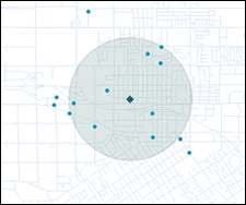 |
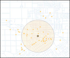
| Daytime burglaries tend to be slightly more concentrated than nighttime burglaries, indicated by the smaller standard distance circle. These circles also highlight the differences in the locations of daytime and nighttime burglaries. |
Looking for Clues to Criminal Activities
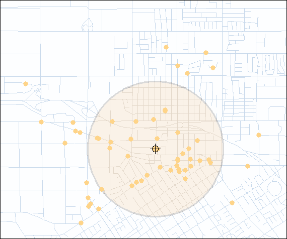
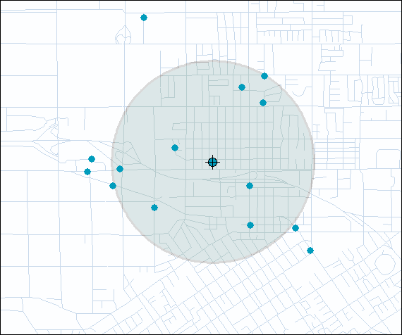
One of the simplest approaches to better understand some factors that encourage criminal activity is examining the distribution of different types of crimes. A crime analyst, for example, might want to know if the mean center for burglaries shifts when evaluating daytime versus nighttime crime incidents. This information could be used to improve the way police departments assign personnel. The Mean Center tool available in ArcGIS 9 computes the average x-coordinate and y-coordinate for each crime incident in the study area.
Continued on page 2
|