Are You Buried in a Landslide of Imagery?
Esri Spatial Roundtable Discusses How to Access and Manage Remotely Sensed Data
May 31, 2011
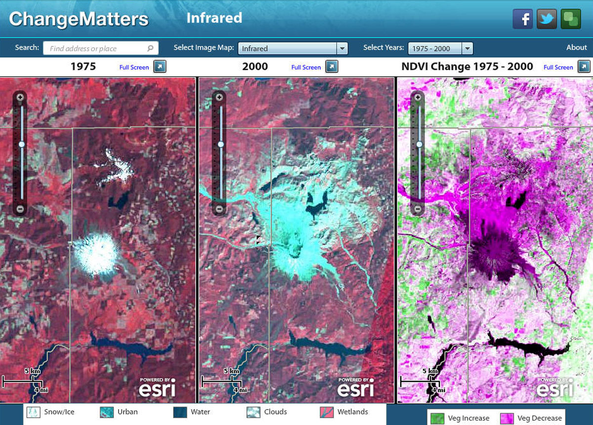
Accessing historic and current imagery can help make science-based decisions.
Redlands, California—As remotely sensed data becomes more and more ubiquitous, organizations are looking for ways to correctly use and manage this information. Lawrie Jordan, director of imagery for Esri asks organizations to discuss how they are improving access to imagery by weighing in at the Spatial Roundtable.
"Availability of imagery is no longer the problem—accessibility is," explains Jordan. "The landslide of imagery data is overwhelming. In response, users are shifting their work habits to handle this surge so they can get their jobs done quickly and more easily."
At first, imagery was a special data type available only to the military and large corporations with major investments in land, such as oil and mineral exploration companies. Today, anyone can use imagery, and it is becoming freely available thanks to services such as Landsat. Many organizations are using imagery to better understand and generate opinions about what government officials, environmental scientists, and news reporters are telling them.
As the amount of remotely sensed data grows and users demand fast access to terabytes of information, experts need to have a plan in place to maximize access. Join the discussion and describe how you are helping users at your organization stay ahead of the curve at spatialroundtable.com.
# # #
Press Information:
Karen Richardson, Esri
Tel.: 909-793-2853, extension 1-3491
E-mail (press only): press@esri.com
General Information: info@esri.com