King County, Washington, Grows GIS with Esri ELA
Greater Access to Software Will Support Expanded Web Application Development
November 28, 2011
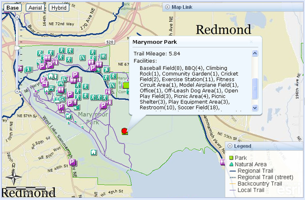
King County's ParkFinder shows park and trail information including mileage and facilities.
Redlands, California—King County, Washington, the nation's fourteenth most-populous county and home to Microsoft, Amazon.com, Boeing, and Starbucks, has signed an enterprise license agreement (ELA) with Esri to better support the county's geographic information system (GIS) programs and initiatives.
The majority of King County's departments have used Esri's ArcGIS software for many years to improve operations and the delivery of services, but increasing use has frequently strained resources. Staff have often had to wait for licenses to become available to continue with their work. Now, all employees throughout the organization will have unlimited access to the ArcGIS software they need.
The ELA will also provide the platform that developers need to accelerate web application development. "Having additional flexibility with more ArcGIS licenses available for testing and production will enhance our ability to develop additional applications that serve our various agencies and the general public," says Greg Stought, King County GIS Center enterprise services manager.
King County GIS Center manager George Horning adds that he is looking forward to creating mobile versions of popular web mapping applications such as ParkFinder and What Do I Do With…? ParkFinder shows residents information on local parks and trails, while What Do I Do With…? shows people where they can recycle or dispose of unwanted materials, such as carpet, appliances, batteries, and scrap wood.
"We have a very active community in King County, so putting information into the hands of residents and businesses is essential," notes Stought. "There is a great deal of effort from division staff and program managers to be aware of what people are interested in and educate them about our programs. Putting information out in mapping applications that are intuitive and easy to use has proven very popular."
County leaders also plan to deliver mobile GIS applications for staff members such as appraisers. "They will have access to all the information they need in the field to complete their appraisals instead of checking back in to the office before they can finish their work," says Horning.
To learn more about Esri ELAs for government, visit esri.com/ela.
# # #
Press Information:
Emily Pierce, Esri
Tel.: 909-793-2853, extension 1-3571
E-mail (press only): press@esri.com
General Information: info@esri.com