New Esri Basemap Highlights Thematic Content
Free Light Gray Canvas Basemap Service Now Available
October 6, 2011
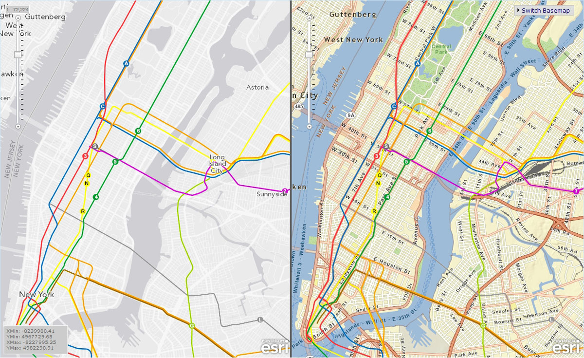
User data shown on top of Light Gray Canvas map is easier to distinguish compared to user data displayed on busier maps
Redlands, California—Esri released a new global basemap service designed to highlight your data. The Light Gray Canvas map is now available at arcgis.com and ArcGIS Explorer Online.
The Light Gray Canvas map features an overall soft gray color for land and darker gray for oceans and other bodies of water. These shades provide a pleasing neutral background so that data overlays contrast sharply with the rest of the map. With fewer features and labels on the map, you have more freedom to color and label your own data. The map is a perfect alternative to traditional basemaps, which can have an abundance of detail that obscures data overlays. Any existing map backdrop can be changed to the Canvas map for a cleaner, less cluttered presentation of operational or custom data.
To start using the Light Gray Canvas map for your custom maps, visit arcgis.com.
# # #
Press Information:
Matthew DeMeritt, Esri
Tel.: 909-793-2853, extension 1-2930
E-mail (press only): press@esri.com
General Information: info@esri.com