Esri Donation Supports Collaboration with OpenStreetMap Community
ArcGIS Users Continue to Contribute to the OSM Initiative
March 19, 2012
The OSM basemap is available on ArcGIS Online.
Redlands, California—Esri president Jack Dangermond affirmed his commitment to making map content accessible to everyone with a monetary donation to the OpenStreetMap Foundation. The OpenStreetMap Foundation's initiative, OpenStreetMap (OSM), strives to create and provide free geographic data, particularly street maps, for use worldwide. The mission of this nonprofit organization parallels Esri's efforts to empower people to share a common picture of the world through map-based information over the web.
"Publishing data as map services is one of the most valuable ways we can communicate and collaborate with each other," said Dangermond. "Maps enable an immediate understanding of patterns and relationships. The OSM Foundation and its volunteers have made geographic data available in areas of the world where it has been lacking to foster understanding of complex problems. We are happy to support their efforts."
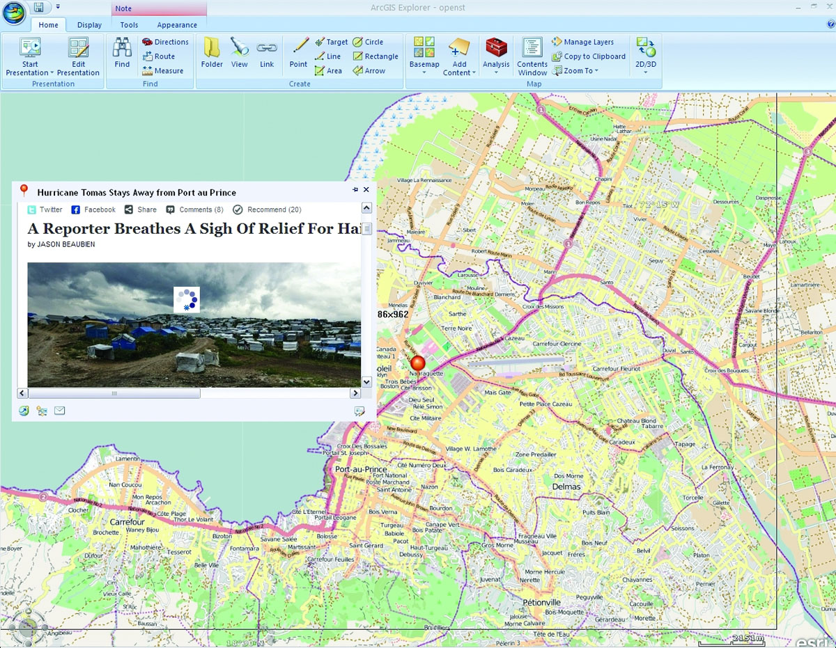
One powerful example of OSM's efforts took place after the earthquake in Haiti, when project volunteers crowdsourced a street map of the capital city, Port-Au-Prince, and other places in the country. Mapping was completed rapidly with high-resolution imagery, which was used to trace vector maps of streets and other features, and by people on the ground using handheld GPS devices. This allowed first responders to provide assistance and start planning for rebuilding as quickly as possible.
"We're thrilled to receive this support from Esri—not just the donation but the integration within their tools," said Steve Coast, OpenStreetMap project founder. "We love it when Esri and its customers get excited about OpenStreetMap, because they understand better than anyone how to unleash the potential of raw geodata."
OpenStreetMap data is one of the basemaps used on Esri's ArcGIS Online, a cloud-based, collaborative content management system for maps, apps, data, and other geographic information. The OSM basemap is available for use in any Esri environment including desktop, mobile, and via the web.
Esri users can become active members of the OSM community by using ArcGIS Editor for OpenStreetMap. The editor is a free, open source add-on for ArcGIS for Desktop that provides the ability to download OSM data, make changes to the dataset, and contribute those changes back to the OSM community. The ArcGIS Editor for OpenStreetMap download, documentation, and source code are available on CodePlex, Microsoft's open source repository, and released under the Microsoft Public License.
For more information, visit esri.com/osmeditor.
# # #
About OpenStreetMap
Started in 2004 the OpenStreetMap project has become the largest provider of free and open geodata. More than 550.000 volunteers around the world (and growing every day) work collectively to create the most detailed and most up-to-date map of the world. The OpenStreetMap Foundation is an international non-for-profit organization supporting, but not controlling, the OpenStreetMap project. OpenStreetMap data is being used by many organizations all around the world. Amongst them are Apple, Foursquare, Bing, Worldbank and MapQuest. More information about the OSM Foundation can be found at www.osmfoundation.org.
Press Information:
Karen Richardson, Esri
Tel.: 909-793-2853, extension 1-3491
E-mail (press only): press@esri.com
General Information: info@esri.com