Tropic Forest Dataset Available on ArcGIS Online
Esri Publishes Woods Hole Research Center's Carbon Density Dataset
March 5, 2012
Carbon density datasets from Woods Hole Research Center are available on ArcGIS Online.
Redlands, California—Woods Hole Research Center (WHRC) is using Esri's ArcGIS Online to make its new carbon stock datasets available to scientists and environmental experts throughout the world. Decision makers will be able to easily access this data and use GIS to study tropical forest carbon-density and change, which impacts the atmosphere and affects climate change.
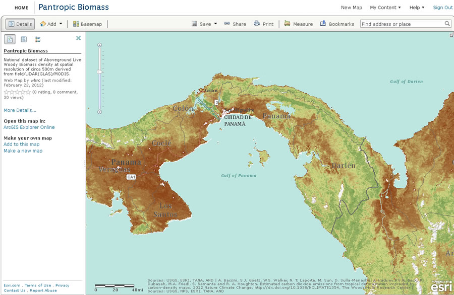
"We at WHRC are proud to be at the very cutting edge of this type of research in tropical forests, and we are honored to partner with Esri to help make the results available," said Dr. Eric Davidson, executive director of WHRC. "Knowing how much carbon is in these forests is key to devising effective programs and finances to conserve them." The Pantropic Biomass dataset includes carbon contained in the aboveground live woody vegetation of tropical America, Africa, and Asia. At 500-meter resolution, it is the highest-resolution carbon-density dataset to date. Researchers will be able to access the dataset via a few clicks and bring it into the ArcGIS environment. This enables them to
- Estimate the amount of carbon stored in the vegetation of the world's pantropic forests
- See how aboveground carbon is distributed across land-cover types both locally and regionally
- Estimate CO2 emissions from tropical deforestation
- Calculate carbon units of forests for the carbon exchange market
"The science and expertise the WHRC has put into this important dataset increases data credibility for climate change analysis and land-use decision making," said Jack Dangermond, president of Esri. "The addition of this and other carbon datasets contributed by Woods Hole to ArcGIS Online makes the service richer for all users."
The WHRC database is more accurate than previous data collections because of developments in satellite sensors designed specifically for vegetation measurements derived from LiDAR data and MoDIS data from NASA. The output layer is "metric tons of biomass," which is basically the amount of matter sitting in each pixel. Included in the carbon-density model are the actual measurements of trees sampled at thousands of locations throughout the tropics. Workers from these field campaigns used established protocols that were designed to standardize data collection.
The carbon-density dataset was developed with support from the Gordon and Betty Moore Foundation, the Google Foundation, and the David and Lucille Packard Foundation.
WHRC uses Esri products for many of its research projects. By using ArcGIS Online, it has extended its GIS with a public platform that provides a cloud-based, collaborative content management system for maps, apps, data, and other geographic information. Data consumers can access the Pantropic Biomass dataset at esri.com/tropcarbon.
# # #
Press Information:
Barbara Shields, Esri
Tel.: 909-793-2853, extension 1-2641
E-mail (press only): press@esri.com
General Information: info@esri.com