Peoria County Parcel Data Now an iOS App
April 17, 2012
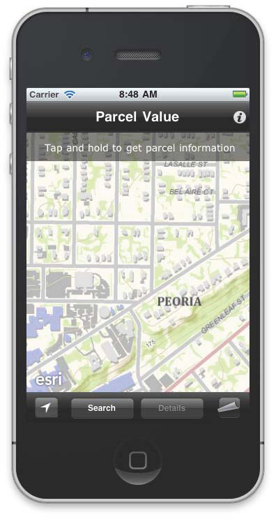
A Peoria County app provides property values and other real estate data.
Redlands, California—Real estate professionals, residents, and other consumers can now download a free iTunes application, Parcel Value GIS, to check the assessed value of properties in Peoria County, Illinois. The app was created using the Parcel Value for iPhone template from Esri.
Micah Williamson, GIS manager for Peoria County, said it took less than two days to get a testable beta app up and running on its servers. Since the app went live, there have been more than 435 downloads and plenty of positive feedback.
"People appreciate the convenience of being able to walk the neighborhood and learn about the area—to immediately see home values and nearby sales, instead of researching that back in the office," said Williamson."We chose to build this app with Esri technology because of the ArcGIS for Local Government template, which comes preloaded with data and made development so easy."
The preloaded demo data from Esri includes centerlines, parking lots, vegetation, terrain, aerial photos, parcel data, and home values.
The app allows users to search by address or parcel identification number (PIN) or, using the iPhone's GPS technology, search by current location. Users can turn on or off layers that show home sales for 2010 and 2011, including information about assessed value and home details such as style, square footage, and number of bedrooms.
# # #
Press Information:
Jessica Wyland, Esri
Tel.: 909-793-2853, extension 1-3345
E-mail (press only): press@esri.com
General Information: info@esri.com