Skip to Content
ArcGIS Field Maps

ArcGIS Field Maps

The all-in-one app for mobile work

Go to pricing
Sign up for a free trial
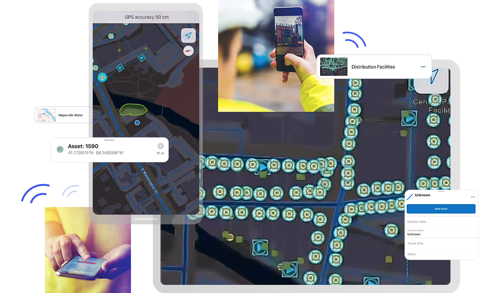
Collage of tablets and mobile phones collecting field assets for ArcGIS Field Maps

ArcGIS Field Maps is an all-in-one app that uses data-driven maps and mobile forms to help workers perform data capture and editing, find assets and information, and report their real-time locations. ArcGIS Field Maps is the go-to field app that streamlines the critical workflows mobile personnel use every day. Because it is built on ArcGIS, everyone—whether in the field or the office—will benefit from using the same data.

You can do more with ArcGIS Field Maps

Streamline field workflows

Replace paper processes and disparate tools to bring efficiency to mobile work with a single app that can be configured for the specific workflows of your mobile workforce. Mobile workers have the preconfigured field maps and forms they need on their mobile devices to efficiently and accurately complete their work.

A person holding a mobile phone inputting the location of a fire hydrant that is pouring out water in the background

Empower your mobile workforce

ArcGIS Field Maps provides mobile workers with secure, 24/7 access to your organization's ArcGIS maps on their mobile devices, ensuring they have the most current information. Workers can easily locate assets and data and even add markups and notes to document and share findings with others. Maps are dynamic even in disconnected environments.

Fieldworker holding a mobile phone, hard hat, and a clipboard at a construction site. Phone screenshot with the area circled in green.

Access current data 24/7

Get greater accuracy when reporting data from the field by using a mobile data collection and editing app that avoids errors introduced from transcription, transfer, and other manual and paper-based processes. New or edited data is automatically fed into the ArcGIS system and accessible across the organization.

A person in a white hard hat and yellow safety jacket looking at a mobile phone held in their hand, beside a large graphic of a phone screen displaying a fictional person's account data

Transparency in field activities

Achieve real-time location awareness of mobile personnel so you know where everyone is and can quickly adapt to changing circumstances. Location sharing analysis can be used to verify when, where, and by whom work was done. Identify patterns of workforce movement that reveal where efficiency is being gained or lost.

Two fieldworkers looking at a mobile phone and a screenshot of the screen showing the hydrant inspection number and its location

Deploy quickly and easily

ArcGIS Field Maps can be quickly deployed to any mobile workforce and is available for download from most app stores. As an all-in-one field app, one download supports many capabilities and means greater efficiency for your mobile workers and IT associates. Workers can get familiar with it quickly and with minimal training to be productive right away.

Aerial view of construction vehicles and a screenshot of their location on a map

How ArcGIS Field Maps works

Case Study

Digital workflow streamlines annual inspections

The Charlottesville Fire Department in Virginia simplified its digital fire hydrant inspection process with ArcGIS Field Maps.

Explore the case study

Better together

ArcGIS Field Maps can be combined with other focused ArcGIS apps to meet your specific workflow needs and streamline your field operations.

Explore field mobility solutions
ArcGIS Navigator

ArcGIS Navigator

From any point on the map, a simple click opens ArcGIS Navigator and routes you to your selected destination. It then returns you to ArcGIS Field Maps so you can capture data.

Explore ArcGIS Navigator
ArcGIS Workforce

ArcGIS Workforce

Coordinate field activities. Select a task from your Workforce task list. Use ArcGIS Field Maps to complete the required work. Then, easily return to ArcGIS Workforce when you are done.

Explore ArcGIS Workforce
ArcGIS Dashboards

ArcGIS Dashboards

Visualize the data captured with ArcGIS Field Maps in real-time dashboards to support more informed decision-making.

Explore ArcGIS Dashboards
ArcGIS Survey123

ArcGIS Survey123

Pair ArcGIS Field Maps with this robust formcentric app to complete more complex field data collection workflows.

Explore ArcGIS Survey123

ArcGIS Field Maps is fully integrated

Combined with other ArcGIS apps, you can maximize efficiency in your mobile workforce on a platform you can trust with the flexibility to run in the cloud or in your own IT infrastructure.

Explore ArcGIS

Purchasing options for ArcGIS Field Maps

New Esri customer

Explore license options

Existing ArcGIS account

Download ArcGIS Field Maps

Talk to someone on our sales team

1-800-447-9778

7:00 a.m.–5:00 p.m., Monday through Friday (PT)

Outside the US?