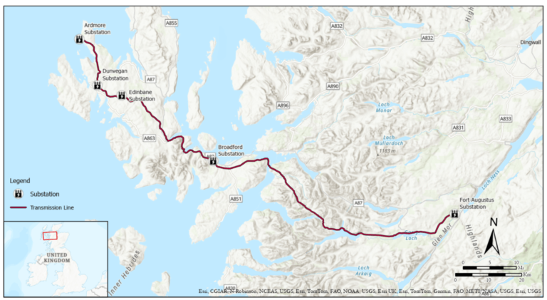
Stretching across the rugged terrain of the Scottish Highlands—from the home of the legendary Loch Ness to beyond the fairy pools of Skye—a huge project is underway: the construction of a new 132-kilovolt transmission lines interfacing with five substations to modernize the country’s electrical grid and unlock the potential in renewable wind energy.
Scottish & Southern Electricity Networks (SSEN), which owns and operates northern Scotland’s high-voltage electricity transmission network, is spearheading the effort. Known as the Skye Reinforcement Project, it’s one of many projects that support Scotland’s ongoing efforts to achieve net zero.
When completed, the transmission lines will run 99 miles (about 160 kilometers) and replace an aging asset to improve reliability to the region’s island communities while also providing capacity for wind farm developments.
Connecting Renewable Energy, Project Teams, and Data
For this part of the project, SSEN team members needed to make design decisions for four sites that span 87 miles (about 140 kilometers). This included selecting the right locations and foundation types for steel transmission towers in some of Scotland’s most mountainous terrain, all based on soil conditions and other factors such as constructability.
In the project’s early stages, many key processes were manual, disconnected, and time-consuming, according to Michael Milligan, SSEN’s engineering manager of capital projects. For example, the ground investigation data that the team needed—such as site coordinates and soil descriptions—was buried in spreadsheets, had no visual geographic context, and was difficult to coordinate with design decisions.

To accelerate collaboration and improve decision-making, the team wanted to see ground investigation data alongside 3D design models of steel towers, overhead transmission lines, substations, and wind turbines—all with geographic context. To accomplish this, the team developed detailed digital models from building information modeling (BIM) data stored in Autodesk Construction Cloud.
The team then began exploring several software options for 3D design collaboration. There were concerns, though, about software performance on such a large, linear project with complex geography and a wide variety of equipment assets, file types, systems, and design data. None of the options the team reviewed were a good fit.
Seeking a more effective solution, SSEN turned to Esri partner Arcadis, a global design, engineering, and consulting firm headquartered in the Netherlands. Arcadis specializes in delivering services across the architecture, engineering, and construction sectors. With a global workforce, Arcadis was able to draw on local expertise for this project, engaging its UK-based GIS and survey team to lead the work and provide region-specific insights.
Integrating Data Across Systems
Arcadis and SSEN staff launched a yearlong pilot project with two goals: addressing SSEN’s current challenges, and testing process innovations to improve efficiency in future infrastructure projects.
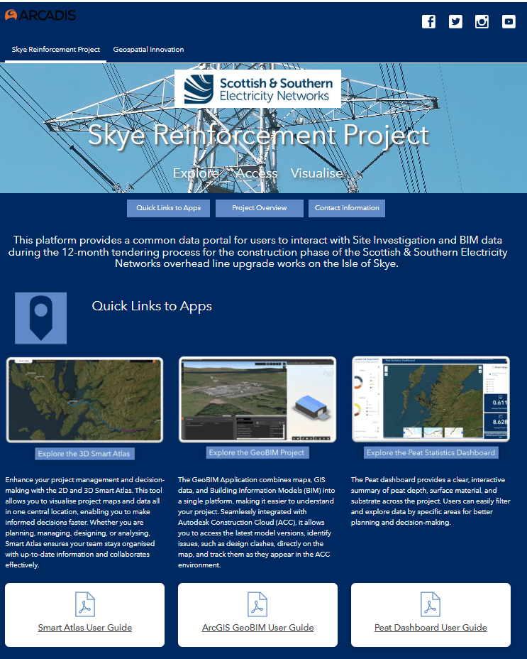
Arcadis leveraged its Smart Atlas web-based GIS application—built on ArcGIS Enterprise—to deliver a powerful, cloud-based integration, visualization, and engagement platform for the SSEN Skye Reinforcement project. More than just a mapping tool, Smart Atlas served as a central hub for coordination, bringing together SSEN’s maps, data, dashboards, and documentation into a single, dynamic environment.
By providing a common project view accessible to all stakeholders, Smart Atlas enabled real-time collaboration and transparency, allowing teams to integrate layers of information from diverse sources—ranging from engineering models to environmental data—to create a common operational picture.
“The initial steps involved acquiring and incorporating open-source data to provide geographic context,” explained Matt Gamlin, principal GIS consultant at Arcadis. “We then brought in project-specific datasets, including GIS layers and CAD drawings.”
Using ArcGIS Pro, the team members applied symbology and prepared the web scene for publishing to ArcGIS Enterprise. They also integrated 3D models, enabling the team to visualize designs spatially and assess them in relation to environmental constraints.
To streamline access to current design information, the team created a project in ArcGIS GeoBIM, linking directly to the latest BIM data stored in Autodesk Construction Cloud. This integration allows users to view source documents as they’re updated through a single, unified interface in ArcGIS GeoBIM.
This enabled the SSEN team to create, sync, and manage project issues. Issue is an Autodesk term used to identify, categorize, and communicate areas of concern or potential improvement. These issues are created in Autodesk Construction Cloud or on-site using the ArcGIS Field Maps mobile app. The team was able to pinpoint issues geospatially, assign them to a project member for resolution, and manage issues by type (such as design and safety) and status (such as active or completed) in dashboards.
Using ArcGIS Hub, the team built an intuitive and visually engaging web platform that gives project teams easy access to key data, tools, and resources. This has streamlined how geospatial information is discovered and analyzed, helping teams make faster, more informed design decisions.

The final step was to bring the ground investigation data into ArcGIS for 3D coordination. By connecting ArcGIS to the cloud-based ground investigation data source, data from boreholes (narrow shafts drilled in the ground) could be visualized as clickable 3D cylinders. This includes subsurface attributes and links to the most current version of sampling and testing information.
As borehole sampling continued, the SSEN team could see the latest ground investigation data alongside the BIM models—all integrated into a single, cloud-based Smart Atlas. This interactive map served as a collaborative, up-to-date source of truth, replacing siloed offline folders and enabling seamless access and coordination across teams.
Visualizing the Results
The platform has laid the foundations for practical collaboration between engineered models and GIS layers such as environmental constraints. It also opens the possibility for live analytics and KPI reporting. These improvements scaled across the portfolio will reduce design time by 50 percent, Milligan estimated.
The platform will help the engineering team understand environmental factors faster—accelerating environmental assessments and project planning while improving communication and contractor cost evaluations. SSEN staff can now visualize towers and substations, foundation selections, and boreholes in a geographic context.
“When you’re in a meeting with the application on screen, you can easily navigate to a specific area of interest, rotate the view, and explore the model in detail,” Gamlin explained. “It helps everyone in the room better understand the challenges and collaborate more effectively on potential solutions.”
Planning the Next Steps
With the project in the stage of discharging planning conditions, SSEN and Arcadis are looking to visualize the entire route for construction tracking, providing a practical method for federating long linear assets in the design and construction phase. They also hope to include new additions such as heat maps of lightning strike risks, which pose hazards to workers and the electrical network. The team plans to use imagery and remote sensing capabilities to detect soft ground due to deep peat levels and prevent disturbances during construction.
The pilot project has led to ideas for adding artificial intelligence (AI) technology to support decision-making that uses both Esri and Autodesk products. For example, with the launch of ArcGIS for Autodesk Forma, the SSEN team is exploring the use of AI to accelerate predesign workflows that can be developed in greater detail using ArcGIS GeoBIM. Milligan and Gamlin see this as a potential game changer for enhancing project delivery and collaboration.
For more information on Arcadis, visit arcadis.com. For more information on the Skye Reinforcement Project, visit the SSEN Skye Reinforcement Project web page.

