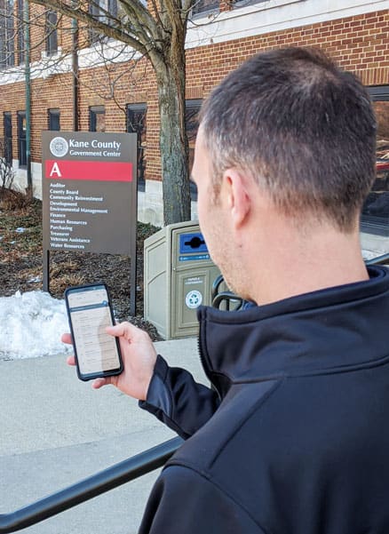
Each Election Day, Kane County, Illinois, sends staff members from its IT department to each polling station to ensure that all election equipment is up and running at full capacity by 6:00 a.m. The county covers approximately 524 square miles, so this is quite an operation.

IT staff members must be at the first polling station by 5:15 a.m. to inspect equipment such as Wi-Fi pucks, printers, and pollbook tablets. They troubleshoot, document, and resolve any issues and make notes about how effective the polling station’s setup is. Once they deem a polling station ready for voting, they quickly move on to the next one to do the same thing. Throughout the day, these staff members are also on hand to fix any new issues that pop up until polling stations close at 7:00 p.m. Depending on the type of election—whether it’s a big, national election or one with only local measures on the ballot—the county makes varying numbers of IT staff available to support polling stations, each of which is unique and unfamiliar to the crew.
This all used to be cumbersome to plan. The Kane County GIS team would present large paper maps to management, who used them to dole out assignments. Managers often went through several iterations when creating their staff members’ routes, and they couldn’t systematically share anything.
For the March 2019 local election, however, which required 37 support staff to provide assistance to 121 polling stations, the GIS group collaborated with the IT development team to implement something different. Using web maps built in ArcGIS Online, managers were not only able to come up with better routes more easily and efficiently, but they were also able to introduce spatial analysis to the process.

Prior to Election Day, the managers did a proximity analysis in ArcGIS Online to plan and optimize everyone’s routes according to where they’d be starting out—at home. With this as a baseline, the GIS team built an app using Web AppBuilder for ArcGIS that allowed staff managers to employ the Batch Attribute Editor widget to supplement route information with other factors, such as which polling places had certain problems in the past and who had expertise in what. For the first time, the final staff assignments were tailored toward staff members’ location and expertise.
Assigning election support staff to certain polling places in this way was a big time-saver. But the county also needed to get over another big hurdle: dispatching staff to those locations. On previous Election Days, managers didn’t have a good understanding of where their staff members were in an area twice the size of Chicago. They also did all dispatching over the phone.
This time, the IT development and GIS teams worked together to come up with an effective solution using Kane County’s existing enterprise help desk software from GroupLink. The idea was to both feed information into and receive data from three Esri field apps: Workforce for ArcGIS, Survey123 for ArcGIS, and Navigator for ArcGIS.
Throughout Election Day, IT staff members deal with two types of support issues: problems with pollbook tablets, which election staff use to check and maintain people’s voter registration information, and malfunctioning printers. For the March 2019 election, county staff members (who are not in the IT department but get trained to help on Election Day) entered all requests for IT support into the county’s help desk software. From there, everything was automated. Each request that was flagged as election support was passed to ArcGIS GeoEvent Server, which generated a new task in Workforce.

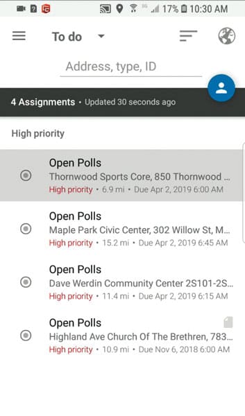
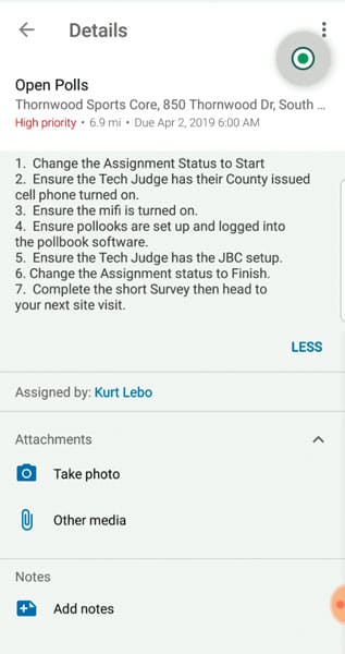
A Workforce task for opening a polling station contained all the data relevant to that polling station, such as its name and location, the name of the election judge assigned to that station, and all IT staff assignments. For Workforce tasks that popped up during the day, all applicable information, including a description of each issue, was passed to the app. With that on hand, staff managers were able to log in to the Workforce web app to assign each new issue to the appropriate staff member based on his or her location, workload, expertise, and availability.
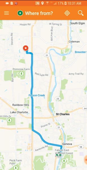
The IT development and GIS teams also integrated Workforce with Survey123 and Navigator. This enabled field support staff to use Workforce to review their assignments, Navigator to get to each polling place, and Survey123 to answer required questions about whether or not each polling place was ready to open.
The final step in processing each issue was to mark it as resolved in Kane County’s help desk software. Developers were able to easily access the REST services in Workforce and extract information, such as what time the issue was resolved and any relevant notes, to post to the county’s help desk software in near real time.
The improvements these apps made to Kane County’s election support system—from assigning staff and dispatching them to polling stations to getting back their data—were so pivotal that GIS is now, and for the foreseeable future, an integral part of Election Day IT support.

“Elections are not like many other projects. They have a very specific start time that is required by law, without exception,” said Kane County deputy chief information officer and chief of staff Charles Lasky. “Before using these products, I spent the whole morning on my cell phone communicating with over 40 different support staff spread over 524 square miles, trying to address high-priority issues with my best guess about who might be closest to the issue without knowing how many items they still had on their plate. Now, we are able to manage the support staff and route staff to high-priority issues in less time, since we know where they are and how many support issues they are currently assigned.”
Because Lasky is no longer relying on texts, emails, and phone calls to route staff, explain issues, or determine support staff locations, he is able to answer almost every call that comes in and provide more timely assistance to his staff in the field. He estimates that this implementation has saved him 35 hours of time in organizing Election Day IT support.
“I would never want to go back to supporting an election without the Esri suite of products,” Lasky concluded.


