Bureau of Land Management Supports Employees Driving Technology Change
Most organizations recognize the value of digital transformation. Unfortunately, less than a third of those that attempt it succeed, according to consulting firm McKinsey & Company. But the problem is not the technology. The success of digital transformation depends on people. Even if the technology is flawless, if people don’t use it, it fails.
Digital transformation initiatives must include strategies that engage people to adopt new technology. That’s why, as the Bureau of Land Management (BLM) looks to implement the next generation of location technology, it is first learning what its employees need.
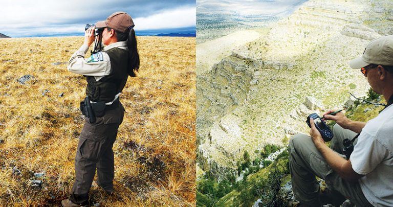
BLM, a bureau within the US Department of the Interior, manages 1 out of every 10 acres of land in the United States and approximately 30 percent of the nation’s minerals. These federally managed lands and minerals are found in every state and encompass forests, mountains, rangelands, arctic tundra, and deserts.

Because every piece of BLM’s data is connected to a location, it is a heavy user of GIS. Currently, BLM’s nearly 6,000 GIS users mostly rely on desktop software to manage data and create maps.
Given the advantages of cloud-based and enterprise GIS—from connecting more data sources to enhancing data collection, accuracy, and analysis—BLM is looking to institute Web GIS. But the bureau wants to do it in a way that’s beneficial for all its users, so it is working to get buy-in from them at the outset.
Let Business Needs Drive Change
In the past when BLM headquarters implemented new software, it frequently experienced problems because it didn’t consider its workforce’s behaviors in adapting to change. The bureau developed and launched several GIS apps without a full appreciation for the scope of work being managed in field offices. This resulted in adoption rates in some offices being very slow or nonexistent once the apps were deployed.
This time around, BLM is applying a change management approach to introducing new technology. The principle at the heart of BLM’s GIS modernization initiative is to let business needs drive change.
At its national office, 12 state offices, and hundreds of field offices, business needs are as diverse as the nation’s geography. So BLM is implementing an engagement strategy to get people at all levels of the organization—from GIS users to land management professionals and resource specialists—to talk about their needs.
BLM headquarters asked state offices across the agency the following questions:
- Who are your users?
- What are their needs?
- What are their workflows?
“While each office has a unique way of doing business,” according to BLM geospatial training administrator Peggy Deaton, “the overall needs were the same: a system that is reliable, adaptable, and well supported at all levels of the organization.”
Establish Roles for Each Key Part of the Process
A best practice when it comes to change management is to understand and fill key roles.
First, and most critical, is the role of executives. They assign budgets, move the organization forward, and commit resources to support initiatives through completion.

Second is the role of champions, whom the organization enables and empowers to get the work done. These are the project managers and problem solvers.
The third role belongs to technical leaders who oversee system implementation. They select the frameworks that will be used and design the applications that will grow performance across the organization.
Fourth is the people-focused role, which is responsible for enterprise-wide adoption. This may be the most challenging position of them all because its purpose is to integrate the perspectives and needs of developers at one end of the spectrum and users at the other. The people who fill this role end up collaborating with executives, champions, and technical leaders.
For its change management initiative, BLM put together four teams: a data team, a technology team, a business process team, and a people team. The people team, led by Deaton, focuses on engagement, training, staffing, and capacity building. Its job is to prepare the workforce for the change that’s coming.

“Change management means thinking about adoption throughout the entire process,” Deaton said.
Engage Different Types of Users
The people team wanted to make staff aware of BLM’s plan to adopt new technology, but communication within an organization the size of BLM can be difficult. With this in mind, the team set up a discussion site via a private GeoNet group in Esri’s cloud service. Now, staff at all levels and from every office can ask questions and talk about the transformation plan.
To engage all BLM employees in the project, the people team also needed to know whom to communicate with, what messages to relay, and how best to build project awareness. Working with the Esri change management group, the team came up with a plan to identify GIS users within BLM and group them into personas. This list allowed the team to tailor communication to specific user types rather than send generalized messages to everyone.
To develop the personas, members of the people team reached out to different BLM field offices and sent surveys that asked who in the office uses GIS and how they employ it. Once they received responses, the team members read them, looked for similarities, and grouped particular user types together. The categories BLM ended up with included GIS consumers who simply view data, people in leadership roles who want reports, and GIS professionals.
Because the information used to define these personas came from field offices rather than BLM headquarters, it was extremely important to understand nuances in the different users—and that was also the point. For example, the user base that works in New Mexico’s desert has concerns that are different from the user base that focuses on forests in Oregon.

Get Participation in Development
People who are not technology professionals, such as some BLM scientists, have been hesitant to update their processes. Some are concerned that new technology will make their jobs harder. From experience, BLM knows that it needs to get buy-in from these users or they will push back, and the implementation of this new Web GIS technology will not be successful.
To get user buy-in, Justin Grossman, the CEO of a design and development agency called meltmedia, suggests three best practices in a post on the Forbes Agency Council’s website. First, leadership needs to collaborate with employees in every department to come up with ideas. Second, organizations need to evaluate gaps in their technology. And third, any solutions that get implemented need to be cross-functional.
To this end, BLM’s people team invites users to participate in the project’s discovery phase, wherein the technology team listens to what users need and then builds apps for field staff to test. Since technology gaps are very apparent to those who will be using the tools every day, staff provide direct feedback to developers, who use it to tweak their apps. This lets users know that their input is valued and shows them that their concerns are being addressed.
“We want to make sure our users know that we are not going to force them to use something that doesn’t work for them,” said Deaton. “They are participants in the process. We are aware that technology is not one size fits all. This project is very consumer based. We support solutions that work best in individual areas.”
Conduct Tailored Training Workshops
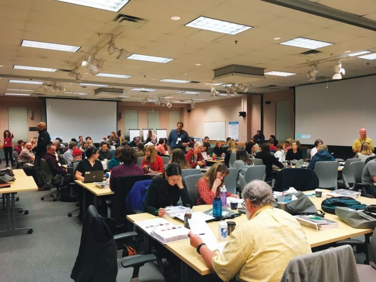
In addition to facilitating dialogue among leaders, developers, and users, the people team at BLM plans training workshops for field offices. Instructors draw on locally based examples and use data collected by individual field offices to tailor the workshops to specific audiences.

With these customized learning plans, participants receive hands-on GIS training using familiar data to map their environments. The result is that at the end of the workshop, people leave with the ability to use the new technology the very next day.
“Today’s GIS technology has so many options,” Deaton said. “Now, BLM users can make their own maps when and where they need them. They have access to data and the tools to use it. The workforce has greater capacity to do research, make decisions, and share information.”
The Benefits of Change Management
Technology companies continually roll out innovative products that elevate work quality and capabilities. This means that, for successful organizations, digital transformation is a never-ending process.
BLM’s change management approach will increase the capacity of its workforce to create their own maps and do in-depth analysis. The GIS team, once dedicated to making maps, now has more time to advance technologies that further BLM’s mission.

