The City of Hobart, Indiana, which lies along the banks of Lake George, is one of Lake County’s oldest municipalities. With a population of about 28,000 people, Hobart provides a close-knit community in which residents and visitors enjoy a lively downtown, thriving retail opportunities, and great schools just 40 miles outside Chicago, Illinois.
In early 2019, a small cadre of experienced and visionary staff members in the Hobart Sanitary and Stormwater District (HSD) recognized that geospatial technology and location intelligence could transform the city. The team reached out to Esri partner Geographic Technologies Group (GTG) to write and implement a GIS-specific strategic plan. Using this as a guide, HSD staff members quickly developed a phased, multiyear, citywide GIS road map; secured buy-in from all stakeholders; and found funding for the modernization project. They are now successfully building a sustainable, resilient, and scalable enterprise GIS for the whole city.

A Phased Approach to Developing a GIS Strategic Plan
Staff members at the City of Hobart were facing growing pressure to deliver geospatial data to both internal and external customers and integrate GIS with other supported business systems. Additionally, the city’s GIS needed to align more closely with and support the overall vision and goals set by the mayor and the city council.
The process for creating the GIS strategic plan was broken down into three phases. The initial phase revolved around assessing the current GIS that HSD and the City of Hobart were using. Project team members from GTG interviewed key stakeholders; performed a strengths, weaknesses, opportunities, and threats (SWOT) analysis; identified gaps in key performance indicators (KPIs); and presented a report to stakeholders, including city employees and HSD board members, that established KPI benchmarks for the plan. In phase 2, the GTG team focused on systems design, which included laying out technological recommendations and best practices not only for the entire city government but also for each department, based on the needs identified in the first phase. For phase 3, the team at GTG assessed the returns on investment (ROIs) the city would realize with its new enterprise GIS and presented the formalized GIS strategic road map to city staff members, HSD board members, and Hobart’s city council.
Each phase of the process, along with the accompanying deliverables, adhered to GTG’s Six Pillars of GIS Sustainability:
- Supporting good GIS governance
- Having accurate and reliable GIS data and databases
- Making procedures and workflows interoperable
- Developing a cohesive and robust ecosystem for GIS software
- Establishing well-designed infrastructure
- Providing training and education in GIS to ensure its sustainability
Once a strategic implementation plan was put in place, staff members from HSD and the City of Hobart worked with GTG’s team to bring items in the plan to fruition. They deployed an ArcGIS Online organization and began using Microsoft Azure Virtual Machines to host the city’s custom GIS apps and other media. Team members also employed ArcGIS Hub to develop internal and external hub sites, which serve as open data portals. Additionally, they built a variety of viewers, dashboards, and stories made with ArcGIS StoryMaps to better present data and communicate important city initiatives.
A GIS Viewer That Integrates with Key Resources
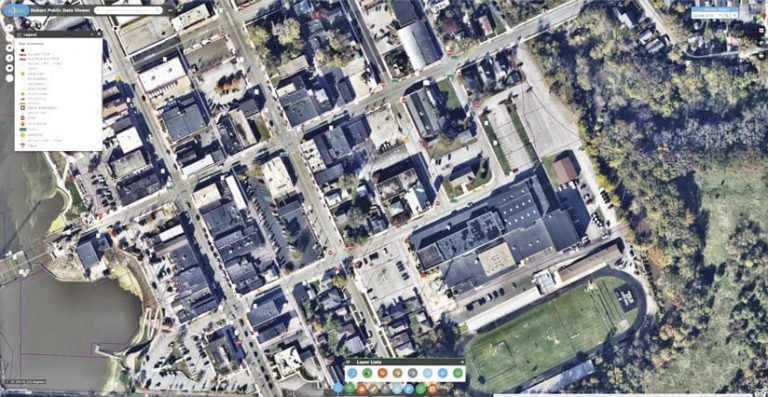
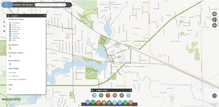
One of the most important web apps that GTG helped the City of Hobart develop was its GIS Viewer, which has both an internal interface and a public-facing one. Built using ArcGIS Web AppBuilder, the team at GTG equipped the viewer with user-friendly controls and customized it to address HSD’s needs.
A key customization for the GIS Viewer was integrating it with Esri partner Nearmap, which provides accurate aerial imagery for more than 430 markets in North America. HSD commissions Nearmap to collect high-resolution aerial imagery of Hobart three times each year, so it was crucial for GTG to make this resource more readily available to city staff.
“Our range of high-resolution aerial content…acts as a valuable component [of] the strategic planning services offered by GTG,” said Karl Terrey, director of global alliances at Nearmap. “Our imagery is refreshed multiple times per year and, when combined with GTG’s technology, [it] allows cities, towns, counties, and state governments to make decisions based on conditions in their communities in near real time, at a fraction of the cost.”
With assistance from a Nearmap technician, the team at GTG created a custom widget that allows users of the GIS Viewer to see available imagery according to the date a flight was taken, going back to 2015.

One other significant integration for the GIS Viewer involved connecting it more seamlessly with data from the County Assessor’s office. To help staff at the city’s Planning and Economic Development departments find and view official parcel records, the GIS Viewer links directly to the assessor’s website, which has historical ownership information, engineering sketches, and photos for parcels throughout town. All users have to do is click on a parcel on the map, and that takes them directly to the associated web page on the County Assessor’s website.
Internal and Public-Facing Hub Sites Increase Transparency
Another central piece of the City of Hobart’s GIS strategic plan was creating two sites with ArcGIS Hub—one for use by internal teams and one for engaging with the public.
The internal hub page, which is fully customizable, includes links to Nearmap’s high-definition imagery, access to other GIS apps, and additional departmental information that needs to be communicated. The main page of the internal hub highlights key apps that all city staff can use, while subpages are more specific to various departments, including HSD, Planning, Economic Development, Police, Fire, and Parks and Recreation. Staff members in each department can view other departments’ subpages and the apps linked from there, which increases transparency and communication among teams. As the city’s use of GIS grows, staff members can also add new pages to the internal hub site. And GTG plans to continue developing solutions that will get placed on each department’s own hub page so team members can use them.
The external hub site essentially acts as an open data portal for the public. People can visit the site to download any GIS files from Nearmap’s archives that the city has identified as open data. For instance, a student doing a school project can retrieve shapefiles related to city parks to analyze the data. Community members are also able to view a variety of GIS apps—such as the GIS Viewer (with confidential information removed) and narratives built with ArcGIS StoryMaps—to increase awareness and understanding of city initiatives. For example, if people want to find out more about the $1.25 million Hobart has invested in green infrastructure, they can check out the Stormwater Management and Green Infrastructure Projects story to see how the city is working to reduce runoff pollution and improve local water quality.
Hobart’s Continued Commitment to Evolving Its Enterprise GIS
With all these tools in place and a still-growing enterprise GIS infrastructure, the City of Hobart is well on its way to becoming a smart community.
The city has a ratified GIS governance and management model that is guiding its geospatial growth, and all its geospatial systems are becoming interoperable via a phased integration. Its software and IT infrastructure is moving to a modern, cloud-based framework. Staff members are gaining a better understanding of what location intelligence is and how it works. Various departments have their own geospatial apps that are helping them streamline and share their work. More people throughout the community are making better use of accurate, reliable, and well-maintained digital data. And the whole system promotes economic, environmental, and social development.

