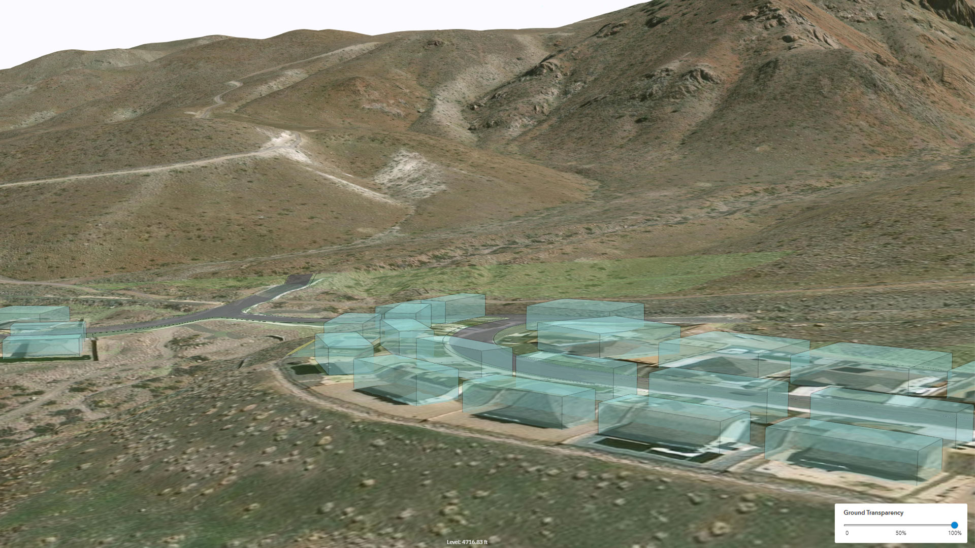
Thanks to AI, new approaches to civil engineering design are emerging—particularly for large-scale land development. Allsite.ai, a recent graduate of the Esri Startup program, has built a design platform that incorporates AI with ArcGIS technology to automate parts of the design process and develop digital twins.
“Esri’s technology provides us with the means to work with data at a massive scale, which is critical for us because the projects running on our programs can be the size of a city,” said Sam Blackbourn, cofounder and CEO of Allsite.ai, which has used Esri technology since its founding in 2021. “Our software uses the ArcGIS 3D Analyst extension to prepare spatial data for Allsite.ai’s proprietary AI models and algorithms that rely on huge graphics processing unit (GPU) clusters for processing.”
The resultant platform allows civil engineers to generate cut-and-fill plans to create level construction sites, build road profiles (perpendicular views of roads that show the ups and downs of their surfaces), and produce long sections that display a project’s elevation profile. ArcGIS Pro SDK for .NET and ArcPy are used as well to extract and process data.

Initially, the Allsite.ai team used ArcGIS to develop automations, such as generating scheme plans—detailed drawings that illustrate the design, layout, and other aspects of a property development project—and doing quality assurance verifications on engineering designs to ensure they meet local engineering requirements.
“More recently, we have used ArcGIS to prepare data for AI model runs and visualizing our design outputs for the development of digital twins,” said George Stirling, cofounder and CTO of Allsite.ai.
The company has built two AI-powered design agents: one, called Level AI, for surface designs, and another, called Service AI, for underground infrastructure. The agents work with ArcGIS Pro and Autodesk’s Civil 3D software, leveraging their interoperability and the robust collaboration between Esri and Autodesk. All assets are hosted in ArcGIS Online, and ArcGIS Maps SDK for JavaScript provides additional information in the digital twin models.
“Our optimization engine was a significant challenge to develop—but an essential part of our work,” said Blackbourn. “The scale of the parameters required for our projects is huge, which prompted the development of a distributed architecture. This required us to utilize advances in cloud GPU computing to rapidly produce optimal designs that would be difficult to achieve without AI.”
The Level AI design agent provides compliant surface and roading designs from a 2D layout. It is an advanced grading optimizer that considers many factors—including flood risks, roadways, and the ability to service the site—in its analysis and recommendations. The Service AI design agent automatically designs storm sewer and storm drain pipe sizes and invert levels to create optimal pipe networks that stand up to local engineering requirements. Additionally, Service AI combines generative AI and algorithms to forecast operating and capital expenditures.

“Our customers are primarily civil engineering land development consultancies that can utilize the technology to rapidly progress civil engineering land development projects,” said Blackbourn. “The end user deriving the greatest benefit is the land developer . . . because our design platform provides faster and more comprehensive development insights, which improves decision-making and saves money.”
Allsite.ai is working with some large homebuilders in the United States on development projects in California, Arizona, and Texas. One project is a 2,000-house subdivision near Sacramento. The site has a large number of detention ponds to hold stormwater runoff during flooding events, as well as a tunnel under a parkway—and these were all automatically designed using Level AI. For a 38-acre project in San Francisco, roadway surfaces were automatically generated by AI rather than manually designed, leading to more than $1 million in savings for earthwork grading.
“By using Allsite.ai, our customers get rapid design iterations in days, not weeks,” said Stirling. “This allows engineering consultancies to spend more time ensuring that their clients have greater options and are better served. Our design platform allows the time-consuming aspects of large land development projects, like grading, to be handled by the computer, whilst the more challenging engineering problems can be tackled by the engineer.”