On a warming planet, understanding the ocean is more critical than ever. Not only does the ocean cover almost three-quarters of the surface of the earth, it also absorbs 90 percent of the world’s excess heat and 25 percent of its carbon dioxide. This means that the ocean is buying humans and other species valuable time. But how much, and at what cost, is unknown.
Like the rest of the planet, the ocean is in peril. Climate change, overfishing, and ocean acidification are jeopardizing the health of marine ecosystems. Loss of biodiversity and the destruction of coral reefs threaten the ocean’s ability to provide food and sustainable livelihoods to millions of people.

To understand what’s happening to the ocean and, in turn, how this affects the rest of the earth, humans need comprehensive maps of the ocean. Yet there are more detailed maps of the surface of Mars than there are of Earth’s ocean floor. To date, only 23.4 percent of the ocean floor has been mapped to modern standards, and we need to get to 100 percent to more fully use and protect the ocean’s resources and uncover clues about what climate change might do to the rest of the planet.
Part of the reason for this disparity stems from differences in technology. To map other planets, scientists use electromagnetic energy, which easily travels through Earth’s atmosphere and space but not through water. Because Earth is a water planet, and given how well acoustic (sound) energy travels through water—think about the calls of marine mammals—this is the best type of energy to use to map the ocean floor. Gathering data from acoustic instrumentation, however, takes much longer than it does with satellite or airborne remote sensing technology.
There are two ways that acoustic instrumentation is deployed: either at the surface of the ocean, in large arrays from the bottoms of ships and surface drones; or closer to the ocean floor, in portable arrays from deep-diving drones and submersibles. There are also two ways that acoustic energy is used: to measure the travel time of sound pulses to and from the ocean floor, which returns depths (bathymetry), or to measure the intensity of those sound pulses as they return, which yields backscatter imagery of the seafloor (akin to a hillshade or an aerial photograph). The instruments deployed at the surface of the ocean can already provide very good maps of the ocean floor. But maps of certain places still need more intricate detail—hence the higher-resolution mapping from deep-diving drones and submersibles.

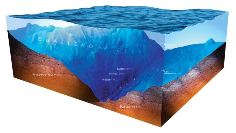
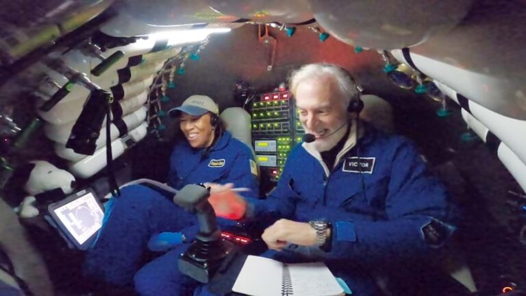
On July 12, 2022, I took part in an expedition with ocean research company Caladan Oceanic to dive with its founder, undersea explorer Victor Vescovo, to the deepest point on Earth: Challenger Deep, located in the Pacific Ocean’s Mariana Trench near Guam. With Vescovo piloting the Limiting Factor submersible, the two of us descended 10,919 meters below the ocean’s surface to the Western Pool of Challenger Deep. For our dive, the submersible was outfitted with a first-of-its-kind portable acoustic instrument for mapping the backscatter of the ocean floor. Normally, these types of portable instruments implode at 6,000 meters due to the intense pressures of the deep ocean, but our instrument was customized to operate at the greatest depths of the ocean—that is, full ocean depth. We just needed to prove it. So as mission specialist, my primary duties during the dive were to operate this instrument and, together with Vescovo, conduct the first high-resolution backscatter survey of this part of Challenger Deep.
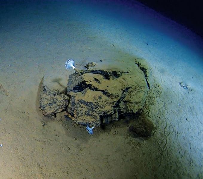
During our ten-and-a-half-hour dive—with two-and-a-half hours of visual observation and successful acoustic surveying on the bottom of the ocean—Vescovo and I saw stunning evidence of where two tectonic plates collided; several deep-water marine species, including some striking anemones and amphipods; and, if you can believe it, a beer bottle. We must do better!

In all, we collected nearly four terabytes of data that maritime scientists at Esri are currently processing using ArcGIS Pro and ArcGIS Image for ArcGIS Online. Among the many products we hope to release are the first high-resolution acoustic images of a portion of Challenger Deep’s Western Pool, which will add to our knowledge of the geomorphology there and inform the design of future deep-diving portable acoustic instruments. When the data and maps are ready, they will be shared through ArcGIS Living Atlas of the World; through a series of ArcGIS StoryMaps stories; and with Seabed 2030, a joint project of the Nippon Foundation and the General Bathymetric Chart of the Oceans (GEBCO) that seeks to get 100 percent of the ocean floor mapped to modern standards by the end of the decade.
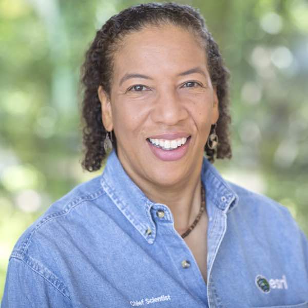
Many firsts were achieved during this dive to the deep ocean floor, including this one: I became the first person of African descent (of any gender) to visit Challenger Deep. I hope that like many of my own heroes did for me—including oceanographer Dr. Evan Forde, who in 1979 became the first Black person to complete a research dive in a submersible, and Dr. Mae Jemison, who in 1992 became the first African American woman to go to outer space—this adventure will inspire young people, especially young Black people and early career academics and scientists, to live out their own dreams. Science, the oceans, and the earth will be the better for it.


