The Iowa Department of Natural Resources (Iowa DNR) Fisheries Bureau has developed various public mapping tools designed to improve fishing opportunities for anglers in Iowa. However, lakes, urban ponds, rivers, and trout streams have historically been covered by separate maps and were developed with different platforms. Symbology was inconsistent, not all maps were interactive, and location updates were not automatically pushed from associated databases to apps. Additionally, some of the platforms used to make these maps were outdated.
To address these inconsistencies, Iowa DNR staff sought to combine their mapping tools into a single interactive web mapping app. The solution was the Iowa Fishing Atlas, a one-stop shop for the mapping needs of Iowa anglers.
The app, created with ArcGIS tools such as ArcGIS API for JavaScript and ArcGIS Field Maps, facilitates ease of data collection and updates, standardizes map symbology, improves user trip planning, highlights amenity locations, and showcases fishing structures. Anglers of all skill levels can use it.
A Collaborative App
The first step in designing the Iowa Fishing Atlas was fostering collaboration among three disparate departments: the Iowa DNR Fisheries Bureau, the Iowa DNR GIS section, and the Iowa Department of Management (Iowa DOM). The Fisheries Bureau collected the location data and provided important feedback to the GIS section and Iowa DOM, which jointly developed the web app.
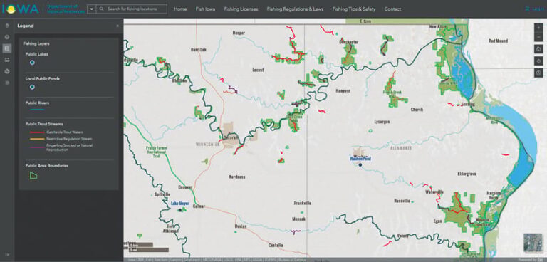
Built with HTML5, CSS3, and Bootstrap 5, the app is responsive and mobile friendly. Bootstrap’s built-in components, such as the navigation bar and grid system, allow for rapid interface development and a consistent look across devices. Custom styling ensures the app remains visually aligned with Iowa DNR branding while offering a clean and intuitive user experience.
The core mapping functionality is powered by JavaScript API, which enables dynamic map rendering, feature popups, complex spatial queries, and spatial interactions. Fishing data is presented with a variety of feature layers grouped by type, such as lakes, rivers, and amenities—eliminating the need for separate mapping tools.
A custom basemap and URL-driven map centering also enhance usability, letting users easily share or revisit specific locations. A wide range of interactive map widgets are designed to further enrich the user experience. These include a search bar, layer list, legend, basemap toggle, coordinate display, print tool, and sketch and measurement tools. Widgets are configured dynamically through JSON, allowing for flexibility and scalability. On smaller screens, certain tools are automatically hidden or repositioned to ensure a clean and accessible interface for all users.
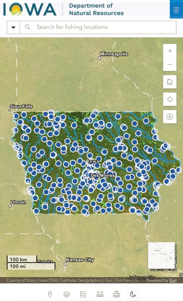
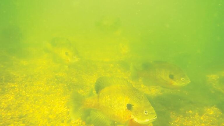
One of the unique aspects of the Iowa Fishing Atlas is that it provides support to anglers of all skill levels and types, including shoreline anglers, boat anglers, and ice anglers. A novice angler can plan a trip from the comfort of home on a laptop, then open the Iowa Fishing Atlas on a mobile device after arriving at their destination to find congregations of fish near fishing structures. Avid anglers can view lake bathymetry, reducing the amount of time spent fishing unproductive waters.
Sometimes people prefer a map in hand; this was the impetus for designing the printing widget. Symbols can be turned on or off and spatial scale can be adjusted to create customized PDF maps. And all these features are available using equipment most people already own—cell phones, tablets, and PCs. No need to purchase specialized gadgets.
Internal Capabilities
Internally, the Iowa Fishing Atlas has proved useful as well. Iowa DNR uses the app for project planning, inventorying fishing structures, and maintaining infrastructure. A measuring widget, for instance, was added to facilitate measuring areas for aquatic vegetation treatments and shore lengths for shoreline bank armoring. Accurate and precise project planning can reduce costs, especially with an app all staff can take advantage of.
Given the importance of visual communication with the app’s public users and the limited resources available for managing location data, ArcGIS Field Maps is another invaluable tool Iowa DNR has used to collect data and provide instant updates to the app. It’s important to be able to communicate the locations of stiles and signs used to navigate trout streams, for example, or sites for Iowa’s Community Fishing Program, which are dynamic and thus require constant updating.
For Iowa DNR, collaboration and communication have bridged the gap between fieldwork and the end user, helping to improve its maps and provide easy-to-use navigation. The Iowa Fishing Atlas is a vital tool for both Iowa anglers and the internal staff dedicated to managing the state’s fisheries.
For more information, contact Lewis Bruce at lewis.bruce@dnr.iowa.gov or Freddy Segura at freddy.segura@dom.iowa.gov.