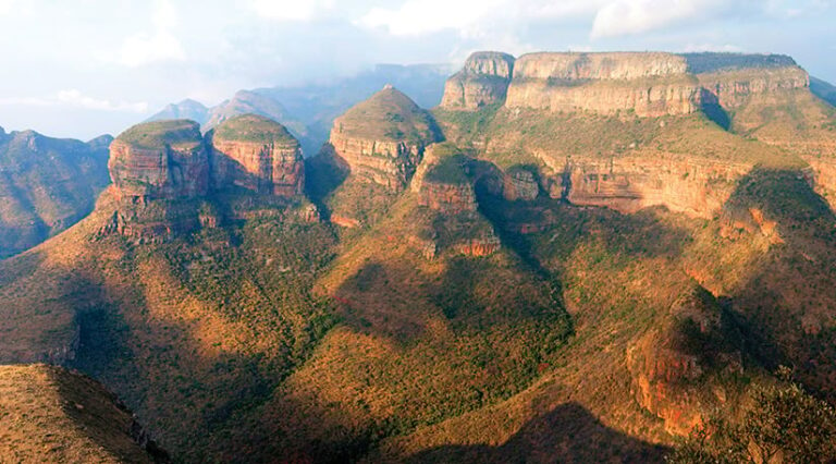
In the Nguni languages of southern Africa, the word “mpumalanga” means “the place where the sun rises.” It’s a fitting name for the South Africa province of Mpumalanga—both in terms of its location near Africa’s eastern coast and as a region of optimism in the wake of apartheid.
A place of ancient human archaeological history and rich agricultural, mining, and tourism resources, Mpumalanga is known for its magnificent scenery, tribal legends, and colorful gold rush stories from the late 1800s. But Mpumalanga also has rich biodiversity and incredible value as a home to many species that can only be found there.
Many of these species are protected in Mpumalanga’s extensive nature reserves. These species include Barberton sugarbush (a flowering plant threatened by mining activity), Sim’s spotted aloe (another plant, threatened by road construction), and Treur River barb (a river fish that has overcome displacement by exotic fish species and gold mining).
Mpumalanga is also home to more than 300 species of flora and fauna that are officially classified as vulnerable, endangered, or critically endangered. More than 300 others are classified as species of conservation concern. This makes identifying and locating their ranges vital so that they can receive the conservation attention needed to ensure their protection.
GIS-Fueled Conservation in Mpumalanga Province
As a biodiversity planner and GIS manager for the Mpumalanga Tourism & Parks Agency, Mervyn Lötter supports a commitment to conserve and protect all animal and plant species in the province. In this effort, Lötter faces an uphill challenge, albeit with some powerful GIS tools.
Surveying the local environment and building awareness of it is central to Lötter’s work as he manages his organization’s spatial databases and GIS. He also coordinates the collection of species data being gathered by scientists in the field using ArcGIS Survey123 and ArcGIS Field Maps.
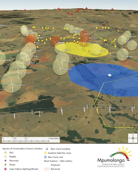
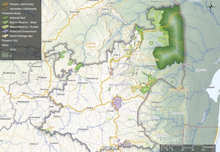
With this information, Lötter runs a systematic conservation plan for Mpumalanga and brings together all spatial data on species, ecosystems, threats, and areas currently under protection. This field data is included in the agency’s conservation plan, where conservation targets are set and progress is assessed. When targets fall short, additional areas are prioritized for conservation.
Partnerships, Scholarships, and Collaboration
Having reliable and detailed GIS information is essential for attracting partnerships, building public support, and securing financial support in a part of the world where conservation funding is often scarce, Lötter said. He noted that the way data is presented can matter as much as the data itself, and that maps and web apps are effective tools to convey important messages.
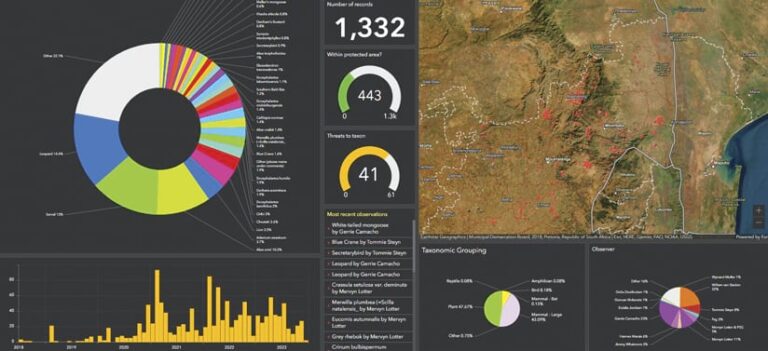
“If you want your products used and you want [them] to be considered by municipalities and the like, then you need to make the data available in a format that they can use and access and understand,” Lötter said.
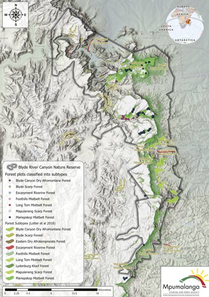
Education and industry collaboration have also been key to Lötter’s GIS efforts. After starting his career at the Mpumalanga Tourism & Parks Agency as a botanist in the mid-1990s, Lötter learned about GIS as a way to predict the distribution of plant species. In 2011, he joined 16 other recipients in a scholarship program offered by the Esri-supported Society for Conservation GIS (SCGIS), a nonprofit organization that helps scholars from developing countries access GIS training.
“No other training event has had such a positive impact on my life, ever,” Lötter said.
There was still plenty to learn, though, and Lötter’s ongoing need for education found a ready resource in Esri Community, a global online community of Esri users where members can find solutions, share ideas, and collaborate to solve problems with GIS.
“I would never have been able to learn to use GIS to its full potential on my own,” Lötter said. “Through the Esri Community, you’re much more able to reach out to a broader network to get their advice, their support, and learn from where others are stumbling.”
Lötter described Esri Community’s role in supporting GIS professionals by quoting an African proverb: “If you want to run fast, run alone. But if you want to run far, run together.”
Giving and the Spirit of Ubuntu
Now nearly three decades into his conservation work, Lötter’s community-mindedness is reflected in hundreds of Esri Community messages and responses. An SCGIS board member for the last decade, he is now a GIS trainer for the SCGIS Global Scholarship program and the SCGIS Train-the-Trainer program for scholars who are selected for additional training to become certified instructors.
Lötter captured his philosophy about giving back to the GIS community by sharing another African term—”Ubuntu,” which he translated as “taking care and having care and concern for your neighbors or your community.”
“You can’t do everything on your own,” Lötter said of the GIS community. “We need to help and support others.”
