Every year, floods, earthquakes, typhoons, and hurricanes cause unfathomable damage to communities all over the world. When they do, responders know whom to reach out to: GISCorps.
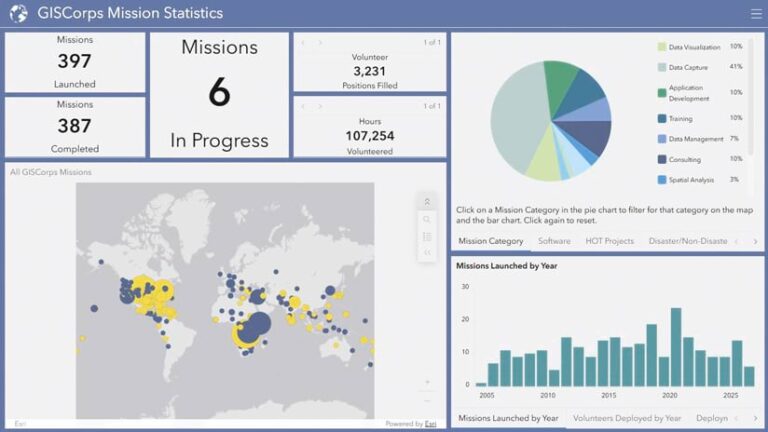
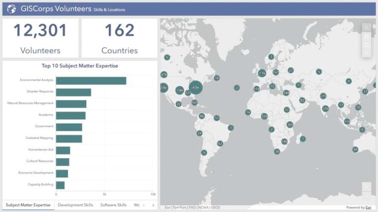
A program of the Geospatial Professional Network (GPN), GISCorps has attracted over 12,000 prospective volunteers from 162 countries and launched more than 380 missions worldwide since 2003.
But the organization does more than assist with disaster response. It also helps nonprofits develop maps and apps, review and collect datasets, conduct GIS training, and more. So far in 2026, more than 500 GISCorps volunteers have contributed their expertise to 14 completed disaster and non-disaster missions, with more in progress.
GISCorps is powered by the tireless work of volunteers. Yet its origins can be traced back to one person: Shoreh Elhami, who built the organization one spare evening at a time.
Giving Time
Elhami’s path to founding GISCorps wasn’t a straight line. Trained as an architect and urban planner in her native Iran, she eventually enrolled in a master’s program in city and regional planning at The Ohio State University. As a research assistant, she got her first real taste of GIS and realized it could do in minutes what she had spent years doing by hand.
GIS soon became the center of Elhami’s career. She created one of the first GIS-driven county comprehensive plans as a GIS coordinator for the Delaware County Regional Planning Commission. She then joined the Delaware County Auditor’s GIS division, where she and her team built the county’s first land information system from the ground up. She taught GIS classes as an adjunct for 11 years. And in 2013, she was hired by the City of Columbus as a GIS manager, then promoted to an enterprise data architect to lead the city’s data and analytics services program, supporting hundreds of datasets and dozens of apps.
Since Elhami first began developing the idea of GISCorps, she has spent part of nearly every weeknight and weekend reviewing mission requests, vetting volunteers, writing job descriptions, coordinating logistics, and staying personally involved with missions. Her participation has always been an unpaid commitment.
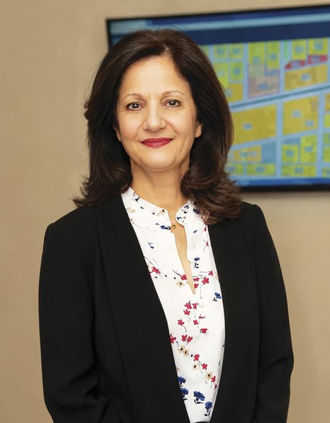
“It’s what I do and love,” she said. “Nothing makes me happier than helping someone whom I feel our expertise can help.”
The Real GIS Heroes
Elhami has always insisted that the volunteers are the real story.
“There’s nothing like meeting people who are like-minded, like-hearted,” Elhami said of the GISCorps volunteer community.
The first volunteer requests arrived following the 2004 Indian Ocean tsunami and Hurricane Katrina the following year, when 40 volunteers stepped up to support disaster response. In the early years, most missions focused on GIS training in the United States and countries such as Afghanistan, as well as building apps and datasets for nonprofits.
As GIS technology advanced, more requests could be fulfilled virtually, although on-site missions continued. In 2014, for example, the World Health Organization (WHO) asked for volunteers to travel to four countries in West Africa to help map the Ebola response. In 2017, WHO turned to GISCorps again to support its polio eradication program, this time virtually. More than 270 volunteers from 20 countries contributed over 5,400 hours, placing more than 760,000 structure points in one of the largest GISCorps virtual missions.
That same year, GISCorps established a team called PhotoMappers, who have participated in more than 60 disaster response missions. This coincided with the start of another program, in partnership with Esri, called the GIS Service Pledge (GSP). Esri donates a one-year ArcGIS for Personal Use license to each GISCorps volunteer who commits to contributing their expertise to a worthwhile cause. Seventy GSP projects have been completed so far, and the program is growing.
The Search for an Executive Director
GISCorps faces a new challenge. Elhami has been diagnosed with a rare form of brain cancer. She has chosen to share this news with the GIS community because she wants GISCorps to be in strong, capable hands—and because ArcNews readers represent the community she and her team have spent two decades calling on to show up for others. Now, the organization needs someone to show up for it.
The organization has so far been sustained almost entirely by the unpaid efforts of its founder, core committee, advisory board, and volunteers. It is a model that has taken GISCorps further than anyone could have predicted.
That’s changing. GISCorps is searching for its first paid executive director—someone who can continue to shape how the GIS community shows up for the world’s most vulnerable people in their time of need, from earthquake zones to Ebola treatment centers.
And it could be you.
Given the limitless energy Elhami has poured into GISCorps, it’s hard to imagine anyone stepping into her shoes. But the invitation is simple: If you’re a skilled GIS professional, have mapped for GISCorps, or simply believe that GIS skills are worth volunteering when they matter most, this is the time to step up. The organization Elhami and her team built one late night at a time is ready for someone to carry it into its next chapter.
To carry on the vital work that GISCorps does all over the world, submit a cover letter and résumé to advisoryboard@giscorps.org by November 9, 2026. Find out more details about the post.