Building the Geospatial Nervous System
Esri president Jack Dangermond describes his vision for GIS becoming a global platform that shapes decision-making across communities.
Esri president Jack Dangermond describes his vision for GIS becoming a global platform that shapes decision-making across communities.
Some claim that Easter Island suffered from ecological and societal collapse. A digital twin disproves this theory.
Staff now have real-time insight into operations, leverage prescriptive analytics, and benefit from AI-enhanced decision-making.
Crisfield, Maryland, has high flooding risk. A digital twin, built with ArcGIS technology, is helping to assess flood adaptation strategies.
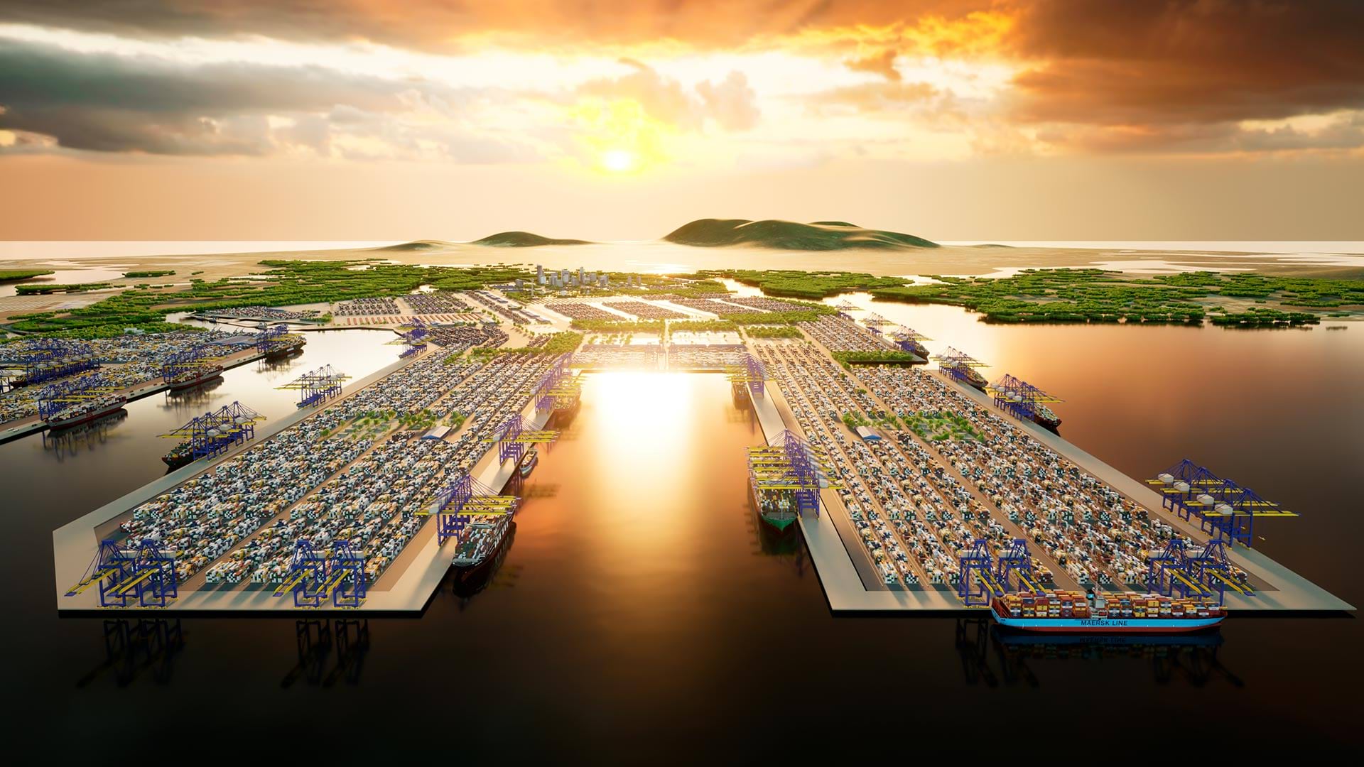
3D GIS workflows and models have created a digital twin to help guide development of port facilities in Vietnam.
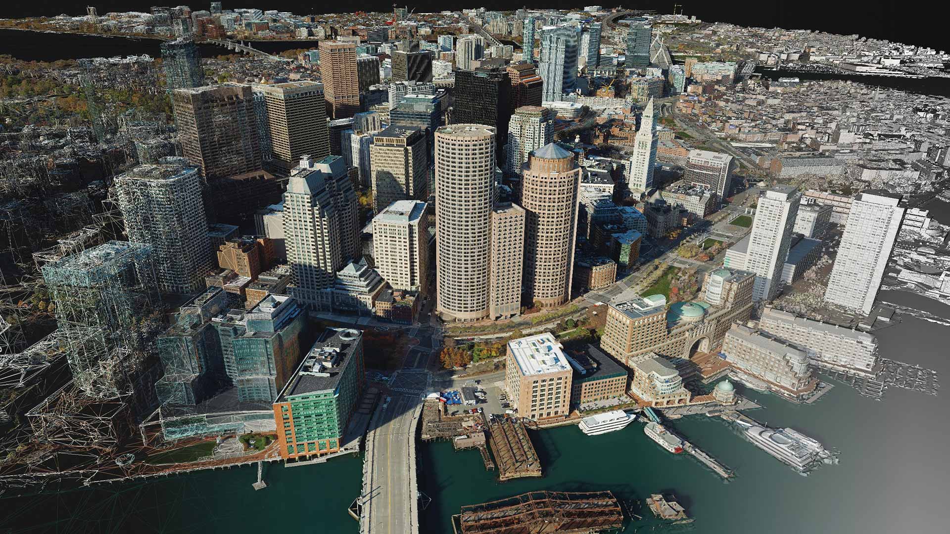
With a suite of photogrammetry software products, users can build accurate digital renderings of objects and scenes at multiple scales.
For a team of archaeologists, GIS offers an effective way to collect data and quickly disseminate project findings in compelling formats.