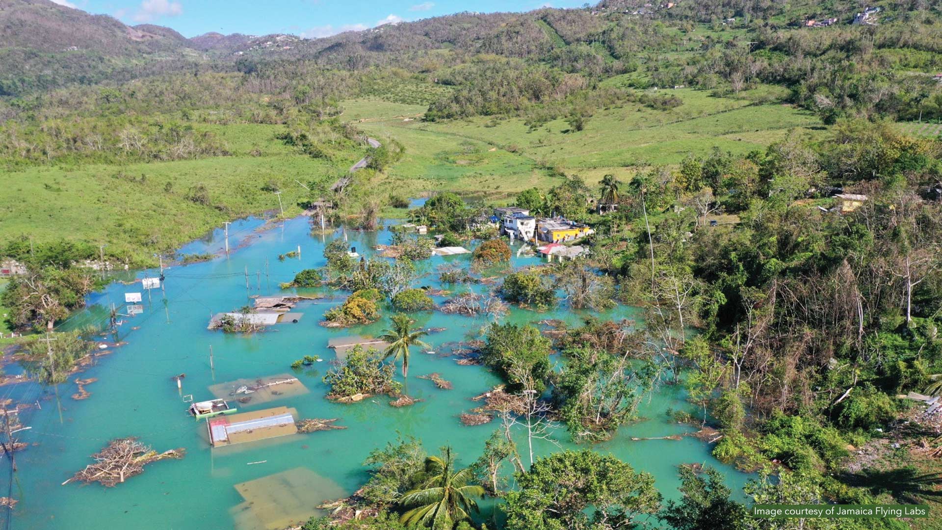
When Category 5 Hurricane Melissa slammed into Jamaica on October 28, 2025, Alicia Edwards and her team at the National Spatial Data Management Branch of Jamaica’s Ministry of Economic Growth and Infrastructure Development moved quickly. Within days, they identified about 191,000 damaged buildings across the island—nearly 20 percent of Jamaica’s structures.
As principal director of the branch, Edwards had spent the previous year building the geospatial infrastructure that proved essential when disaster struck.
From River Rapids to Geospatial Technology

Edwards’ path toward GIS began with observation. As a teenager, she went on driving trips that took her over Jamaica’s historic Flat Bridge, which connects the capital, Kingston, with the north coast. She often reflected on the connections between nature and humanity—in this case, a river, a road, and a bridge. That recognition of how Earth and humans coexist led her to focus on geography for her secondary school studies.
In her second year of college, Edwards encountered Esri software and recognized it as a powerful tool for someone who thought about landscapes and patterns. She quickly saw how spatial analysis could reveal trends and provide insights.
Since then, Edwards has built a career spanning more than 25 years across Jamaica’s government. Starting as a GIS technician with the National Works Agency of Jamaica, she progressed to manager and moved into forestry. Each role taught her that geospatial technology transcends any single sector.
“It’s all about ensuring that authoritative, quality data exists so decision-making can be easily integrated within critical workflows,” she explained.
Building the Foundation Before the Storm
By March 2024, Edwards led Jamaica’s National Spatial Data Management Branch. Under her direction, the branch revamped the country’s National Geospatial Repository, which has consolidated 95 percent of Jamaica’s spatial information.
“The repository is a game changer for Jamaica,” Edwards said, noting how it can be put to a range of uses, from distributing water and designing climate-resilient roads to preparing for disaster response.
Edwards also helped strengthen the National Emergency Response GIS Team (NERGIST), which includes GIS professionals from various Jamaican government agencies to support the country’s Office of Disaster Preparedness and Emergency Management (ODPEM). During Hurricane Beryl in 2024, the team learned valuable lessons about managing national operations during crises.

Dealing with Hurricane Melissa
In October 2025, throughout the days leading up to Hurricane Melissa’s landfall, Edwards and NERGIST mobilized, treating the event as a time-critical national data operation.
Using the Government of Jamaica’s ArcGIS Online environment and authoritative layers from the National Geospatial Repository, NERGIST created a common operating interface before impact so that agencies could move immediately into coordinated operations once conditions deteriorated. The team prepared and tested shelter datasets, baseline operational maps, partner access, and reporting workflows to support the first phase of emergency management.
As the hurricane made landfall and disruptions increased, the interface became the central tool for real-time coordination. Dashboards displayed shelter locations and occupancy rates, facilitating comparisons between available resources and local needs. Transportation agencies updated road conditions, while utilities mapped outages and restoration points to identify areas that lost essential services and those that still had them. This shared environment also supported relief logistics.
These coordinated efforts enabled partners like ODPEM and the Jamaica Defence Force to focus on the most affected communities. They were able to monitor distribution packages and delivery points to reduce duplication and quickly address service gaps.
Help from A Variety of Partners
As leadership requirements sharpened, Jamaica’s prime minister, Dr. Andrew Holness, appealed for international support.
Esri’s Disaster Response Program provided hands-on technical support and accelerated connections to key partners. An Earth observation company provided satellite imagery to better show national damage. Jamaica Flying Labs worked with WeRobotics, the Caribbean Disaster Emergency Management Agency, and the Jamaica Civil Aviation Authority to provide targeted drone imagery where hurricane damage restricted ground access. Humanitarian mapping charity MapAction collaborated with NERGIST and ODPEM to create operational maps that humanitarian teams could use to quickly plan routes, target relief, and coordinate field operations. Geospatial specialists from Amazon Web Services (AWS) stood up the ArcGIS infrastructure on the AWS cloud platform and provided ongoing support for post-hurricane recovery efforts.
As services began to come back online, partners used the same data environment to track restoration of critical facilities and lifelines such as water, roads, electricity, and communications. Damage assessment outputs helped prioritize recovery efforts and the shift to rebuilding.
\" presents post-hurricane analysis for Jamaica. It reports 960,200 total buildings, with 191,000 damaged. Visuals include a coastal map highlighting damaged structures, a donut chart of damage levels, a bar chart of damaged buildings by parish, and a gauge showing 88 percent average confidence.")
Raising Geospatial Awareness More Broadly
Edwards also serves on the United Nations Committee of Experts on Global Geospatial Information Management. She noted that the recent hurricanes helped demonstrate what Small Island Developing States—57 nations that face challenges related to their small size, geographic isolation, and vulnerability to natural disasters—can achieve with strong data governance and preestablished partnerships.
From her vantage point, Edwards helps drive coordination across Jamaica’s geospatial information community, which reverberates far beyond the island. She gets partners to align on priorities and collaborate on practical initiatives, strengthening GIS capacity and public awareness of geography.
“Creating trusted data and understanding the governance and the strategy that works with your sector matters because decision-makers want workflows that help move from uncertainty to verified information,” she said.
Edwards’ journey illustrates how geospatial technology creates trusted pathways from uncertainty to action. Data systems designed for resilience, combined with national and international partnerships, help the island respond with speed and precision. Her leadership shows that thoughtful preparation, collaboration, and geospatial technology can help even small nations mount sophisticated responses when catastrophe strikes.