During the 2025 Esri Partner Conference, held March 9–10 in Palm Springs, California, Esri honored nine partners for their outstanding use of ArcGIS to help customers achieve their goals. The award-winning companies are recognized for implementing Esri technology in productive and innovative ways that not only extend the reach of GIS but also advance the use of geospatial technology. Read on to get to know each of these award-winning partners and what makes their work stand out.
Use of Emerging Technologies with ArcGIS to Deliver an Innovative System
samdesk
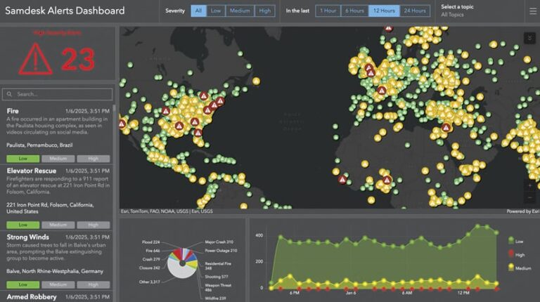
Real-time situational awareness is critical to keeping people and assets safe. Traditionally, disruptions have been difficult to spot the moment they happen—including major disruptions such as disease outbreaks, natural disasters, or geopolitical shifts. Over the last decade, samdesk has addressed this gap with its AI-powered crisis detection and monitoring platform, which provides real-time indicators and warnings for breaking events. Samdesk technology integrates with Esri’s ArcGIS to deliver the geospatial dimension of crisis data, allowing organizations to visualize, assess, and act before a crisis escalates. The samdesk API puts real-time incident data directly into ArcGIS, updating every minute to furnish the most accurate, actionable intelligence available. This sets a new standard for proactive situational awareness, helping organizations such as the Los Angeles County Metropolitan Transportation Authority (LA Metro) improve its decision-making to enhance public safety.
Compelling Use of Esri Technology to Impact Current Global Issues
JMT Technology Group
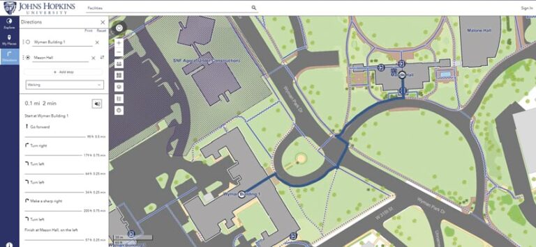
Staff at JMT Technology Group understand the complex world of geospatial data and are deeply committed to creating practical, user-centered GIS solutions that have a significant impact. For example, they helped build the Johns Hopkins Wayfinding App, which is available to assist about 7,000 students in navigating Johns Hopkins University’s 140-acre, tree-covered Homewood campus. The company’s expertise in leveraging Esri products, including ArcGIS Indoors, ArcGIS Experience Builder, and ArcGIS Velocity, helps clients understand their data in ways that would not have been possible otherwise. JMT Technology Group enables its clients to maximize the value of their collected data by designing integrated workflows, incorporating cutting-edge technology, creating tools for process management, and producing advanced visualizations. Specializing in system design and the development of spatially enabled business solutions, JMT Technology Group has extensive experience customizing and configuring Esri products and integrating them with other progressive technologies.
Successful Customer Engagement Through Partner-to-Partner Collaboration
OpenGov
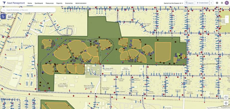
OpenGov is the leader in developing AI-enabled software for cities, counties, state agencies, and special districts—all with the goal of powering more effective and accountable government. Serving over 2,000 communities across the United States, OpenGov helps teams move beyond spreadsheets and disconnected systems by integrating ArcGIS to provide real-time, data-driven tools for asset management, work orders, permitting, licensing, and more. By eliminating inefficiencies, improving collaboration, and automating workflows, OpenGov helps agencies work more efficiently, adapt to change, and strengthen public trust. “OpenGov and ArcGIS have been such a success story across the organization,” said Andy Richter, public works asset manager for the City of Colorado Springs, Colorado. “I never thought in my wildest dreams how it would just go across the entire enterprise as it has with different departments using it.”
A Large-Scale ArcGIS Implementation Using Multiple ArcGIS Products
Onneer

A company specializing in establishing the core of integrated geospatial infrastructure at the national level, Onneer focuses on implementing secure, sustainable, and modern enterprise GIS using multiple Esri products, including ArcGIS Enterprise and ArcGIS Monitor. Staff at Onneer understand the challenges facing public and large-scale organizations in making norm-breaking changes to their capabilities, so the company assists them with figuring out how to leverage ArcGIS as the heart of their smart, geographically driven initiatives. Onneer’s ability to design, implement, and operate enterprise GIS at scale is key to its involvement in numerous large projects, including the ambitious Digital Atlas of Australia, which aims to provide a central platform for users to access and employ curated, trusted spatial data from across government. Onneer supports its customers’ continued success with ArcGIS technology and is ready to apply its skills to various organizations’ unique challenges.
Successful Integration of ArcGIS with Another IT System
National Information Solutions Cooperative
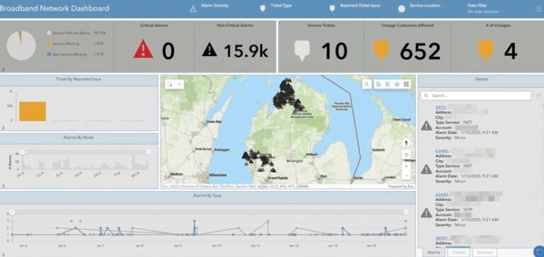
The National Information Solutions Cooperative (NISC) is an information technology cooperative that develops, implements, and supports software and hardware solutions for more than 960 independent broadband companies, electric cooperatives, and other public power entities in all 50 US states and beyond. Esri products are integral to NISC’s Operations Solution, which helps provide efficiencies in building and maintaining model integrity for outage management, engineering analysis, and other business needs. The intelligent, integrated mapping tools also assist NISC’s members in leveraging visual data to uncover relationships, trends, and patterns that are essential in planning and enabling data-driven operational decision-making. By combining cutting-edge mapping capabilities with members’ existing data, NISC’s partnership with Esri drives actionable insight that is critical for optimizing NISC’s enterprise solution.
Transformative Use of Analytics
Halff
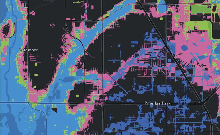
Halff is a full-service infrastructure consulting firm with a 75-year legacy of improving lives and communities. As an Esri partner for more than 20 years, Halff uses advanced Esri technology to help local, state, and national agencies mitigate risks and make data-driven decisions. The firm provides services such as flood modeling, mapping, vulnerability assessments, and asset management. Committed to excellence and innovation, Halff leverages the latest development tools and predictive methods to monitor infrastructure assets and develop flood risk products and apps that assist communities in risk prevention and improving emergency response. Halff develops and maintains asset inventories and physical and desktop condition assessments, in addition to providing professional guidance on GIS and asset management implementations.
Leveraging ArcGIS for New Markets and New Customers
MGT
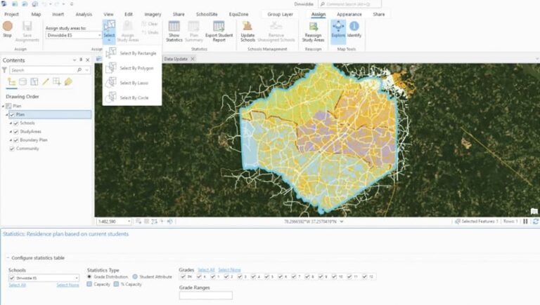
MGT partners with Esri across North America to provide advanced GIS for educational organizations and state and local government entities. Leveraging Esri’s powerful software including ArcGIS Pro and ArcGIS Online, MGT delivers specialized tools, such as SchoolSite Pro, and services. These encompass comprehensive school district planning solutions that cover enrollment, boundaries, and facilities, along with critical indoor GIS and incident mapping for enhanced safety across various public sectors. MGT’s expertise in spatial analysis and data integration empowers leaders to optimize operations, make informed decisions, and improve community services by employing Esri’s leading GIS technology.
Successful Deployment of a New Field Asset Management System Leveraging the ArcGIS Mobile Worker User Type
GCS
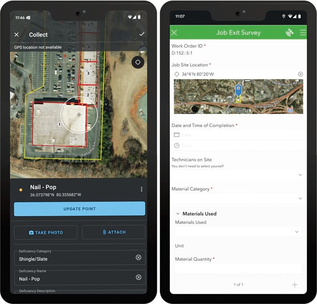
GCS specializes in geospatial consulting, cloud GIS migration, and business system integration to enhance operational efficiency. Serving customers in the United States and around the world, GCS empowers industries such as utilities, natural resources, and field services by leveraging advanced GIS solutions. Most recently, in partnership with North Carolina-based Highland Roofing Company, GCS deployed a field service operations solution that incorporates ArcGIS Field Maps, ArcGIS Workforce, and ArcGIS Survey123, along with Oracle’s NetSuite, to optimize field asset management. The solution streamlines crew dispatching, real-time data collection, and business system integration, improving workflow efficiency, cost savings, and data accuracy. “GCS designed and developed a solution that has saved countless hours and improved throughput through operations, sales, [and] administration while enabling us to better serve our clients,” said Highland Roofing Company CFO Jamie Schmidt. GCS president Mike Beltz added, “Integrating ArcGIS with business systems enables smarter, more efficient decision-making.”
Successful Modernization of a Customer’s GIS Leveraging New Esri User Types
The Sidwell Company
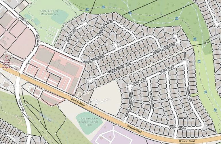
The Sidwell Company is a leading geospatial solutions provider specializing in GIS modernization for local governments. Sidwell extends and implements ArcGIS to enhance land records management, public safety, and GIS operations. Working across more than 30 US states and collaborating with Esri’s US regional offices, Sidwell helps agencies adopt and utilize ArcGIS by focusing on system integration, strategic planning, and managed services. Sidwell has the State and Local Government and Parcel Management specialties and is an ArcGIS Marketplace provider. The company offers an ArcGIS bundle for local governments that includes ArcGIS Pro, ArcGIS Enterprise, ArcGIS Online, ArcGIS Parcel Fabric, the Equitable Property Value solution, and the Agricultural Parcel Analysis solution, along with Sidwell’s Parcel Administrator solution. Clients such as Jefferson County, Alabama, benefit from improved efficiency, better data quality and accuracy, and enhanced public engagement.
