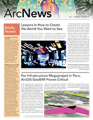
In 2017, various regions of Peru experienced torrential rain, widespread flooding, and landslides due to El Niño—when unusually warm water in the Pacific Ocean causes abnormal climate conditions. The catastrophic weather affected 1 million residents along Peru’s coast and destroyed nearly 22,000 homes.
To aid with recovery, the Peruvian government established the Authority for Reconstruction with Changes (ARCC), a temporary public entity that was charged with leading the efforts to rebuild damaged public infrastructure. The ARCC’s reconstruction plan consists of a series of projects in 13 regions, including one for the Olmos and Zaña river basins in northern Peru. For this project, river defenses, containment dikes, and evacuation channels are being built to reduce flooding and protect vulnerable residents in the event of other storms.

Because the design and development components involve many stakeholders and a large number of assets, everything needed to be organized efficiently. So the Rovella INMAC Consortium—the company charged with managing, designing, and implementing the project—deployed ArcGIS GeoBIM. This web-based app enables team members and other stakeholders to view and collaborate on building information modeling (BIM)-based projects, assets, and portfolios. By creating a cloud-to-cloud connection between ArcGIS and Autodesk Construction Cloud, ArcGIS GeoBIM simplifies how teams access up-to-date design and construction information that’s stored across systems, including documentation, 3D digital models, and project management issues.
Integrating BIM and GIS
With the Olmos and Zaña project, a significant challenge for the Rovella INMAC Consortium—which is composed of Rovella Carranza and INMAC PERÚ, two companies based in Argentina—was getting all stakeholders to utilize the project information model (PIM) during construction. The PIM is a collection of digital information that’s developed during a project’s design and construction phases. A PIM assembles information from multiple disciplines, including nongraphical data and project documentation.
According to David Antonio Castillo, a BIM specialist at the Rovella INMAC Consortium, the software typically employed to create a PIM was not designed for work areas as large as the Olmos and Zaña river basins, which together comprise 1,239 square miles (3,210 square kilometers)—an area four times the size of New York City. Because the PIM is a compilation of 3D digital models, the software used for it also typically runs on high-end desktop computers, which not everyone on the team has access to.
Royer Franklin Ttito, a civil engineer and BIM manager at the Rovella INMAC Consortium, thought that integrating BIM and GIS technology to digitize relevant data and manage information could solve the PIM problem and add value to the project. It would also help the team adhere to ISO 19650, an international standard for managing information using BIM throughout the life cycle of a built asset.
“To organize and digitize the information, it was necessary to connect the GIS technology and integrate the BIM methodology into it…during the design stages,” said Castillo.
The initial strategy was to federate Autodesk Construction Cloud and ArcGIS model data in Autodesk InfraWorks. However, the team encountered two very specific challenges.

“[Autodesk InfraWorks] could only be operated by a small team,” said Ttito. “In addition, the [size] of the entire project made it difficult to use this software to build the PIM. It was possible to visualize parts of the elephant but not the entire elephant.”
That’s when ArcGIS GeoBIM came into the picture.
A Way to View Designs Holistically
For Castillo, it was imperative that all members of the consortium be able to work with BIM and GIS data without needing advanced technology. As a web-based app, ArcGIS GeoBIM—which can be used on BIM projects from the design phase through construction—was able to offer this. The app also enables the team to link data across disparate systems—for example, by connecting design and construction information that’s managed in Autodesk Construction Cloud with ArcGIS.
“ArcGIS GeoBIM is a digital solution that satisfies our strategy of integrating information within a digital model. We can connect the construction of digital assets with [this] environment and promote collaboration with the other [stakeholders] involved,” said Ttito. “This allows us to avoid rework and reduce the latency of information response time.”
Castillo added that with ArcGIS GeoBIM, the team “can incorporate and link endless information in terms of models converted to feature layers and models in their native software that are stored in Autodesk Construction Cloud.”
To learn how to use ArcGIS GeoBIM, Castillo and Ttito watched instructional videos and practiced working with the app. Ttito in particular liked how ArcGIS GeoBIM allows specialists to easily view final design information during construction, since data visualizations are available in the cloud.
“The way of working in order to visualize the alphanumeric information of the BIM models and the GIS information is much friendlier for the specialists involved,” Ttito said. “ArcGIS GeoBIM is intuitive, and it is as simple as opening a web page without having to install desktop software.”
Team members now use Autodesk Construction Cloud to design and store the data needed to make digital models and for documentation, such as metrics and budgets. The team also employs Autodesk Docs, a cloud-based document management environment on the Autodesk Construction Cloud platform, to manage formal information submissions from design and construction subcontractors. Project management software Autodesk Build helps the team organize documents, connect BIM data with GIS data, and enhance collaboration among stakeholders.

With ArcGIS GeoBIM apps—which connect web maps, web scenes, and georeferenced Autodesk project data—team members can leverage linked data to support project delivery goals and operational workflows. And the apps can be shared with various stakeholders within the consortium so that they can view projects holistically and easily share feedback.
For Castillo, the most appealing aspect of using ArcGIS GeoBIM is that it has the capacity to tackle a project as large as the one being done in the Olmos and Zaña river basins.
“I like the fact that ArcGIS GeoBIM has been thought of as a solution for megaprojects, where the amount of information that is handled is not a limitation,” he said.
The Project’s “Greatest Achievement”
The Olmos and Zaña project is still in the design phase, but the consortium’s use of ArcGIS GeoBIM has already yielded positive results for planning and cost calculation. The digitized, organized, and linked GIS and BIM data has made the project more agile because stakeholders are able to easily access the information they need to make decisions quickly and effectively.
Members of the consortium team, as well as subcontractors on the project, can work on BIM documents and digital models and communicate in Autodesk Construction Cloud. This data is also shared in Microsoft SharePoint, which fosters additional cooperation.
Having a web-based space to store and link project assets has been the consortium’s “greatest achievement,” according to Castillo.
“We could say that ArcGIS GeoBIM is the icing on the cake in the entire project,” he said. “The collaboration that exists between Esri and Autodesk has been a great contribution to the GIS and BIM/CAD integration, which was necessary for the development of projects in the AEC [architecture, engineering, and construction] sector.”
“The information collaboration is making it possible to discover deficiencies in spatial coordination that would not have been possible if we worked in a conventional way,” Ttito added.
Using ArcGIS GeoBIM, the team can produce a coordinated digital model of a piece of infrastructure prior to building it. The web-based experience delivered by ArcGIS GeoBIM that connects to Autodesk Construction Cloud allows the team to gauge environmental impacts and potential damage to archaeological remains before construction begins.

“Autodesk and Esri solutions have definitely become a necessity for specialists, making their work more efficient compared to traditional workflows,” said Ttito. “Our client has more confidence in the designs, and it is possible for [the designs] to be accepted faster so they can be built.”
When construction does start, stakeholders will still be able to access the information they need in a single digital model—and that digital model will even be useful when the infrastructure ultimately goes into operation. This reduces duplicate work and makes it possible to more efficiently provision resources and figure out where surplus materials could be used, according to Ttito.
“Building a coordinated model…makes it possible to have a complete, holistic vision of the project,” he said. “We have clearer access routes to the works, and also the freight calculation estimation for the budget is more realistic and effective.”
A Pillar for Success
Although the Rovella INMAC Consortium is still in the process of implementing ArcGIS GeoBIM, Ttito confirmed that the organization is planning to use it, along with Autodesk and other Esri offerings such as ArcGIS Field Maps and ArcGIS Survey123, to manage construction and perform data collection. Consortium personnel who will be participating in construction are being trained on the solutions now, with construction subcontractors to follow.
The team is also using ArcGIS GeoBIM to put together presentations for residents in the Olmos and Zaña river basins to keep them informed of project updates. Ttito said the team will continue this throughout the project’s life cycle.
“The Rovella INMAC Consortium is convinced…that digital solutions from Esri and Autodesk are a fundamental pillar for the success of the project,” Ttito concluded.