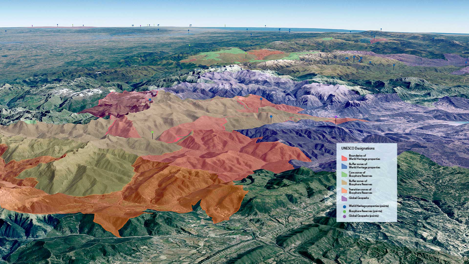
For decades, the United Nations Educational, Scientific and Cultural Organization (UNESCO) has worked to protect places of outstanding cultural and natural value. These efforts are coordinated across multiple programs and have multiple designations; the organization’s well-known World Heritage sites share importance with Biosphere Reserves and Global Geoparks. These different designations reflect unique mandates, but the pressures that affect these sites—from climate impacts to conflicts to tourism pressures—do not recognize those distinctions.
To confront this reality, UNESCO partnered with Esri to develop the UNESCO Sites Navigator, which brings the organization’s various designations together in a single interactive geospatial platform. The result is a unified view of thousands of sites that were once visualized and managed through parallel systems and uncoordinated PDFs. Now, World Heritage sites, Biosphere Reserves, and Global Geoparks appear superimposed so end users can see their interrelationships, risks, and potential impacts.
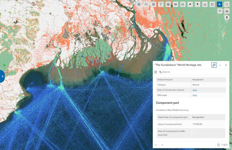
For Fernando Avakian, the Navigator’s project lead, the ease of using Esri’s tools was a key differentiator. “We’re very happy that we have the technology today in our hands to do all this wonderful stuff without being, for example, a developer,” he said. His team, while fluent in GIS analysis, is primarily focused on understanding and communicating the importance of cultural heritage, not writing code.
With Esri’s out-of-the-box and low- and no-code tools, Avakian’s team members created a solution that they can maintain themselves and that allows them to concentrate on the vital work of protecting the world’s cultural and natural heritage.
Building at Global Scale, Inside the Platform
Once the Paris-based World Heritage Centre had the foundational elements of the Sites Navigator, it was critical to implement more advanced analytic and alert-oriented capabilities. The team collaborated with Mapular UG, a partner of Esri Germany, whose expertise helped integrate live data into the Navigator to generate alerts. This engagement added two new sections to the tool: an advanced data view consolidating alert-related layers, and an alert dashboard.
While UNESCO already had the foundational data—core site layers, alert concepts, and the scientific logic behind them—Mapular’s challenge was to translate that structure into a system that could capture the global picture. Using ArcGIS Experience Builder, the team built an app integrating more than 50 layers, including external data sources on everything ranging from flood forecasts to active fires to tree loss. These disparate sources all had to be registered, hosted, and optimized for performance.
Many of the required layers were not native to ArcGIS. Ensuring that these layers could be accurately visualized and continuously refreshed was one of the project’s main challenges.
-
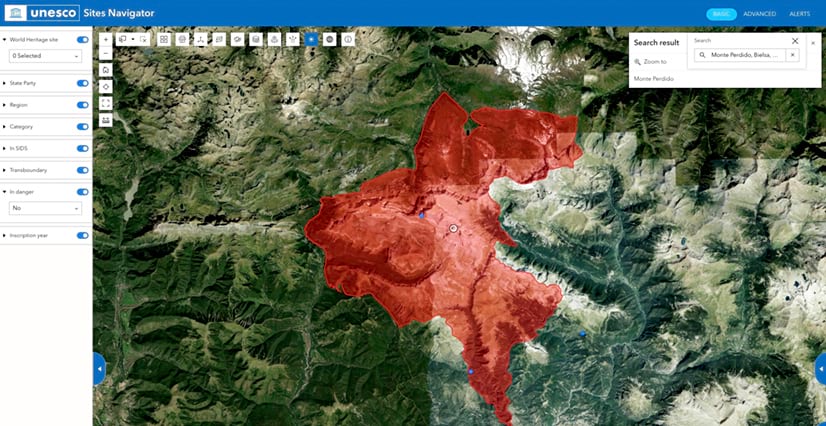
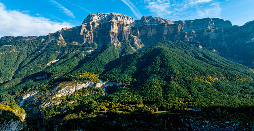
Where France meets Spain, Mont Perdu in the Pyrenees holds a rare triple designation: World Heritage site, Biosphere Reserve, and UNESCO Global Geopark—all tracked together in the Sites Navigator.
One early structural decision proved especially valuable. Heritage sites vary enormously in geometric complexity. Some are extensive polygons spanning hundreds of miles; others are a single point. To handle that variability consistently across a daily automated process, Mapular developed a harmonized layer defining the geometry around each site.
“This harmonized layer let us simplify the process and be more accurate during the analysis while also keeping performance management, since these processes run every day across many sites,” said Nisleida Morales, a geospatial developer at Mapular who worked intensively on the project.
UNESCO also made it clear that everything needed to be built using out-of-the-box capabilities.
“One of the main things they communicated was that they wanted to be able to maintain all these apps independently,” Morales explained. “We needed to build everything natively—out of the box—using whatever Experience Builder provided.”
Automating the Science
While the Sites Navigator offers a smooth and interactive user experience, a lot of complex automation is happening behind the scenes. UNESCO had already defined, for instance, what constitutes a meaningful alert—which is important because overalerting erodes credibility with stakeholders. Variables like wildfire are not always a threat and can be normal in environments such as Boreal forests.
As a result, UNESCO’s deep domain expertise drove the articulation of alert thresholds, buffer distances, and data sources suitable for the app. Mapular’s key task was to wire these complex parameters into the platform. Using ArcGIS Notebooks, Morales translated UNESCO’s alert logic into automated analyses that run on a regular schedule, pulling in authoritative data sources.
For Mapular’s broader team—developers accustomed to writing their own scripts outside the Esri platform—ArcGIS Notebooks was a revelation.
“The capabilities were really impressive,” Morales noted, “particularly that you can schedule their execution and see the impact directly in the output layers.”
All the sources the domain experts provided are official. For wildfire monitoring, the system draws from NASA FIRMS, the National Aeronautics and Space Administration’s Fire Information for Resource Management System. For tsunamis and floods, it relies on the Global Disaster Awareness Coordination System. For coral bleaching, it pulls from the National Oceanic and Atmospheric Administration (NOAA) Coral Reef Watch program.
-

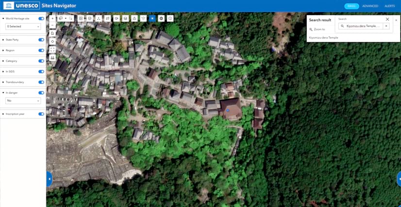
World Heritage sites like Kiyomizu-dera Temple in Kyoto, Japan, are no longer just dots on a list. The Sites Navigator gives each a precise spatial footprint, enabling real-time monitoring of the conditions around them.
Given that the Navigator is focused on near real-time data, each alert is recalculated daily. Users see the most recent available information in the dashboard. UNESCO and Mapular also made the design decision to avoid graduated alert levels or color-coded warnings.
“We chose not to apply yellow, orange, [and] red symbology,” Morales explained, referencing UNESCO’s rigorous alert guidelines. “Everything displayed in the dashboard is an alert. Every alert is well-studied—the methodology, the buffer distances.”
The dashboard presented a distinct design challenge to make it immediately legible to users who might not know GIS.
“How do you let someone go deep and see the alerts quickly and intuitively?” asked Morales. “We used ArcGIS Dashboards features as tooltips and [added] a welcome message to provide users with complementary information about the alerts. We also used ArcGIS Arcade expressions to provide dynamic content in the pop-ups and alerts list.”
The Operational Shift
Once UNESCO had the data mapped and georeferenced, it expanded what the organization could see, monitor, and protect.
The Sites Navigator signals not just a technical innovation but also an operational shift at UNESCO, enabled by heightened visibility. Lesser-known sites—those outside well-trodden tourism locales or far from media attention—now appear alongside the better-known sites, with the same analytical scrutiny applied to all. (The World Heritage list alone comprises nearly 1,200 individual sites.) This change highlights risks that might otherwise go unnoticed.
“We started discovering that things were happening at sites from which we’d received no information,” Avakian said.
“Everything displayed in the dashboard is an alert. Every alert is well-studied—the methodology, the buffer distances.”
In practical terms, the platform helps UNESCO focus and prioritize action. It indicates where staff should look more closely and what type of response might be appropriate. Responses range from formal correspondence to field mission deployment—and in all cases, the decision is informed by shared, up-to-date spatial awareness.
The conflict dimension has proven equally significant. During recent conflicts in multiple regions, Avakian’s team used the Navigator to cross-reference reported strike coordinates against World Heritage sites in near real time—the first time such tracking was possible at that speed and scale.
Since December 2025, when the Committee for the Protection of Cultural Property in the Event of Armed Conflict formally designated the Sites Navigator as an official notification method, its reach has extended further. The Navigator was the system of record used for media views showing sites in Lebanon, Iran, and Ukraine marked with a Blue Shield emblem, indicating they should not be targeted.
“I won’t say that it stops attacks,” said Avakian, “but we’re conveying the data. We’re doing our job.”
The Sites Navigator also animated analysis of the relationship between climate change and UNESCO sites—the complexities of which have, at times, been elusive. The Navigator data formed the foundation of the recent People and Nature in UNESCO-Designated Sites report, a global assessment of all World Heritage sites, Biosphere Reserves, and Global Geoparks, which investigated not only the impacts of climate change but also how sites contribute to mitigating climate change and biodiversity loss. UNESCO seeks to highlight this interdependence—and the Sites Navigator helps make that more apparent.
-
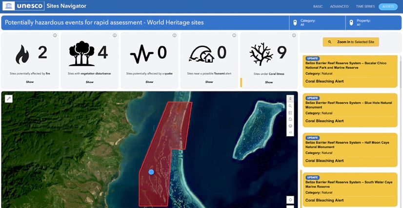
Daily coral bleaching data from NOAA feeds into the Alerts dashboard. Waters around the Belize Barrier Reef Reserve System—shown with a protected area polygon—were under watch in August.

An Amplifier That Improves Action
Avakian sees the Navigator’s ability to break down silos as equally important among different units within UNESCO—all of which are working toward a common goal. The World Heritage Centre’s stature gave the Navigator immediate credibility, and Avakian says its launch triggered a cascade of internal requests for integration to capitalize on the work, bring together designations, and show interlinkages across natural and cultural assets.
The result is a more holistic reflection of UNESCO’s diverse sites and mandates—something that can help expand public perception of the organization. For many people, UNESCO is synonymous with the World Heritage Centre and its highest-profile listings. But by showing the organization’s full range of designated sites, the Sites Navigator reveals a more complete picture.
“When hearing about UNESCO, people immediately think cultural sites,” Avakian said. “But UNESCO works not only on World Heritage—it’s also intangible heritage, oceans, forested areas, and geodiversity.”
Avakian makes clear that the Sites Navigator is an amplifier, a tool that, at its core, can improve action.
“UNESCO has a huge mandate,” Avakian emphasized. And the Navigator lays the groundwork to bring the organization’s expansive data, stakeholders, and users together. In doing so, it enables UNESCO to act earlier, more consistently, and across the full range of invaluable places it protects around the globe.