In 2009, New Zealand’s Royal Commission, which reviews significant matters of public concern, recommended that Auckland make some bold changes to the way it was administered. So the government decided to consolidate eight local authorities into one. This was the largest organizational restructuring that New Zealand had ever seen.
The resultant Auckland Council came into existence in November 2010. It is New Zealand’s largest local government organization, with more than 10,000 staff members serving 1.5 million people.

Unsurprisingly, there was a great deal of data to amalgamate as well. The Auckland Council tapped Eagle Technology Group, Esri’s official distributor in New Zealand, to help manage the four-year-long GIS project. Called the Geospatial Future Mode of Operation (GFMO), it was one of the most substantial geospatial technology ventures ever undertaken in New Zealand.
Consolidating Scores of Datasets
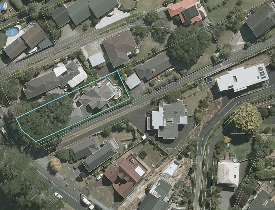
“GIS underpins many council services, including—but not limited to—property information, civil defense, resource planning, and building consents,” said Auckland Council’s geospatial manager Ingrid McClymont. “GIS provides teams within the council [with]the tools to do their work and also provides services to the public.”
The complexity of consolidating all this information was immense.
“At the outset of the project, although there was one new organization, there were still a multitude of different software platforms, systems, databases, processes, and people required to carry out common activities,” said Nathan Heazlewood from Eagle Technology’s GIS professional services team, who was also the project manager for GFMO.
Searching for property information in Auckland’s central business district, for example, used to require a very different process than conducting a similar search in the rural district of Rodney.
“We also had a mass of inherited data—much of which had been created years or even decades before,” continued Heazlewood.
New Zealand’s local governments are required to retain any data that has been used for an official purpose in case decisions need to be reviewed later.
“There were literally hundreds of thousands of data items that had to be carefully organized, rationalized, and cataloged—all without losing the ability to trace information back to its original purpose and cross-referenced material,” he said.
To rationalize this historic data, GFMO used ArcGIS for Desktop to visualize new data structures for the information. The team then used ArcGIS for Server and Esri partner Safe Software’s FME to migrate the data over to the Auckland Council’s system.
During this process, a total of 8,470 geographic datasets were reduced to just 2,056—a cutback of 75 percent. Rationalizing the Auckland District Plan (which contains all the bylaws, planning stipulations, and rules that come under the governance of a council) was another feat, requiring that 697 different geographic datasets be replaced with just 25 new ones.
Replacing Legacy Software with ArcGIS
While sorting out the inherited data issues, GFMO also consolidated several legacy software platforms, apps, integrations, and versions into one GIS—the ArcGIS platform. This allows Auckland’s GIS to be upgraded, extended, and enhanced more easily than it could be with myriad independent systems.
While this very essential project was challenging, it presented a golden opportunity to review the way things were done before and adopt new best practices.
Given the size of the organization and the magnitude of the operation, the undertaking required assembling the largest geospatial team in the country. The Auckland Council’s geospatial team became part of the greater information services (IT) business unit, driving the team to adopt standard IT best practices, which facilitates communication between GIS staff and general IT personnel. This close coordination has also allowed GFMO to contribute to streamlining various aspects of governance and bureaucracy in Auckland.
Geospatial technology is intimately integrated with other software systems at the Auckland Council, which means that a large number of Auckland Council teams now depend on GIS. To ensure that GIS is available to the whole organization with minimal outages, GFMO introduced service-level agreements (SLAs) as a best practice. The geospatial team has also made GIS tools such as Portal for ArcGIS available to other, nongeospatial teams like the city planning and environmental protection departments. This allows these teams to have GIS tools that are easy to use and tailored to their needs—though the geospatial team still manages data integrity.
Realizing the Tangible Benefits of GIS
According to Paul Donald, the Auckland Council program director for the GFMO project, the council can now begin to realize the value of its GIS.
“One tangible benefit is a 25 percent reduction in personnel,” he said. “This figure—along with savings through such things as decommissioning older systems and saving space—will save the Auckland ratepayers millions of dollars over the coming years.”
He says that there is a growing awareness of geospatial technologies both inside and outside the council.
“Day-to-day council business is conducted using GIS, for example, to manage parks and waste,” said Donald. “Ratepayers can access property records online, and land consents will be accessible and easier to transact with GIS.”
The council is now starting up a mobile workforce program, which will enable fieldworkers to update information remotely and allow employees in the head office to then access that data.
“This negates the need for many to ever have to drive to the office to file a report,” Donald pointed out. “It increases efficiency both in time and in environmental impact.”
Zooming out to the bigger picture, GIS has become central to governance in Auckland and the council’s direction for the future.
“GIS can create 3D visualization and analysis to reimagine the cityscape and assess the impact of planning decisions,” said Donald. “And increasingly, nontechnical decision-makers will be accessing a central geodatabase and integrating geospatial information with their business tools every day.”
For more information on this project, including Esri partner Geographic Business Solutions’ web viewer contribution, email Eagle Technology’s Sarah MacDonald.

