Often described as the world’s thermostat, the Arctic reflects solar heat and regulates the global jet stream that dictates weather patterns far beyond the North Pole. Climatic conditions in the Arctic have implications for the rest of the planet.
But the Arctic’s critical cooling system is under immense strain. The region is warming at a rate nearly four times the global average, sparking the potential for more extreme weather and rising sea levels that threaten communities in every latitude.
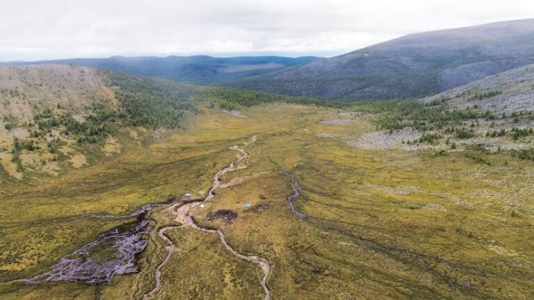
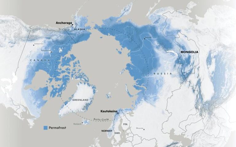
For the Indigenous Peoples who have stewarded the Arctic for millennia, this crisis is compounded by a dual pressure: the rapid physical collapse of their environment, as permanently frozen ground—called permafrost—thaws, and the encroaching footprint of industrial resource extraction and development.
At Woodwell Climate Research Center, cartographers and geospatial experts with the Permafrost Pathways project recognize that navigating this unprecedented breaking point requires more than just remote monitoring.
Making Threats Visible
Woodwell Climate’s geospatial experts work throughout the Arctic, including in one of the most unique corners of the permafrost zone: the high-altitude taiga of northern Mongolia.
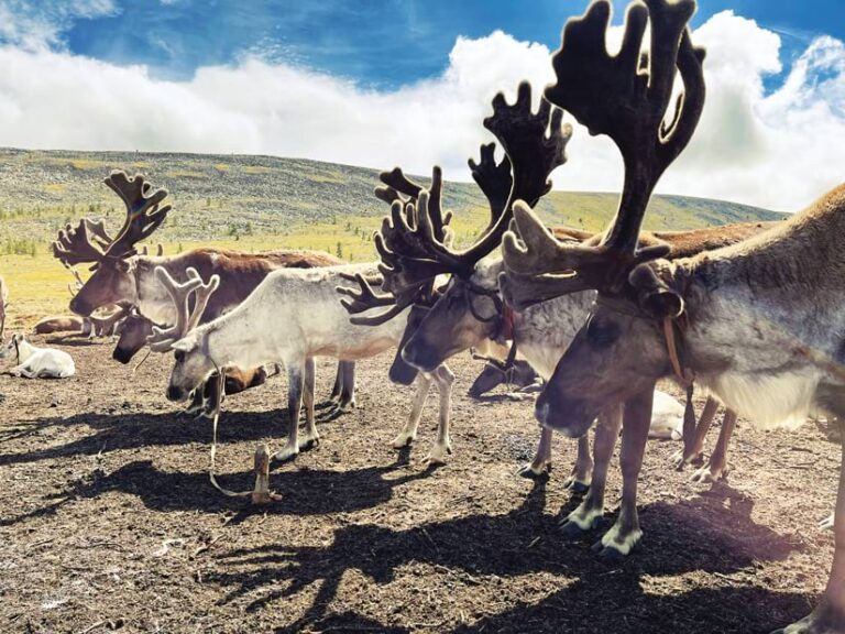
The work in Mongolia is carried out in partnership with the International Centre for Reindeer Husbandry (ICR), which has worked with Dukha reindeer herders for many years to strengthen Indigenous-led resilience, knowledge exchange, and sustainable land stewardship. With the Reindeer Herding and Resilience project, ICR supports Indigenous reindeer herders through participatory mapping, knowledge co-production, capacity building, and climate adaptation.
Through the partnership between ICR, Dukha reindeer herders, and Permafrost Pathways, GIS has become a tool that supports Indigenous priorities rather than externally-driven mapping initiatives.
The Dukha people have lived in this part of the world for thousands of years and have maintained a delicate symbiosis with their reindeer and the frozen earth beneath them. But today, this balance is under pressure from multiple angles.
The foundation of ICR and Woodwell Climate’s mapping work on Dukha land—and throughout the Arctic—is the coproduction of maps: an intentional synthesis of Indigenous knowledge and Western geospatial science. Coproducing maps is a collaborative, community-led process in which Indigenous knowledge-holders and external partners work together as equals to create map products that integrate Indigenous knowledge with Western science.
Building trust and long-term friendships is the core of this process and a benchmark for success.
Training Events and Workshops
True coproduction begins not with discussions of data and software but with iterative conversations. Workshop priorities are jointly developed with Indigenous participants and partner organizations, including ICR, ensuring that technical activities respond to community-defined needs.
“This is a deeply iterative process,” said Jackie Dean, a research assistant and geospatial expert on the Permafrost Pathways project. “We listen, we map, and we adjust based on constant feedback.”
By centering Indigenous community members’ experiences and specific goals, the resultant maps become more than data visualizations—they become a shared language that respects millennia of tradition while benefiting from cutting-edge geospatial technology.
The Power of the “Map Share-Out”
Woodwell Climate cartographers have extensive experience facilitating map-based training workshops throughout the Arctic. The process follows a narrative arc that begins and ends with the participants’ unique voices.
The sessions start with a “map share-out,” where each participant stands at the front of the room to introduce their home and history. Using whatever tools are available—a paper map, an interactive web map, or a digital layer—they define what their land means to them and describe what’s special about their home and way of life.
Custom technical training comes next. Based on the priorities identified in the months leading up to the workshop, Woodwell cartographers develop tutorials that provide the tools needed to solve local problems. This could include how to manage drone data using Site Scan for ArcGIS, an introduction to using ArcGIS Pro for government-level reporting, or an ArcGIS StoryMaps lesson for public advocacy and communication with broad audiences.
Gaining Geospatial Fluency
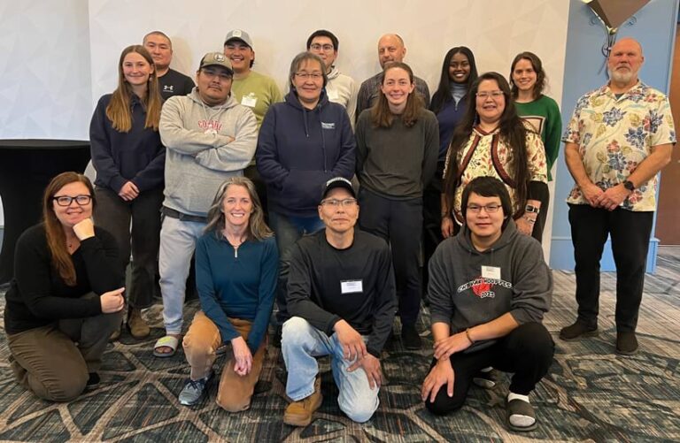
The true power of this relational approach to mapping was evident during Woodwell’s 2025 workshop in Anchorage, Alaska, held in the wake of Ex-Typhoon Halong. Participants came from the Yukon–Kuskokwim Delta in southwest Alaska—a region devastated by the storm.

The resilience shown by workshop participants was staggering. Three people arrived at the training just two weeks after evacuating from their homes. Two of them were rescued from inside their houses as the structures floated away. One of these people was Lucy Martin of Kuigilnguq, Alaska, who, despite enduring this trauma, felt that gaining geospatial fluency was important enough to continue with the training so she could use maps to tell her story.
At the workshop, Martin developed a comprehensive map of community infrastructure destroyed by the typhoon. Her work has since transcended the classroom, serving as a visceral and effective tool for briefing Alaskan representatives from state and US congressional offices on the urgent need to fund climate adaptation in her community.
Over the years, Woodwell has worked with numerous workshop participants like Martin to build GIS expertise for local advocacy. This collaboration relies on weekly check-ins—both before workshops, to identify specific needs, and afterward, to help participants hone their newly acquired skills.
Building the Digital Infrastructure to Help
Each workshop culminates in a final share-out, where participants retell their stories through the lens of their newly acquired skills. This is often the most transformative part of the experience and demonstrates what participants have learned. The final map share-outs also serve as catalysts: When one participant shares a breakthrough, it often inspires others.
Whether the challenge is storm resilience in southwestern Alaska or the rapidly changing landscape of the Mongolian taiga, the fundamental mission remains the same: providing Indigenous communities with the tools to tell their stories on their own terms. GIS has proven transformative in this effort, shifting the power of mapmaking from distant agencies to those who have lived in harmony with these landscapes for as long as humans can remember.
By documenting their boundaries, migration routes, and climate impacts, these communities are doing more than just creating data; they are building a digital infrastructure to support their cultures and futures.
A Deep Global Partnership
The lessons from across the Arctic are clear: If there’s any chance of stabilizing the Arctic permafrost, we must look to the people who have managed it for millennia. Indigenous-led conservation, fueled by the precision of modern mapping, represents one of the most effective strategies for global climate adaptation.
When we support the traditional stewards of the North in visualizing and defending their lifeways, we aren’t just helping them navigate a changing landscape—we are ensuring a more resilient and equitable future for the entire planet.
