
Cartographers and geographic information scientists often fall into this field because they enjoy maps. They like sourcing data, conducting geospatial analysis, and communicating visually. Many also enjoy the solitude and relative control they have over the process, which leaves plenty of room to make maps that are accurate, rigorously researched, and aligned with best practices in cartographic and geospatial standards. Meanwhile, the cartographer’s client stands on the other side of the desk (or email), asking for their expertise and offering feedback when necessary.
Then, something different happens. The once-left-alone cartographer is asked to work with a community to use maps to better understand their worldview. Perhaps they’ve been approached by a local organization trying to produce social or environmental data, or they’ve joined a movement that wants to make a map for certain groups of people. Suddenly, the cartographer’s processes, setup, and even fonts are thrown into disarray. Suddenly, the cartographer is making a map with people rather than for people.
When this happens, it can feel overwhelming. Cartography and GIS are often taught to be methodical, systematic, and orderly. Most cartographers develop their systems and workflows based on these expectations. Working with communities, however, is rarely any of that. Typically, mapping with communities flips the entire process on its head, rearranging the classic pipeline of gathering data first, conducting analysis next, and determining representation last.
Participatory mapping, for instance, is a method of working with people to understand how they see and know their worlds. It is often used to work with Indigenous and other vulnerable communities to bridge the divide between state-based understanding and local knowledge. Here, the map acts as a spatial anchor for information sharing.
Cartographers usually start these projects with a blank piece of paper and colored pencils. Participants identify what they would like to see on the map (for example, where land rights have been abused or people have been displaced) and what to keep off of it (sacred and ceremonial places, locations that are vulnerable to resource extraction, and spaces for people escaping violence or persecution). These kinds of projects engage with information that’s not routinely collected, so recuperating data is the end goal, not the first step.
This way of mapping is challenging. It also offers an opportunity for seasoned cartographers and geographic information scientists to see their professions from the viewpoint of people whose lives and environments are being mapped—people who might want different data, analysis, and representations so they can make their own decisions. This is one of the most valuable aspects of community-based mapping: It asks cartographers and geographic information scientists to rethink their processes, systems, and representations to better fit a new purpose.
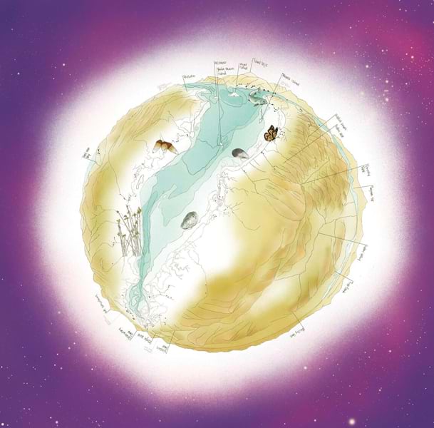
Making maps with people requires a great deal of humility, care, and flexibility. Cartographers must listen, ask questions that may not seem necessary, and challenge the conventions they may take for granted. It’s hard work. But keeping the following principles in mind can help:
Know the Purpose
Who is this mapping project designed for, and why are you participating in it? What is the end goal? (To develop a proposal for a government organization? For the community to gather information about themselves or their environment?) Is the process more important than the final product? Is the map’s purpose something other than wayfinding or conducting conventional analysis? Will the map challenge or expand the way maps tell stories? Who makes the map? Who reads it?
Set the Standards
Different community projects have different values. The training that cartographers and geographic information scientists receive prioritizes accuracy, quality, and readability. When mapping with people, however, participants might have different priorities that reflect their experiences and needs, such as data sovereignty, including where the data comes from and is stored; whether the software is no cost or inexpensive; how flexible the cartographic design is; or whether the politics of the project’s technical side match or conflict with their own cultural and political worldviews. Sometimes, urgency is critical; other times, moving slowly and building trust is more important. The cartographer’s role is not to decide on the standards but rather to advise on options and explore them as openly as possible.
Make a Community Agreement
Community agreements document the decisions made between mapmakers and the community partners they’re working with. Agreements elucidate the project’s values, along with how and when intellectual property and cultural knowledge is shared, acknowledged, and credited (including authorship of the data or map). They also outline parties’ labor and compensation expectations—and the right to end the partnership without animosity, plus what happens to the data if that occurs. The Guidelines for Ethical Research in Australian Indigenous Studies, from the Australian Institute of Aboriginal and Torres Strait Islander Studies, is a helpful resource for community agreements.
Listen
Community partners won’t always know technical lingo, and it might be difficult for cartographers to be open to criticism of their work or the organizations they represent. But surprisingly often, these arguments are similar to the critiques that cartographers and geographic information scientists already have of their own industry. (We know the world is not the map!) Community partners may just use different language and experience unfamiliar consequences. What appears to be a technical issue could reflect generations of attempted erasure or the dispossession of knowledge and cultural property. So it’s important to listen—carefully, openly, and slowly—and come to community agreements on how projects should proceed. Sometimes just listening and acknowledging is enough.
Not All Solutions Are Software
When cartographers and geographic information scientists learn to listen, a range of problem-solving options open up—options that don’t involve technical or software-based solutions. Maybe there’s no way around placing data on the mapping organization’s server, but the community agreement can be renegotiated to ensure that control of intellectual property and copyright remains in the hands of the people who created it. Perhaps the modifiable areal unit is an enduring problem for measuring local outcomes, but the map or platform can display a disclaimer that makes viewers aware of the history of the unit and how it skews the data. Maybe adding images, videos, recordings, or other materials to a map would help communicate knowledge that can’t be reduced to points, lines, and polygons.
By creating a space of reciprocity based on mutual respect and trust, it is possible for cartographers and geographic information scientists to embrace new opportunities that make a difference for those who need maps most. If you are prepared to listen, be flexible, document agreements, seek out unusual solutions, and let go when necessary, you can do incredible things and make maps with people, not just for them.