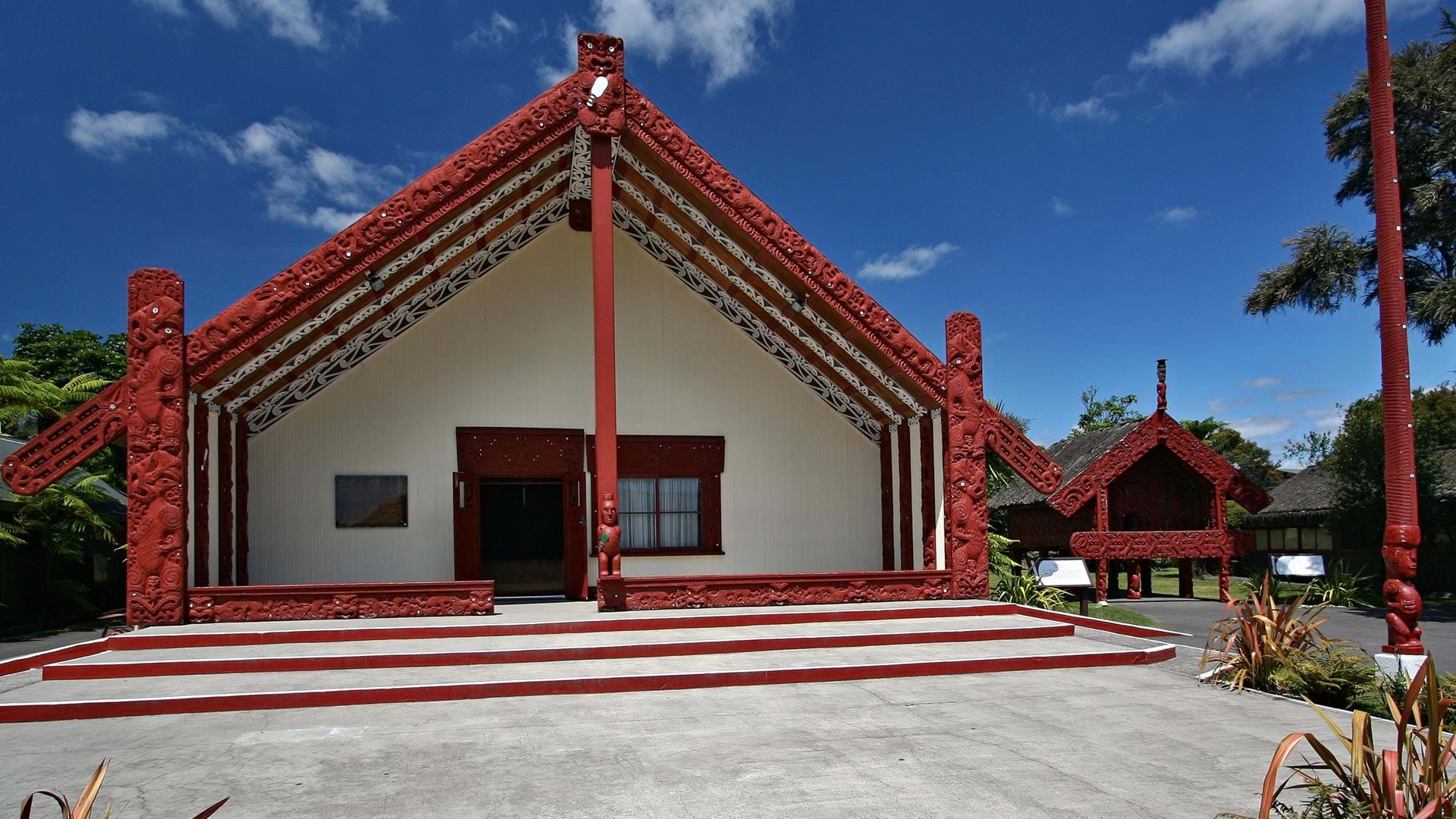
Every map is shaped by the perspective of the person who makes it—who decides what story to tell and how to tell it. That perspective is its strength. For University of Auckland PhD researcher Haukapuanui Vercoe, Indigenous knowledge, engineering analysis, and ArcGIS technology come together in research aimed at protecting marae. These traditional meeting grounds are a vital component of cultural infrastructure for Māori, the Indigenous peoples of New Zealand.
Vercoe grew up at Pounamunui and Ōhākī, two historic marae near the New Zealand North Island town of Rotorua, and spent his schooling immersed in te reo Māori, the Māori language. His upbringing shaped his perspective on engineering—a perspective that places cultural, social, and environmental considerations alongside technical and economic ones.
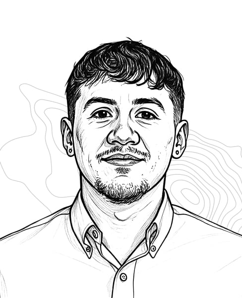
In Māori culture, an individual’s genealogy extends to the natural world: the land, forests, winds, and seas. Through that lens, it is vital that Māori look after the natural world.
About a century ago, construction of a power station displaced many of Vercoe’s ancestors from their land, changing the trajectory of their identity.
“There’s a Māori proverb that says, ‘If the land is sick, the people are sick,’” he said.
That history and cultural grounding continues to influence how Vercoe approaches engineering today.
“Instead of developing a solution and consulting communities later, engagement and community input shapes the project from the beginning,” Vercoe said. “My philosophy as an Indigenous engineer is to place relationships first, solutions second.” In te ao Māori (the Māori worldview), this concept is called whakawhanaungatanga—the practice of building and maintaining relationships.
Vercoe also described the concept of “tea-towel-tanga,” in which true leadership extends beyond talk and begins with humble service—by rolling up your sleeves and getting your hands soapy. In the wharekai (dining hall), doing dishes demonstrates a willingness to contribute and meaningfully connect with people. The most impactful communication may occur after a formal presentation, while people work together in the kitchen.
“That’s where all the relationship building starts, where all the conversations are and where all the laughing happens,” Vercoe said. “It’s sometimes where we have the most important discussions, where we discuss whānau [family] matters.”
Bringing Indigenous Knowledge to Engineering
Vercoe was always drawn to mathematics and physics and decided at 16 to pursue engineering. However, his school had limited access to teachers for subjects such as science and calculus. After his family met with a university dean, he studied science by correspondence and worked with an after-school tutor to complete the prerequisites he needed.
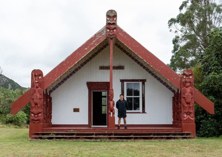
Vercoe described that schooling as a source of strength. Immersion in Māori culture gave him knowledge and perspectives uncommon in engineering and helped him see beyond technical calculations to the people affected by engineering decisions. The experience also helped his younger brother, Sonny, prepare for the same pathway.
The brothers pursued doctoral research in civil engineering at the same time. Haukapuanui studies the impacts of natural hazards on marae, while Sonny focuses on the seismic resilience of marae buildings. They conduct fieldwork together, often within their own communities. Rather than approaching a community as outside researchers with predetermined answers, they ask people what they need and then work toward possible solutions.
Mapping is a significant part of their research. For communities where oral and visual ways of sharing knowledge are important, a chart with technical data may be less effective than a map showing a familiar marae, its buildings, surrounding land, and nearby hazards.
Vercoe’s national research examines and maps marae exposure to river and coastal flooding, earthquakes, landslides, soil liquefaction, and tsunamis. Using ArcGIS technology, Vercoe combines marae locations, land parcels, building outlines, and hazard datasets. Spatial joins help identify where hazards intersect parcels or buildings. He also considers critical infrastructure, such as access roads, because a marae that remains undamaged during a flood event, for example, can still become isolated.
His national assessment covers more than 800 marae and was recognized with the 2025 New Zealand Esri Young Scholar Award from Esri partner Eagle Technology. For Vercoe, scale matters, but communication—including with maps—matters just as much.
“A picture is worth a thousand words,” he said, “but a map is worth ten thousand.”
Asking, Not Answering
The maps are not intended to dictate what communities should do. Instead, they prompt questions. Should a building be raised or relocated? Is the current location acceptable? What adaptations might make the most sense technically and culturally?
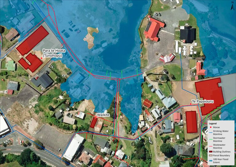
“It’s not about going in and saying that we’ve got all the answers,” Vercoe said. “It’s about providing the information to say, ‘This is what the data suggests. How can this information be leveraged to make more informed decisions for Indigenous communities?’”
Recent analysis indicates that the need for those conversations is urgent. His results show that about half of all surveyed marae could be exposed to flooding. A similar percentage are at risk from earthquakes.
In the aftermath of natural disasters, marae provide food and shelter to hundreds of people with limited resources. Vercoe argued that public support structures should recognize the civil defense role marae already perform rather than leaving communities to finance that service themselves.
That idea is informed by direct experience. In his home region, Vercoe and Sonny worked with their aunt Mere Vercoe—who led Te Arawa Lakes Trust’s emergency preparedness work—to develop marae-specific hazard maps supporting preparedness plans for 26 marae.
A Local Story Goes Global
As a 2025 Young Scholar Award winner, Vercoe attended the 2025 Esri User Conference in San Diego, California. Conversations there reinforced how local experiences can connect with global challenges. He recalled speaking with a Hawaiian attendee about similarities among Polynesian cultures and with other Young Scholars about climate-change adaptation, rising seas, relocation, and managed retreat.
Vercoe has since begun moving from academia into professional civil engineering while maintaining his connection to research.
“A picture is worth a thousand words, but a map is worth ten thousand.”
Looking further ahead, he hopes the example set by him and his brother brings more Māori into engineering and other STEM fields. The brothers regularly return to their school to speak with students about careers in engineering or other technical fields.
Vercoe’s educational background gave him a perspective he now regards as a strength. Others see that quality as well.
“Haukapuanui is a great example of Māori leadership in engineering,” said Te Rina Triponel, strategic communications partner at the University of Auckland, which is also known by its official Māori name, Waipapa Taumata Rau. “Vercoe’s work has provided a valuable template for starting conversations about how we design, strengthen, and sustain marae infrastructure for the future.”