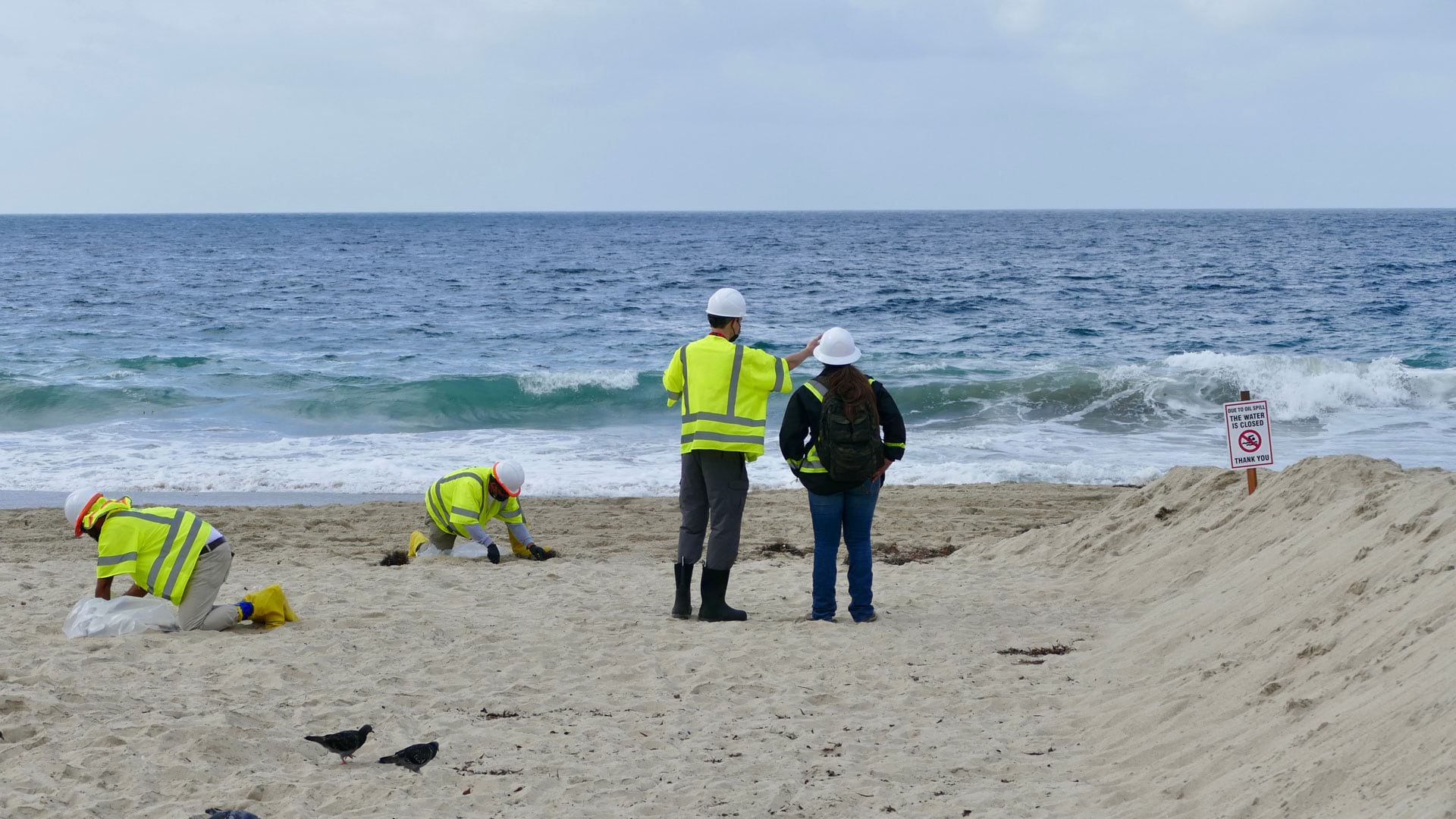
As waves receded from shore on a stretch of Southern California beach on October 2, 2021, they left black outlines at their extents. Soon, sticky tar balls, too toxic to touch without proper protective gear, dotted miles of sand.

A major oil spill off the coast of Huntington Beach had spewed almost 25,000 gallons of crude oil into the Pacific Ocean, killing marine life and birds; threatening wetland ecosystems; and fouling a scenic and popular coastline that contributes $2.6 billion to the local Orange County economy alone, according to the National Ocean Economics Program.
Regulatory agencies, nongovernmental organizations, and residents sprang into action to abate the disaster. The California Department of Fish and Wildlife (CDFW) and the US Coast Guard—part of the Unified Command team that directed the cleanup—received thousands of phone calls from people who wanted to help.
“But there’s a problem,” said Chad Nelsen, chief executive officer of Surfrider Foundation, a nonprofit dedicated to protecting the ocean and beaches. “People want to help, but there’s not much they can do because they can’t actually go out there and clean up the oil on the beach. It’s not safe.”

To take advantage of the public’s interest in volunteering and help guide cleanup efforts, CDFW set up a cumbersome process for people to report tar balls that washed up on beaches. When volunteers encountered a semisolid lump of oil, they were instructed to take a photo and send the department an email with the latitude and longitude of the tar ball sighting, plus the date and time the photo was taken. People tried to participate, but a lot of them submitted emails with incomplete information. This made it hard to pinpoint where the tar balls were and difficult to manage the incoming data.
Nelsen, who is familiar with GIS, knew there had to be a better way to engage the public in the response effort while collecting sound data. So he and his team got in touch with their contacts at Esri. Together, they used an array of ArcGIS technology—from ArcGIS Hub to ArcGIS QuickCapture—to rapidly deploy data collection and viewing apps that helped streamline operations and clean up Southern California beaches.

A Seamless Reporting System
Within a week of the oil spill, more than 10,000 people signed up to help. Surfrider encouraged them to gather data on tar balls using the geospatial apps it spun up with assistance from Esri and a volunteer from GISCorps, a GIS service program provided by the Urban and Regional Information Systems Association (URISA).
The first thing volunteers were instructed to do was go to Surfrider’s Oil Spill Cleanup hub, a site created using ArcGIS Hub that orients volunteers, tracks progress, and provides information to the public. From the Volunteer tab, people were able to download an ArcGIS QuickCapture app using either a QR Code or a link or make observations through a web-based ArcGIS Survey123 form. One of the advantages of using QuickCapture was that participants could track where they had been, which showed other volunteers which beaches had recently been observed. With either app, though, these newfound citizen scientists could quickly and easily photograph tar balls on the beach, and the apps automatically recorded the GPS coordinates where the photo was taken, as well as the date and time.

“The beauty of setting this up is it made it really simple for people to provide usable information because, essentially, once you take that photo and submit it, it automatically reports the date, the time, the GPS coordinates, and all the basic information you need. So, really, all the participants have to do is just get a quality photo,” said Pete Stauffer, ocean protection manager at Surfrider. “Then, we set it up so that on a daily basis, all the data that was being submitted through the app would automatically get forwarded to Unified Command. So they could take that data and know how to deploy their cleanup professionals.”
To make all this work, Surfrider team members had to correlate the locations recorded by volunteers with the maps being used by Unified Command. They created a hosted feature layer that divided the shoreline into segments based on data from CDFW and then employed the ArcGIS REST API to query all the volunteer observations that had been submitted over the previous 24 hours. The results got incorporated into a feature layer that powered a dashboard, developed using ArcGIS Dashboards, that showed where tar balls had accumulated. Leaders at Unified Command used the dashboard to direct each day’s operations. The dashboard was also displayed on Surfrider’s Oil Spill Cleanup hub to further engage volunteers.

A Systematic Response to This Disaster—and Others
In the weeks and months that followed the oil spill, citizen scientists submitted more than 1,100 reports of tar balls on beaches stretching from Oxnard to San Diego. This allowed Unified Command to respond holistically to the disaster. In addition to having vessels skim oil out of the ocean and keep it from entering wetlands in the immediate aftermath of the spill, over the weeks that followed, trained responders in hazmat suits were able to see exactly where oil had deposited onshore and clean it up safely.
“We were able to follow the spill because of reporting through the app,” said Nelsen.
Should there be another hazmat situation that affects the Southern California coastline in the future, the infrastructure now exists for Surfrider to immediately implement GIS-based data collection, management, and mapping tools. The foundation is also advocating that other coastal jurisdictions in California and elsewhere add this suite of technology to their Area Contingency Plans, which detail how emergencies like this are handled.

In all likelihood, this is not the last oil spill that will tarnish California’s coastline—or other beaches around the world. Having the tools available to empower the public to engage in citizen science and help guide safe cleanup efforts will improve response times and increase accountability in the long term.
For more information about Surfrider or this project, email Surfrider technology manager Ruarri Serpa at rserpa@surfrider.org. Learn more about Esri’s Disaster Response Program, which provides immediate assistance in situations like these.