Lafayette Blue Springs State Park in Mayo, Florida, is well-known for its recreational opportunities and natural scenic beauty. But its real importance lies deep beneath the surface, where a complex network of submerged caves channel Florida’s groundwater.
These caves strongly influence regional water quality and safety, water supply, the fluctuating flow of the nearby Suwannee River, and the health of local ecosystems. But accessing this system means going where people often cannot.
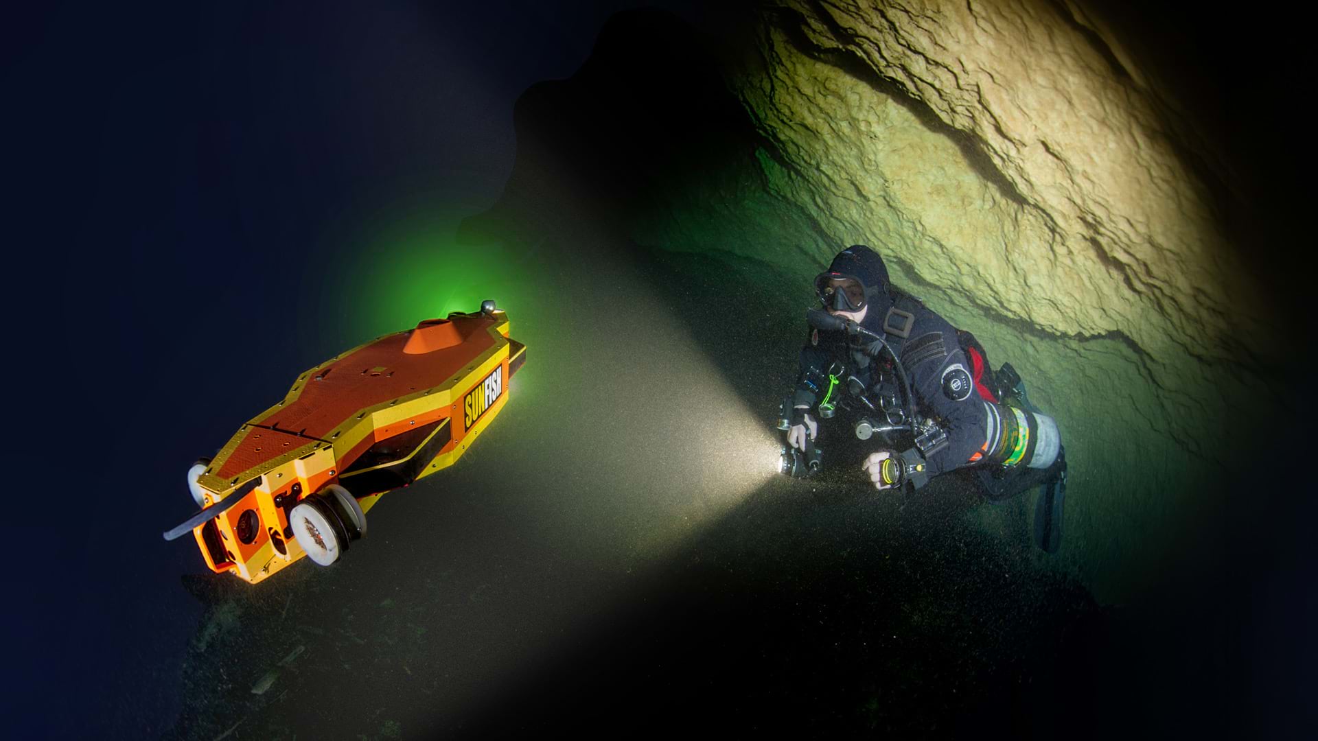
It is difficult, costly, and dangerous to accurately map and monitor this environment. The Florida Department of Environmental Protection (FDEP) needed a safer, more reliable way to collect and update high-quality spatial and environmental data from this groundwater system. Esri startup partner Sunfish, Inc., had the answer: a specialized underwater robot.
Navigating the Unknown
This autonomous underwater vehicle (AUV) technology was originally designed by Stone Aerospace, using National Aeronautics and Space Administration (NASA) grants, to explore the deep, frigid oceans of Europa, one of Jupiter’s moons. The AUV was later adapted to operate in a variety of underwater environments on Earth. In 2019, Sunfish was founded as a spin-off company focused on advanced underwater systems.
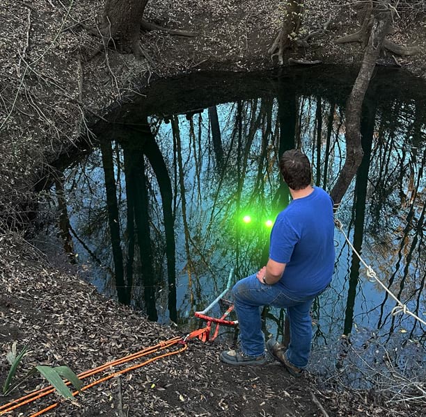
“We wanted to solve some of the world’s biggest problems related to water resources and the ocean,” said Alberto Lopez, CEO and cofounder of Sunfish. “Underwater caves are one of the most challenging environments in our field, so we knew if we could do that, we could probably work anywhere.”
FDEP tasked the Sunfish team with collecting high-resolution spatial and environmental data from the underwater cave system of Lafayette Blue Springs. By combining autonomous robotics technology with ArcGIS, the team transformed fragmented data into a connected geospatial workflow for collecting, processing, analyzing, and sharing information.
“Cave passages can be narrow, unstable, and difficult to access,” said Lopez. “Sunfish gave the project team another way to collect detailed, georeferenced information throughout the system while reducing the amount of work that had to be performed by divers.”
Turning Hidden Waterways into Geographic Intelligence
To start, Sunfish deployed the AUV throughout the Lafayette Blue Springs system. Using multibeam sonar and water quality sensors, the AUV navigated submerged cave passages while collecting georeferenced nitrate, salinity, temperature, and depth measurements. During mapping operations, the AUV surfaced at sink locations—secondary entrances into the flooded cave system—to acquire GNSS position fixes, improving the accuracy of the final cave map. The vehicle mapped more than three miles of underwater passages while taking continuous environmental measurements.
The fieldwork was only the beginning. Once collected, the data moved into a GIS workflow centered on ArcGIS Pro and ArcGIS Online. Sunfish generated a series of spatial datasets, including georeferenced vehicle trajectories, water quality measurements, conduit geometry, point clouds, and surface models. These outputs provided the foundation for a comprehensive geospatial representation of the 3D cave network and the environmental conditions within it.
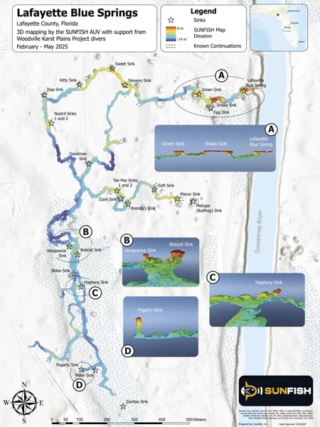
“One of the most valuable aspects of this project was that the data could move directly into ArcGIS workflows,” said Lopez. “By integrating Sunfish data with ArcGIS, we could move from raw sensor measurements to a visual representation of the system that researchers and environmental managers could explore and analyze.”
The project team used ArcGIS Pro to process and analyze underwater mapping data. Sonar and navigation information were transformed into bathymetric surfaces and 3D representations of the cave system, giving researchers a detailed view of the passage geometry. Analysts then examined Sunfish’s spatially referenced nitrate, conductivity, and temperature measurements in relation to conduit structure, depth, and potential groundwater flow paths.
The high-resolution maps produced by Sunfish also informed the next phase of the project. Researchers from the University of South Florida used the georeferenced water quality data to identify locations where more detailed geochemical sampling would be most valuable. Scientific dive teams then collected additional water samples from selected areas of the cave system for laboratory analysis, helping investigators better understand pollution sources and factors influencing water quality variability.
To support collaboration and communication among stakeholders, the team used ArcGIS Online to bring Sunfish sensor outputs, historical water quality records, and site observations into a unified geospatial environment. Interactive web maps and 3D scenes allowed researchers and environmental managers to explore the cave system, visualize water quality patterns, and share findings across organizations. Together, these tools carried the project from underwater data collection through analysis, scientific sampling, and communication with project stakeholders.
A Path Forward
The project gave FDEP a detailed spatial record of the Lafayette Blue Springs cave network and its water quality conditions. These datasets now support groundwater modeling and improve understanding of how land use influences water quality.
“One of the most valuable aspects of this project was that the data could move directly into ArcGIS workflows.”
Beyond the immediate mapping effort, the project established a repeatable approach for bringing AUV data into GIS, offering a model for studying difficult-to-access groundwater systems everywhere.
“Lafayette Blue Springs is just one of many cave systems in Florida. Looking beyond caves, we’re able to inspect water pipelines and map ocean reef structures,” said Lopez. “The ability to map complex underwater environments—and to effectively communicate that spatial data to land managers and asset managers—is the key that opens up many other venues for our technology.”