At long last, ArcGIS StoryMaps is available in ArcGIS Enterprise. Users who have upgraded to ArcGIS Enterprise 10.8.1 have access to an intuitive builder that makes it easy to incorporate maps and other visual elements to create a truly immersive narrative experience.
There are many reasons to adopt Esri’s next generation storytelling tool, but here are six that will hopefully encourage ArcGIS Enterprise users to make the switch from classic Esri Story Maps templates to the new builder as soon as possible.

1. Getting started is easy.
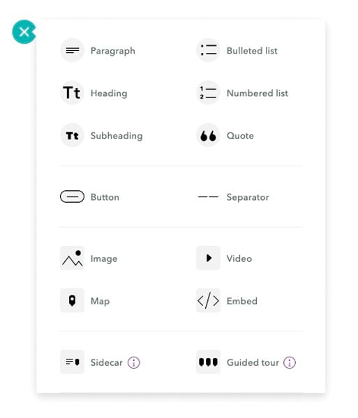
ArcGIS StoryMaps doesn’t have templates. Instead, users build stories intuitively and on the fly using the block palette. It lets users create compelling narratives by adding headings, paragraphs, bulleted lists, and quotations using a simple plus (+) button.
2. Rich, immersive content makes for engaging stories.
There are many ways to embed multimedia content in ArcGIS StoryMaps. One of the most useful tools for creating smooth transitions between maps and photos is the sidecar block. Using a series of slides, users can integrate media with text to create a simple scrolling experience.
3. Draw readers into particular places of interest.
Another new immersive block, called guided tour, enables readers to see where an important place is on a map, and scroll through relevant photos, videos, and text. It’s similar to the classic Story Maps Tour template, but it goes above and beyond what that template could do.
4. Create maps in minutes.
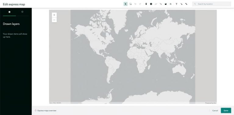
No GIS training or cartographic experience? No problem! StoryMaps users can make quality maps with express maps. This tool allows them to add areas and points of interest, arrows, labels, pop-ups, and more without leaving the story builder.

5. Map narratives look cohesive and can be branded.
ArcGIS StoryMaps has lots of options for making stories look cohesive and professional—and all this is easy to access via the app’s modern design. There are six built-in design themes that users can apply to their narratives, or they can create their own themes using their company’s logo, color palette, and other elements that constitute an organization’s brand. Mobile-first design makes these map narratives look great on any device, and people can easily interact with maps using their phones. What’s more, users can build whole stories using a tablet.
6. An elegant way to present work.
Collections allow stories to be grouped by topic, author, or any other criteria—and they’re a game changer. This feature of ArcGIS StoryMaps makes it possible to present a group of map narratives and share them as a cohesive, easy-to-navigate set. A collection starts with an overview page that shows the collection’s title and description, plus a grid of thumbnails that represents each map narrative in the set of stories. Users can also add other ArcGIS apps, such as dashboards, configurable app templates, and surveys, to a collection.
There is no way to automatically reformat classic Story Maps apps into ArcGIS StoryMaps, since there is no one-to-one relationship between the elements of classic stories and the blocks in ArcGIS StoryMaps. The best way to switch to the new system is to just jump in and start getting acquainted with the builder.
The new dependent user type, Storyteller, is now also available to ArcGIS Enterprise users. The Storyteller user type provides access to ArcGIS StoryMaps for just $100 per year, so anyone who wants to make stories can do so at a more cost-effective price. Often, those in marketing, communications, and public relations sectors—or those who have other content creation roles—get the Storyteller user type.
For more details, visit the new Storyteller product page or contact your Esri representative.

