Learning and growing fuel my curiosity and always stimulate my next accomplishment. Thankfully, throughout my career, I have never stopped doing either one.
When I first started out as a GIS technician, I was very task oriented, trying to learn the tools and tricks of ArcGIS Desktop. Now, I’m discovering that to move GIS into an enterprise environment and employ the technology’s capabilities to their full potential, I need to be a leader and have vision.
Getting involved with the Urban and Regional Information Systems Association (URISA) and other user groups has helped me learn these lessons, develop leadership skills, and forge my own vision for how to use the technology effectively. That’s why I recommend that GIS professionals at all levels of their careers look into the growth opportunities fostered by URISA and other, similar organizations.
Get Involved with Local Groups
I have been with the City of Centerville, Ohio, for more than 10 years. Part of what has made my work consistently engaging and fulfilling is that I have had the opportunity to be a member and leader of local user and professional groups. Not only has that allowed me to learn from and network with my peers, but it has also enabled me to help others cultivate their passions and sustain a supportive circle of fellow GIS professionals.
When I began at the city, getting involved in the Southwest Ohio GIS User Group (SWOGIS) in Dayton, Ohio, was invaluable. That’s where I learned new technology in ArcGIS Server and how to use Microsoft Silverlight. I also discovered a wealth of best practices and got involved in leading events and working with others to decide on the direction the user group would take.
In 2011, I was connected with the Ohio chapter of URISA. My first responsibility was to implement a statewide user group meeting at the annual Ohio GIS Conference. This would be an opportunity for the dozen or so grassroots user groups around the state to share what each organization was doing to learn, grow, and network in the ever-changing geospatial field.
My second responsibility with Ohio URISA was to create a mentorship program for the chapter. In 2012, I led an initiative to have Ohio URISA adopt a mentoring program called MATCH, which pairs undergraduates, graduate students, and young professionals with mentors who then assist with their career development.
Organizing both the meeting and the mentoring initiative helped me understand how Ohio URISA worked and allowed me to get to know many of its members, leaders, and movements. Through this, I realized my knack for leading and fostering collaboration both within my organization and among members of the larger GIS industry.
Take On a Leadership Role
In 2015, I was nominated to the board of Ohio URISA for a three-year term, with one of those years spent as president of the organization. Although I was timid at first, I did want to give back to the chapter that had done so much for me. I supported what Ohio URISA was doing and felt like this would be an opportunity to build up its membership, improve relations with the national-level URISA organization, and enhance relationships among Ohio GIS Conference partners. The chapter was also moving forward with the OneURISA initiative, which seeks to ensure that members benefit from their own chapters as well as the umbrella organization, and I was eager to assist with that.

During my time as president, we were able to
- Expand membership by 16 percent, to more than 400 members, in one year.
- Increase the number of workshops Ohio URISA conducted and add a new annual event: the Ohio URISA GIS Education Series that takes place in Columbus every spring.
- Partner with the Ohio GIS Conference committee to secure keynote speakers for the event.
- Start a First Time Conference Meetup group at the Ohio GIS Conference.
- Increase the number of updates we send out about URISA events and announcements.
Achieving these objectives was not particularly easy, considering there was other chapter business to attend to as well. But one of the keys to our success was having dedicated board members and committee chairs at Ohio URISA.
While I was chapter president, I made sure that they felt like leaders and took ownership of their tasks and initiatives. This was invaluable to me so I could focus on being the voice of Ohio URISA and guide it in moving forward. It was also significant to the board members, since they were able to get more involved in the chapter and realize professional growth opportunities. Additionally, the organization benefited by having more leaders engaged in the chapter’s events.
Although my time on the board has concluded, I appreciate seeing that many of these initiatives—including the MATCH program—are flourishing. The chapter’s new leaders are infusing them with great ideas and developing initiatives of their own. And that’s helping Ohio URISA continue to thrive.
Attend the URISA GIS Leadership Academy
For anyone thinking about stepping into a leadership role, consider attending a URISA GIS Leadership Academy (GLA).
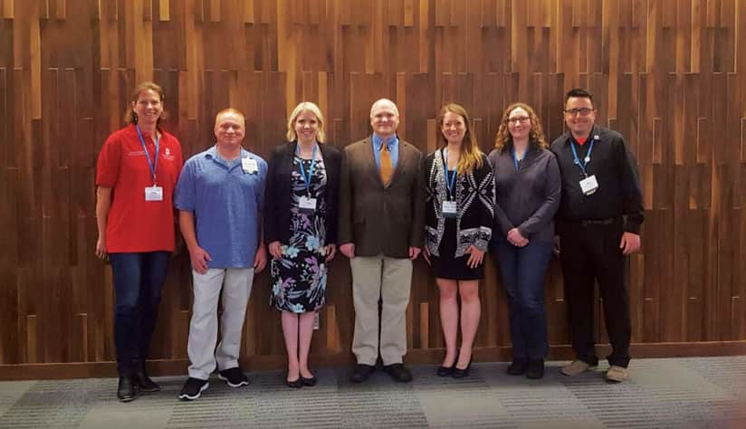
I worked with URISA to bring a GLA to Columbus in 2018 and witnessed firsthand how using management principles can grow the capacity of a GIS implementation. For the five-day event, we hosted 53 attendees from 16 US states and two Canadian provinces. It was a fast-paced week, with various group activities hosted by GLA faculty members, and countless networking opportunities.
The sessions covered an assortment of principles from the Project Management Institute with a geospatial twist. There was much discussion about what it takes to be a manager versus a leader and how management focuses on fighting fires while leadership emphasizes lighting a fire. It seemed obvious upon hearing it, but leadership can go well beyond just leading a team. Everyone can employ those concepts to champion certain projects—and even GIS itself—to the entire organization.
What was perhaps most eye-opening during Ohio URISA’s GLA was everyone’s passion for GIS and geospatial technologies. Hearing others’ stories—like how someone’s love for fishing and mapping got them into GIS—was completely relatable and made me realize all over again why I love this industry and the work I do. It’s important for GIS professionals to connect with enthusiasm like that so it can fuel their own desire for growth, both at and outside of work.
Develop a Vision for GIS
My leadership experiences with Ohio URISA, as well as the opportunity I had to organize and attend the GLA, have been very important to me at the City of Centerville. As the planning department continues to expand the reach of its GIS and the technology becomes the central component of Centerville’s enterprise resource planning implementation, I can say that my involvement with Ohio URISA and what I learned at the GLA have helped me develop a vision for how to make all this work.
So whether you’re a young professional just getting your feet wet with GIS or a 25-year veteran of the field, there are many ways to grow your career and expertise by getting more involved in the industry. Don’t be afraid of new opportunities. Go join a local user group or attend a GLA. Your experience might be just what that new project or organization needs. And some of the colleagues you meet along the way may assist you later in your career.
No matter what your goals are, these opportunities can help you climb that proverbial ladder and get what you want out of this industry.


